1980s Maps of T4 R7 WELS, Maine
Explore 6 historic maps of T4 R7 WELS from the 1980s. These maps offer a rare glimpse into what life looked like during the 1980s — showing old roads, neighborhoods, homes, and landmarks that have changed or disappeared over time.
Whether you're researching your family's past, planning a metal detecting trip, or studying how T4 R7 WELS's landscape evolved across the 1980s, these high-resolution maps are a powerful tool for exploring the history of this region.
- Focus on a specific era: All maps on this page are from the 1980s, giving you a focused view of this time period.
- See what’s changed: Compare century-old streets, trails, and buildings to today's modern landscape using overlays and satellite layers.
- Research with precision: Use these maps for genealogy, historical research, land use analysis, or educational projects.
- View, download, or print: Maps are fully viewable online in high resolution, and can be downloaded or printed for your own records.
Start exploring T4 R7 WELS's history through authentic maps from the 1980s. This is your window into the past.
T4 R7 WELS, ME maps
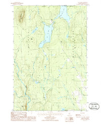
(6)- 1985 Map of Oakfield
 1985 Oakfield1985 Print · USGSAroostook County in the 1980s displays a balance between the timber-and-rail industry and the protected wilderness of the North Woods. Genealogists and local historians can trace family-named hubs like Smyrna Mills, Island Falls, and Knowles Corner along the Bangor and Aroostook railroad line.
 - 1985 Map of Millinocket, 1986 Print
 1985 Millinocket1986 Print · USGSThe North Maine Woods were a landscape of industrial timber and wilderness recreation in the mid-eighties. Genealogists and researchers can trace local settlements and rail stops like Sherman Mills, Wytopitlock, and the Old Long A Siding near the Penobscot River.2 unique versions available
 - 1986 Map of Shin Pond
 1986 Shin Pond1986 Print · USGSPenobscot County’s wilderness is captured in the mid-1980s, centered on the waterway connecting Upper Shin Pond and Lower Shin Pond. Researchers can trace the timber-rich terrain of M O U N T C H A S E and landmarks like Sugarloaf Mountain and Peaked Mtn.2 unique versions available
 - 1986 Map of Bowlin Brook
 1986 Bowlin Brook1986 Print · USGSPenobscot County, Maine, was a landscape of remote timberlands and sporting camps in the 1980s. Local researchers can trace the riverways and landmarks like Bowlin Camps, Grand Pitch Falls, and the Seboeis River.
 - 1989 Map of Deasey Mountain
 1989 Deasey Mountain1989 Print · USGSPenobscot County, Maine, is shown in the late 1980s as a wild landscape of intersecting rivers and prominent peaks. Researchers can trace the rugged topography of Deasey Mountain and the confluence of the East Branch Penobscot River with Wassataquoik Stream.2 unique versions available
 - 1989 Map of Lookout Mountain
 1989 Lookout Mountain1989 Print · USGSNorth of the Penobscot forks in the 1980s, this area shows a landscape of timberlands and river camps. Researchers can trace the Monument Line and locate isolated outposts like Lunksoos Camp, Hunt Farm, and the winding Seboeis River.
End of results
Showing maps 1-6 of 6
Top cities near T4 R7 WELS
- Patten historical maps
- Sherman historical maps
- Stacyville historical maps
- Crystal historical maps
- Mount Chase historical maps
- Hersey historical maps
See more
Frequently asked questions
- What are the different types of historical maps available for T4 R7 WELS?
- What is the oldest map of T4 R7 WELS?
- Where can I purchase historical maps of T4 R7 WELS for my home or office?
- Where can I download high-res historical maps of T4 R7 WELS?
- Are there historical topographic maps available for T4 R7 WELS?
- Is there historical aerial imagery available for T4 R7 WELS?
- Where are historical maps of T4 R7 WELS sourced from?