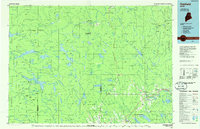
1985 Map of Oakfield
USGS Topo · Published 1985About this map
Smyrna Mills and Island Falls serve as focal points for the river and rail infrastructure of southern Aroostook County during the mid-1980s. The Bangor and Aroostook railroad defines the transportation corridor through Oakfield, connecting smaller settlements like Smyrna Center and Ludlow to the wider region. To the west, the landscape shifts toward the preserved wilderness of Baxter State Park, where the peaks of The Traveler and South Traveler Mtn overlook a complex network of glacial water bodies including Grand Lake Matagamon Lake. The map reveals a transition from the agricultural and logging hubs along the Mattawamkeag River to the unorganized townships of the North Woods, marked by surveyor designations like T 8 R 6 Wels. This era shows the developed highway system, including Interstate 95, beginning to supersede the older rural routes like Halls Corner and Batesville in regional importance.
Find a feature on this map
116 named features on this map. Tap any name to fly to it.
Don’t see what you’re looking for? This feature index may not catch every label — zoom into the map to look around manually.
Map Details
Editions of this 1985 Oakfield Map
This is the sole edition of this map. No revisions or reprints were ever made.
Other maps of this area

1927 · Katahdin
USGS Topo · 1:48,000

1930 · Katahdin
USGS Topo · 1:62,500

1930 · Greenlaw
USGS Topo · 1:48,000

1931 · Ashland
USGS Topo · 1:48,000

1931 · Mooseleuk Lake
USGS Topo · 1:48,000

1932 · Musquacook Lakes
USGS Topo · 1:48,000

1933 · Greenlaw
USGS Topo · 1:62,500

1934 · Bridgewater
USGS Topo · 1:48,000

1934 · Ashland
USGS Topo · 1:62,500

1935 · Musquacook Lakes
USGS Topo · 1:62,500