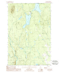
1986 Map of Shin Pond
USGS Topo · Published 1986About this map
The connected waters of Upper Shin Pond and Lower Shin Pond anchor this landscape in northern Penobscot County, illustrating a wilderness shaped by glacial hydrology and logging interests. The map documents a rugged interior divided by township lines such as t6 r7 Wels and M O U N T C H A S E, where elevation varies from the peak of Sugarloaf Mountain to the wetlands surrounding the Seboeis River. Small-scale industrial activity is evidenced by a Gravel Pit near the shore of the upper pond, while the network of named brooks—including Shin Brook, Sucker Brook, and Ragged Brook—suggests the intricate drainage patterns critical to local navigation and early timber transport. Landforms like Davis Ridge and Allen Hill provide topographic context for this remote Maine region as it was surveyed in the mid-1980s.
Find a feature on this map
29 named features on this map. Tap any name to fly to it.
Don’t see what you’re looking for? This feature index may not catch every label — zoom into the map to look around manually.
Map Details
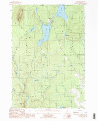
Editions of this 1986 Shin Pond Map
2 editions found
Other maps of this area

1940 · Island Falls
USGS Topo · 1:62,500

1940 · Sherman
USGS Topo · 1:62,500

1942 · Island Falls
USGS Topo · 1:62,500

1942 · Sherman
USGS Topo · 1:62,500

1953 · Stacyville
USGS Topo · 1:62,500

1954 · Shin Pond
USGS Topo · 1:62,500

1954 · Presque Isle
USGS Topo · 1:250,000

1954 · Millinocket
USGS Topo · 1:250,000

1958 · Presque Isle
USGS Topo · 1:250,000

1958 · Millinocket
USGS Topo · 1:250,000