2020s Maps of Parkman, Maine
Explore 12 historic maps of Parkman from the 2020s. These maps offer a rare glimpse into what life looked like during the 2020s — showing old roads, neighborhoods, homes, and landmarks that have changed or disappeared over time.
Whether you're researching your family's past, planning a metal detecting trip, or studying how Parkman's landscape evolved across the 2020s, these high-resolution maps are a powerful tool for exploring the history of this region.
- Focus on a specific era: All maps on this page are from the 2020s, giving you a focused view of this time period.
- See what’s changed: Compare century-old streets, trails, and buildings to today's modern landscape using overlays and satellite layers.
- Research with precision: Use these maps for genealogy, historical research, land use analysis, or educational projects.
- View, download, or print: Maps are fully viewable online in high resolution, and can be downloaded or printed for your own records.
Start exploring Parkman's history through authentic maps from the 2020s. This is your window into the past.
Parkman, ME maps
(12)- 2021 Map of Whetstone Pond, 2021 Print
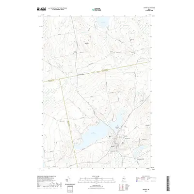
 2021 Whetstone Pond2021 Print · USGSCovers Parkman, including Abbot, Monson, and other nearby areas
 - 2021 Map of Sangerville, 2021 Print
 2021 Sangerville2021 Print · USGSCovers Parkman, including Dover-Foxcroft, Sangerville, and other nearby areas
 - 2021 Map of Guilford, 2021 Print
 2021 Guilford2021 Print · USGSCovers Parkman, including Sangerville, Guilford, and other nearby areas
 - 2021 Map of Wellington, 2021 Print
 2021 Wellington2021 Print · USGSCovers Parkman, including Athens, Harmony, and other nearby areas
 - 2021 Map of Cambridge, 2021 Print
 2021 Cambridge2021 Print · USGSCovers Parkman, including Harmony, Ripley, and other nearby areas
 - 2021 Map of Dexter, 2021 Print
 2021 Dexter2021 Print · USGSCovers Parkman, including Dexter, Sangerville, and other nearby areas
 - 2024 Map of Cambridge, 2024 Print
 2024 Cambridge2024 Print · USGSModern Somerset and Piscataquis Counties maintain their rural character along the upper reaches of the Sebasticook. Genealogists can locate family burial plots like Mount Pleasant Cem and Pingree Cem while tracing the waters of Austin Bog.
 - 2024 Map of Wellington, 2024 Print
 2024 Wellington2024 Print · USGSThe borderlands of Piscataquis and Somerset counties are shown here in modern detail, preserving a network of early family settlements and rural cemeteries. Researchers can trace ancestral locations at Reed Cem, Herriman Cem, and the crossroads at Hutchins Corner.
 - 2024 Map of Whetstone Pond, 2024 Print
 2024 Whetstone Pond2024 Print · USGSPiscataquis County remains a landscape of deep woods and isolated waters in this modern survey. Genealogists and outdoorsmen can trace access routes to Whetstone Pond, Piper Pond, and the high elevations of Russell Mtn.
 - 2024 Map of Guilford, 2024 Print
 2024 Guilford2024 Print · USGSPiscataquis County settlement and industry are centered on the river valleys of Guilford and Abbot in this modern topographic survey. Genealogists and historians can trace local family landmarks through Elmwood Cem, the Old Railroad Grade, and Monson Junction.
 - 2024 Map of Sangerville, 2024 Print
 2024 Sangerville2024 Print · USGSPiscataquis County's river-valley settlements are documented here in recent years, showing the evolving landscape of Central Maine. Genealogists and local historians can trace family locations near the Old Railroad Grade or across several rural cemeteries like Village Cem and Knowlton Mills Cem.
 - 2024 Map of Dexter, 2024 Print
 2024 Dexter2024 Print · USGSCentral Maine's lakeside industry and rural burial grounds are documented here in the 2020s. Genealogists can trace family heritage through numerous sites like Mount Pleasant Cem and Elmwood Cem, or locate the historic Spooners Mill on the river.
End of results
Showing maps 1-12 of 12
Top cities near Parkman
- Dover-Foxcroft historical maps
- Dexter historical maps
- Newport historical maps
- Corinna historical maps
- Saint Albans historical maps
- Palmyra historical maps
See more
Top neighborhoods of Parkman
Frequently asked questions
- What are the different types of historical maps available for Parkman?
- What is the oldest map of Parkman?
- Where can I purchase historical maps of Parkman for my home or office?
- Where can I download high-res historical maps of Parkman?
- Are there historical topographic maps available for Parkman?
- Is there historical aerial imagery available for Parkman?
- Where are historical maps of Parkman sourced from?