1980s Maps of Parkman, Maine
Explore 7 historic maps of Parkman from the 1980s. These maps offer a rare glimpse into what life looked like during the 1980s — showing old roads, neighborhoods, homes, and landmarks that have changed or disappeared over time.
Whether you're researching your family's past, planning a metal detecting trip, or studying how Parkman's landscape evolved across the 1980s, these high-resolution maps are a powerful tool for exploring the history of this region.
- Focus on a specific era: All maps on this page are from the 1980s, giving you a focused view of this time period.
- See what’s changed: Compare century-old streets, trails, and buildings to today's modern landscape using overlays and satellite layers.
- Research with precision: Use these maps for genealogy, historical research, land use analysis, or educational projects.
- View, download, or print: Maps are fully viewable online in high resolution, and can be downloaded or printed for your own records.
Start exploring Parkman's history through authentic maps from the 1980s. This is your window into the past.
Parkman, ME maps
(7)- 1984 Map of Cambridge
 1984 Cambridge1984 Print · USGSMaine's interior border between Somerset and Piscataquis counties is captured here in the early 1980s, showcasing a landscape of timber and small-town resilience. Genealogy researchers can trace local family lineages through Mt Pleasant Cem and Tyler Cem, or locate old homesteads near Pingree Center and Cambridge.
 - 1984 Map of Guilford
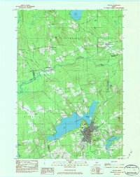
 1984 Guilford1984 Print · USGSMid-century Maine life centers on the river and rail corridors of the Piscataquis valley in the early 1980s. Researchers can trace family roots through Elmwood Cem or explore the layout of old hubs like Abbot Village and Monson Junction.2 unique versions available
 - 1984 Map of Sangerville
 1984 Sangerville1984 Print · USGSPiscataquis County's river-driven landscape is captured here in the mid-1980s as the communities of Sangerville and Guilford developed along the water. Genealogists can trace family locations at Jackson Corner or locate ancestors at Rural Grove Cem and the Old Railroad Grade.
 - 1984 Map of Dexter
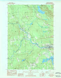
 1984 Dexter1984 Print · USGSMaine's interior highlands near the Penobscot and Piscataquis county lines are shown here as they appeared in the early 1980s. Genealogists and local historians can trace family locations near Jackman Corner, the Storer Cem, or the namesake Spooners Mill.2 unique versions available
 - 1986 Map of Dover-Foxcroft
 1986 Dover-Foxcroft1986 Print · USGSPiscataquis County at the edge of the great Maine woods is documented here in the mid-1980s, centered on the river-and-rail hubs of the interior. Trace the industrial footprints of Dover South Mills, the rail yards at Brownville Junction, or the historic Katahdin Iron Works.
 - 1989 Map of Wellington
 1989 Wellington1989 Print · USGSThe rural Maine interior of the late eighties is detailed here, centered on the village of Wellington. Researchers can trace old family locales like Burdin Corner, explore the extensive wetlands of Whitehouse Bog, and locate active Gravel Pits.
 - 1989 Map of Whetstone Pond
 1989 Whetstone Pond1989 Print · USGSPiscataquis County at the close of the 1980s is captured here as a landscape of isolated plantations and deep woods. Researchers can trace the quiet crossroads of Happy Corner and Cole Corner or locate seasonal sites around Whetstone Pond and Piper Pond.
End of results
Showing maps 1-7 of 7
Top cities near Parkman
- Dover-Foxcroft historical maps
- Dexter historical maps
- Newport historical maps
- Corinna historical maps
- Saint Albans historical maps
- Palmyra historical maps
See more
Top neighborhoods of Parkman
Frequently asked questions
- What are the different types of historical maps available for Parkman?
- What is the oldest map of Parkman?
- Where can I purchase historical maps of Parkman for my home or office?
- Where can I download high-res historical maps of Parkman?
- Are there historical topographic maps available for Parkman?
- Is there historical aerial imagery available for Parkman?
- Where are historical maps of Parkman sourced from?