Old Maps of Sangerville, Maine for Genealogy
Trace your family roots with 44 historic maps of Sangerville. These high-res maps reveal old neighborhoods, homesites, landmarks, and streets — helping you uncover where your ancestors lived and how the area evolved over time.
- Explore historic neighborhoods: Identify where your relatives may have lived in the 1800s or 1900s.
- Compare maps over time: Trace the changes in streets, buildings, and landmarks for multi-generational research.
- Perfect for genealogy & ancestry research: Used by family historians and researchers to map out lineage and migration.
These maps are an incredible resource for exploring your personal connection to Sangerville's past.
Sangerville, ME maps
(44)- 1932 Map of Dover-Foxcroft
 1932 Dover-Foxcroft1932 Print · USGSPiscataquis and Penobscot counties are shown here in the early 1930s, a landscape defined by the Piscataquis River and rail-fed mill towns. Genealogists can trace family names through dozens of rural landmarks like Hurd Corner, Gould Cemetery, and the Higgins Classical Institute.4 unique versions available
 - 1933 Map of Guilford, 1958 Print
 1933 Guilford1958 Print · USGSPiscataquis County townships thrive along the river and rail lines of central Maine in the early thirties. Local historians can trace the foundations of Guilford, locate rural landmarks like Spooners Mill, and find family heritage at Storer Cem or Abbot Village Sta.5 unique versions available
 - 1935 Map of Dover-Foxcroft
 1935 Dover-Foxcroft1935 Print · USGSThe Piscataquis River valley of central Maine is shown here in the 1930s, centered on the mill town of Dover-Foxcroft. Genealogists can trace family names at Rollins Mill, Foss Cem, and dozens of rural schoolhouses like Morrison Sch.2 unique versions available
 - 1937 Map of Guilford
 1937 Guilford1937 Print · USGSPiscataquis County industry and rural life are captured here in the mid-1930s as the river-and-rail economy thrived. Genealogists can trace family roots through numerous local schoolhouses and landmarks like Spooners Mill, Lows Bridge, and the Wassookeag Cem.2 unique versions available
 - 1954 Map of Millinocket, 1968 Print
 1954 Millinocket1968 Print · USGSMaine's North Woods and the Penobscot Valley are captured here during the mid-century era of logging and rail dominance. You can trace the path of the Bangor and Aroostook Railroad through timber towns like Millinocket, Mattawamkeag, and Silver Ridge.3 unique versions available
 - 1958 Map of Millinocket
 1958 Millinocket1958 Print · USGSMaine's North Woods and the Penobscot river valley are captured here in the mid-1950s, showing a landscape of timber, rail, and wild waters. Researchers can trace the legacy of the Canadian Pacific railroad and find historic settlements like Millinocket, Sherman Station, and Mattawamkeag.
 - 1960 Map of Millinocket
 1960 Millinocket1960 Print · USGSThe Maine North Woods and Penobscot River valley are captured at mid-century during the height of the paper milling era. Researchers can trace the Appalachian Trail near Mount Katardin or locate family roots in towns like Dover-Foxcroft and Milo.3 unique versions available
 - 1975 Map of Dover-Foxcroft NW, 1980 Print
 1975 Dover-Foxcroft NW1980 Print · USGSPiscataquis County's river valley and rural crossroads are captured in this mid-seventies aerial survey. Researchers can trace the layout of historic settlements like Dover-Foxcroft and East Dover or locate family-named intersections such as Goffs Corner.
 - 1975 Map of Guilford NW, 1980 Print
 1975 Guilford NW1980 Print · USGSPiscataquis County settlements like Guilford and Abbot Village are shown in detail during the mid-seventies. This orthophoto allows you to trace the landscape from the banks of the Piscataquis River to the shores of Harlow Pond.
 - 1975 Map of Guilford NE, 1980 Print
 1975 Guilford NE1980 Print · USGSCentral Maine's forest and farm country is captured in the mid-1970s as the Piscataquis River flows past timberlands and small settlements. Researchers can trace land use patterns near Guilford Center, Dunham Corner, and East Sangerville.
 - 1975 Map of Guilford SE, 1980 Print
 1975 Guilford SE1980 Print · USGSPenobscot County farmland and woods are captured in this mid-seventies aerial survey during the height of the autumn season. Genealogists and local historians can trace exact property clearings and structures near North Dexter, Gilman Corner, and the shores of Center Pond.
 - 1975 Map of Dover-Foxcroft SW, 1980 Print
 1975 Dover-Foxcroft SW1980 Print · USGSPenobscot County is captured in the mid-seventies, showing the intersection of Maine's timberlands and rural farming life. Genealogists and local historians can trace the precise 1975 building footprints at Dover South Mills, Garland, and Carr Corner.
 - 1983 Map of Dover-Foxcroft, 1984 Print
 1983 Dover-Foxcroft1984 Print · USGSDover-Foxcroft and its surrounding townships are shown in the early eighties as the regional hub of Piscataquis County. Genealogists can locate family names and burial sites at Lee Cem and McAllister Cem, or trace the path of the Maine Central railroad.2 unique versions available
 - 1983 Map of Garland, 1984 Print
 1983 Garland1984 Print · USGSPenobscot and Piscataquis counties are shown in the early 1980s, revealing a landscape of historic mill sites and family-named crossroads. Genealogists and local historians can trace residents through Evergreen Cem and old settlements like Dover South Mills or Silvers Mills.2 unique versions available
 - 1984 Map of Guilford
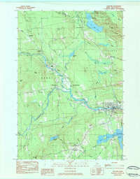 1984 Guilford1984 Print · USGSMid-century Maine life centers on the river and rail corridors of the Piscataquis valley in the early 1980s. Researchers can trace family roots through Elmwood Cem or explore the layout of old hubs like Abbot Village and Monson Junction.2 unique versions available
 - 1984 Map of Sangerville
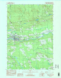
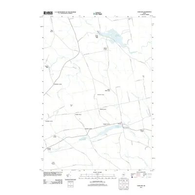
 1984 Sangerville1984 Print · USGSPiscataquis County's river-driven landscape is captured here in the mid-1980s as the communities of Sangerville and Guilford developed along the water. Genealogists can trace family locations at Jackson Corner or locate ancestors at Rural Grove Cem and the Old Railroad Grade.
 - 1984 Map of Dexter
 1984 Dexter1984 Print · USGSMaine's interior highlands near the Penobscot and Piscataquis county lines are shown here as they appeared in the early 1980s. Genealogists and local historians can trace family locations near Jackman Corner, the Storer Cem, or the namesake Spooners Mill.2 unique versions available
 - 1986 Map of Dover-Foxcroft
 1986 Dover-Foxcroft1986 Print · USGSPiscataquis County at the edge of the great Maine woods is documented here in the mid-1980s, centered on the river-and-rail hubs of the interior. Trace the industrial footprints of Dover South Mills, the rail yards at Brownville Junction, or the historic Katahdin Iron Works.
 - 1994 Map of Dover-Foxcroft
 1994 Dover-Foxcroft1994 Print · USGSCentral Maine in the mid-nineties shows a landscape of timber-driven towns and deep glacial lakes. Trace the paths of the Canadian Pacific RR or locate the Moscow Air Force Station Transmit Site and Sebec Lake.
 - 2011 Map of Dover-Foxcroft, 2011 Print
 2011 Dover-Foxcroft2011 Print · USGSCovers Sangerville, including Dover-Foxcroft, Sebec, and other nearby areas
 - 2011 Map of Sangerville, 2011 Print
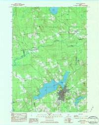
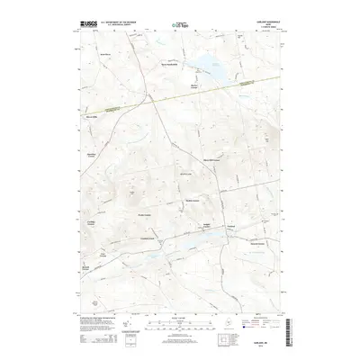
 2011 Sangerville2011 Print · USGSCovers Sangerville, including Dover-Foxcroft, Guilford, and other nearby areas
 - 2011 Map of Dexter, 2011 Print
 2011 Dexter2011 Print · USGSCovers Sangerville, including Dexter, Parkman, and other nearby areas
 - 2011 Map of Guilford, 2011 Print
 2011 Guilford2011 Print · USGSCovers Sangerville, including Guilford, Parkman, and other nearby areas
 - 2011 Map of Garland, 2011 Print
 2011 Garland2011 Print · USGSCovers Sangerville, including Dover-Foxcroft, Dexter, and other nearby areas
 - 2014 Map of Garland, 2014 Print
 2014 Garland2014 Print · USGSCovers Sangerville, including Dover-Foxcroft, Dexter, and other nearby areas
Showing maps 1-25 of 44
Top cities near Sangerville
- Dover-Foxcroft historical maps
- Dexter historical maps
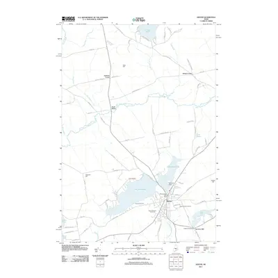
- Newport historical maps
- Corinth historical maps
- Corinna historical maps
- Saint Albans historical maps
See more
Top neighborhoods of Sangerville
- Jackman Corner historical maps
- West Dover historical maps
- Howard Corner historical maps
- East Sangerville historical maps
- Gilman Corner historical maps
Frequently asked questions
- What are the different types of historical maps available for Sangerville?
- What is the oldest map of Sangerville?
- Where can I purchase historical maps of Sangerville for my home or office?
- Where can I download high-res historical maps of Sangerville?
- Are there historical topographic maps available for Sangerville?
- Is there historical aerial imagery available for Sangerville?
- Where are historical maps of Sangerville sourced from?