1970s Maps of Williamsburg Township, Maine
Explore 4 historic maps of Williamsburg Township from the 1970s. These maps offer a rare glimpse into what life looked like during the 1970s — showing old roads, neighborhoods, homes, and landmarks that have changed or disappeared over time.
Whether you're researching your family's past, planning a metal detecting trip, or studying how Williamsburg Township's landscape evolved across the 1970s, these high-resolution maps are a powerful tool for exploring the history of this region.
- Focus on a specific era: All maps on this page are from the 1970s, giving you a focused view of this time period.
- See what’s changed: Compare century-old streets, trails, and buildings to today's modern landscape using overlays and satellite layers.
- Research with precision: Use these maps for genealogy, historical research, land use analysis, or educational projects.
- View, download, or print: Maps are fully viewable online in high resolution, and can be downloaded or printed for your own records.
Start exploring Williamsburg Township's history through authentic maps from the 1970s. This is your window into the past.
Williamsburg Township, ME maps
(4)- 1978 Map of Silver Lake, 1981 Print
 1978 Silver Lake1981 Print · USGSPiscataquis County in the late seventies is captured in this detailed aerial study of the Maine timberlands. Researchers can trace the exact shoreline of Silver Lake and find remote landmarks like Houston Mountain or the winding West Branch Pleasant River.
 - 1978 Map of Brownville Junction, 1981 Print
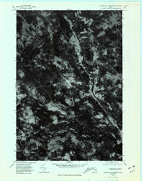 1978 Brownville Junction1981 Print · USGSThe Maine woods near the junction of the Piscataquis rivers are captured in the late seventies, showing the region's transition from wilderness to settlement. Genealogists and historians can trace the clearings of Barnard Corner or the riverbanks of West Branch Pleasant River.
 - 1978 Map of Sebec Lake East, 1981 Print
 1978 Sebec Lake East1981 Print · USGSPiscataquis County appears in the late seventies as a landscape of dense timber and quiet lakeside settlements. Researchers can trace the rural layout of Barnard and Bowerbank or study the natural hydrology of Sebec Lake and Long Bog.
 - 1978 Map of Ebeemee Mountain, 1981 Print
 1978 Ebeemee Mountain1981 Print · USGSPiscataquis County timberlands and waterways are captured in the late seventies just as the autumn foliage season ended. Trace the confluence of the West Branch Pleasant River near Prairie and the isolated shores of Ebeemee Lake.
End of results
Showing maps 1-4 of 4
Top cities near Williamsburg Township
- Dover-Foxcroft historical maps
- Milo historical maps
- Charleston historical maps
- Sangerville historical maps
- Guilford historical maps
- Bradford historical maps
See more
Frequently asked questions
- What are the different types of historical maps available for Williamsburg Township?
- What is the oldest map of Williamsburg Township?
- Where can I purchase historical maps of Williamsburg Township for my home or office?
- Where can I download high-res historical maps of Williamsburg Township?
- Are there historical topographic maps available for Williamsburg Township?
- Is there historical aerial imagery available for Williamsburg Township?
- Where are historical maps of Williamsburg Township sourced from?