Old Maps of Anson, Maine for Academic Research
Study the evolution of Anson with 51 high-resolution historic maps. Whether you're teaching, researching, or modeling changes in land use, these maps provide essential visual documentation of urban, environmental, and geographic change.
- Analyze long-term change: Track patterns in development, transportation, and natural features.
- Ideal for environmental or urban studies: Support academic projects with primary historical map data.
- Use in the classroom or lab: Educators and researchers rely on these maps to bring historical context to life.
These maps are a powerful tool for teaching, research, and visualizing how Anson has changed over the decades.
Anson, ME maps
(51)- 1904 Map of Anson
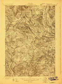
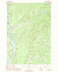
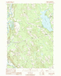
 1904 Anson1904 Print · USGSSomerset County is shown in the early 1900s as a thriving corridor of river industry and rail transport. Genealogists can trace family landmarks like Savage Hill or locate early centers such as Twelve Corners, North Anson, and the island-studded Kennebec River.4 unique versions available
 - 1930 Map of Kingfield
 1930 Kingfield1930 Print · USGSThe Kingfield region and the western Maine highlands are captured here in the early 1930s. Genealogists can locate family homesteads near numerous district schools like Guild Sch and Hardy Sch, or trace the old roads through New Vineyard and Strong.4 unique versions available
 - 1932 Map of Kingfield
 1932 Kingfield1932 Print · USGSThe western Maine mountains in the early thirties are defined here by narrow-gauge rail lines and a network of river-valley settlements. Genealogists can locate numerous rural schools and family landmarks like Soule Mill, Starbird Sch, and Dyer Hill.3 unique versions available
 - 1948 Map of Bangor
 1948 Bangor1948 Print · USGSThe Maine coast and its industrial river valleys are captured here shortly after the war, showing the vital shipping and rail hubs of the late 1940s. Genealogists and historians can trace the tracks of the Maine Central RR connecting Bangor, Augusta, and Old Town.
 - 1950 Map of Lewiston
 1950 Lewiston1950 Print · USGSThe Maine and New Hampshire borderlands come alive in this post-war survey of the White Mountains and Androscoggin valley. Genealogists and historians can trace rail lines like the Maine Central Railroad and find high-altitude landmarks from Mount Washington to Bretton Woods.2 unique versions available
 - 1955 Map of Anson, 1957 Print
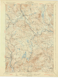
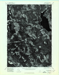
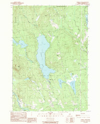
 1955 Anson1957 Print · USGSThe Kennebec River valley in the mid-1950s shows a landscape of busy riverside towns and quiet rural crossroads. Researchers can trace the Maine Central Railroad and find local landmarks like the Union Ch, Purington Sch, and the uniquely named Land of Rest Cem.4 unique versions available
 - 1956 Map of Bangor, 1966 Print
 1956 Bangor1966 Print · USGSMid-century Maine comes alive in this survey of the rugged coast and river valleys during the 1950s. Genealogists and historians can trace the vital rail corridors of the Maine Central RR connecting timber towns like Old Town to the coast at Bar Harbor.3 unique versions available
 - 1956 Map of Lewiston, 1975 Print
 1956 Lewiston1975 Print · USGSThe Northern New England interior is documented here in the mid-fifties, from the industrial Androscoggin River to the high peaks of the White Mountains. Trace the Grand Trunk Railway through mountain passes or locate family landmarks near Sabbathday Lake and Bretton Woods.
 - 1960 Map of Bangor
 1960 Bangor1960 Print · USGSCentral Maine in the sixties reveals a landscape of river-powered industry and sprawling coastal island chains. Researchers can trace the rail corridors of the Maine Central or locate mid-century aviation landmarks like Dow Air Force Base.
 - 1961 Map of Bangor
 1961 Bangor1961 Print · USGSMid-century Maine comes alive through its busy river ports and rocky archipelagoes during a period of steady maritime and rail commerce. Researchers can trace the path of the Maine Central railroad and locate coastal landmarks from Acadia National Park to Vinalhaven Island.
 - 1961 Map of Lewiston
 1961 Lewiston1961 Print · USGSWestern Maine and the White Mountains appear here during the early sixties, showing the industrial river towns and vast timberlands before the modern interstate era. Genealogists and historians can trace the Grand Trunk RR through Berlin or locate landmarks like Old Speck Mountain and Elephant Mountain.
 - 1962 Map of Lewiston
 1962 Lewiston1962 Print · USGSThe industrial river valleys and high peaks of Maine and New Hampshire define the region in the early sixties. Trace the rail-and-river network from Lewiston to the White Mountains, passing through mill towns like Berlin and Rumford.
 - 1969 Map of Lewiston
 1969 Lewiston1969 Print · USGSThe northern New England highlands come into focus during the mid-fifties, showing the vital rail and river networks connecting industrial centers to the deep woods. Researchers can trace the path of the Grand Trunk RR or locate landmarks like Mt Washington and Rangeley Lake.
 - 1975 Map of Anson NW, 1980 Print
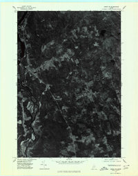
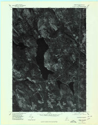 1975 Anson NW1980 Print · USGSCentral Somerset County is captured in the mid-1970s through this detailed orthophotograph of the northern Maine woods. Researchers can trace the timbered shorelines of Embden Pond and follow the paths of the Kennebec River and Carrabassett River.
 - 1975 Map of Anson SE, 1980 Print
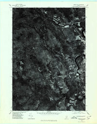
 1975 Anson SE1980 Print · USGSSomerset County land and river patterns are captured in high detail in the mid-1970s. Researchers can trace the winding Kennebec River and identify family-named crossroads like Blackwell Corner and Martin Corner.
 - 1975 Map of Anson NE, 1980 Print
 1975 Anson NE1980 Print · USGSMaine's Kennebec valley remains deeply rural in the mid-seventies, showing the enduring structure of its riverfront towns and upland crossroads. Genealogists and local historians can trace the settlement footprints of Solon, Embden, and the rural junction at Twelve Corners.
 - 1976 Map of Anson SW, 1980 Print
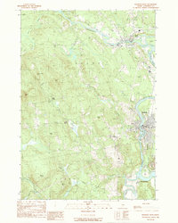
 1976 Anson SW1980 Print · USGSSomerset County river settlements and timberlands are captured in this mid-seventies aerial study. Trace the industrial and residential footprints along the Kennebec River through Anson, North Anson, and Madison.
 - 1979 Map of New Vineyard, 1983 Print
 1979 New Vineyard1983 Print · USGSFranklin County's wooded hills and remote settlements are captured in this late 1970s aerial survey. Trace rural homesteads and land patterns around New Vineyard, West Mills, and the slopes of the New Vineyard Mountains.
 - 1985 Map of Skowhegan, 1986 Print
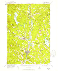
 1985 Skowhegan1986 Print · USGSCentral Maine in the mid-eighties shows a landscape of river-driven industry and rural crossroads. Genealogists can trace family names and farmsteads near Lake George or along the Maine Central Railroad through Pittsfield and Burnham.2 unique versions available
 - 1986 Map of Rumford
 1986 Rumford1986 Print · USGSWestern Maine in the mid-eighties shows a rugged landscape of industrial river towns and high-country timber plantations. Trace the rail-and-river economy through Rumford, Dixfield, and the Maine Central RR or locate the historic campus of Farmington State College.
 - 1989 Map of New Vineyard
 1989 New Vineyard1989 Print · USGSFranklin County's high ridges and river valleys are captured here in the late eighties, showing the settlement of New Vineyard and West Mills. Genealogists and hikers can trace old routes past Mill Pond, local Cem sites, and the peaks of the New Vineyard Mountains.
 - 1989 Map of Madison West
 1989 Madison West1989 Print · USGSThe Kennebec and Carrabassett rivers meet in this 1980s Somerset County survey during a period of enduring rural industry and traditional riverfront settlement. Researchers can trace historical routes like the Arnold Trail and locate family landmarks such as Pease Corner, Savage Island, and Dane Corner.
 - 1989 Map of Embden Pond
 1989 Embden Pond1989 Print · USGSSomerset County's water-rich landscape is captured here in the late twentieth century as it appeared before further modern development. Genealogists and local historians can trace family landmarks and rural infrastructure from the State Fish Hatchery to the Cem near Savage Hill.
 - 1989 Map of Solon
 1989 Solon1989 Print · USGSThe Kennebec Valley in the late eighties remains a landscape of river-powered industry and quiet highland settlements. Genealogists and local historians can locate Arnolds Landing, the Williams Dam, and rural crossroads like Twelve Corners.
 - 1989 Map of Madison East
 1989 Madison East1989 Print · USGSSomerset County's river valleys and lakefronts are captured here in the late 1980s, showcasing the transition from the Kennebec River to Wesserunset Lake. Researchers can trace old crossroads like White School Corner or locate family landmarks on Eames Hill and Tarbell Hill.
Showing maps 1-25 of 51
Top cities near Anson
- Farmington historical maps
- Fairfield historical maps
- Skowhegan historical maps
- Oakland historical maps
- Madison historical maps
- Wilton historical maps
See more
Top neighborhoods of Anson
Frequently asked questions
- What are the different types of historical maps available for Anson?
- What is the oldest map of Anson?
- Where can I purchase historical maps of Anson for my home or office?
- Where can I download high-res historical maps of Anson?
- Are there historical topographic maps available for Anson?
- Is there historical aerial imagery available for Anson?
- Where are historical maps of Anson sourced from?