1920s Maps of Bradstreet Township, Maine
Explore 7 historic maps of Bradstreet Township from the 1920s. These maps offer a rare glimpse into what life looked like during the 1920s — showing old roads, neighborhoods, homes, and landmarks that have changed or disappeared over time.
Whether you're researching your family's past, planning a metal detecting trip, or studying how Bradstreet Township's landscape evolved across the 1920s, these high-resolution maps are a powerful tool for exploring the history of this region.
- Focus on a specific era: All maps on this page are from the 1920s, giving you a focused view of this time period.
- See what’s changed: Compare century-old streets, trails, and buildings to today's modern landscape using overlays and satellite layers.
- Research with precision: Use these maps for genealogy, historical research, land use analysis, or educational projects.
- View, download, or print: Maps are fully viewable online in high resolution, and can be downloaded or printed for your own records.
Start exploring Bradstreet Township's history through authentic maps from the 1920s. This is your window into the past.
Bradstreet Township, ME maps
(7)- 1922 Map of Long Pond, 1955 Print
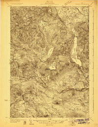
 1922 Long Pond1955 Print · USGSThe Maine north woods in the early twenties reveals a landscape defined by the Canadian Pacific rail line and the timber industry. Genealogists and historians can trace family-named sites like Fogg Farm, Mackamp, and Jackman Mill.5 unique versions available
 - 1923 Map of Attean, 1965 Print
 1923 Attean1965 Print · USGSSomerset County's wilderness is captured here in the 1920s, showcasing a network of remote outposts and waterways along the international border. Genealogists and historians can trace the Canadian Pacific line to Jackman Station, Boston Ranch, and the Stetson School.2 unique versions available
 - 1924 Map of Long Pond
 1924 Long Pond1924 Print · USGSSomerset County’s timber and rail landscape is captured here in the early twenties as the logging and sporting industries thrived. Trace the Canadian Pacific rail line through Jackman Station to remote outposts like Mackamp and the Whipple Farm.5 unique versions available
 - 1925 Map of Pierce Pond
 1925 Pierce Pond1925 Print · USGSSomerset County in the mid-twenties was a landscape of remote timberlands and sporting camps connected by river landings. Genealogists and historians can trace early wilderness outposts like Grace Pond Camp and industrial markers like Spencer Dam or the Coburn Mtn Lookout Station.2 unique versions available
 - 1925 Map of Attean
 1925 Attean1925 Print · USGSThe Maine wilderness at the Canadian border in the mid-1920s is a landscape of timber and rail. Researchers can trace the development of Jackman and Jackman Station or locate remote sites like Boston Ranch and Stetson School.6 unique versions available
 - 1927 Map of Pierce Pond
 1927 Pierce Pond1927 Print · USGSThe remote Maine woods of Somerset County come alive in this mid-1920s survey of the Upper and Lower Enchanted territories. Genealogists and historians can trace early wilderness outposts like Salmon Streams Farm, West Forks, and the riverside Hayden Landing.6 unique versions available
 - 1928 Map of Spencer
 1928 Spencer1928 Print · USGSNorthern Maine's remote logging and sporting country is captured here during the late 1920s. You can trace early wilderness outposts like Gerard (PO) Spencer Lake Camps and Kibby Kamp near Spencer Lake.2 unique versions available
End of results
Showing maps 1-7 of 7
Top cities near Bradstreet Township
- Jackman historical maps
- Moose River historical maps
- Dennistown Plantation historical maps
- West Forks historical maps
- The Forks historical maps
Top neighborhoods of Bradstreet Township
Frequently asked questions
- What are the different types of historical maps available for Bradstreet Township?
- What is the oldest map of Bradstreet Township?
- Where can I purchase historical maps of Bradstreet Township for my home or office?
- Where can I download high-res historical maps of Bradstreet Township?
- Are there historical topographic maps available for Bradstreet Township?
- Is there historical aerial imagery available for Bradstreet Township?
- Where are historical maps of Bradstreet Township sourced from?