1980s Maps of New Portland, Maine
Explore 8 historic maps of New Portland from the 1980s. These maps offer a rare glimpse into what life looked like during the 1980s — showing old roads, neighborhoods, homes, and landmarks that have changed or disappeared over time.
Whether you're researching your family's past, planning a metal detecting trip, or studying how New Portland's landscape evolved across the 1980s, these high-resolution maps are a powerful tool for exploring the history of this region.
- Focus on a specific era: All maps on this page are from the 1980s, giving you a focused view of this time period.
- See what’s changed: Compare century-old streets, trails, and buildings to today's modern landscape using overlays and satellite layers.
- Research with precision: Use these maps for genealogy, historical research, land use analysis, or educational projects.
- View, download, or print: Maps are fully viewable online in high resolution, and can be downloaded or printed for your own records.
Start exploring New Portland's history through authentic maps from the 1980s. This is your window into the past.
New Portland, ME maps
(8)- 1985 Map of Skowhegan, 1986 Print
 1985 Skowhegan1986 Print · USGSCentral Maine in the mid-eighties shows a landscape of river-driven industry and rural crossroads. Genealogists can trace family names and farmsteads near Lake George or along the Maine Central Railroad through Pittsfield and Burnham.2 unique versions available
 - 1986 Map of Rumford
 1986 Rumford1986 Print · USGSWestern Maine in the mid-eighties shows a rugged landscape of industrial river towns and high-country timber plantations. Trace the rail-and-river economy through Rumford, Dixfield, and the Maine Central RR or locate the historic campus of Farmington State College.
 - 1989 Map of New Vineyard
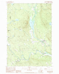
 1989 New Vineyard1989 Print · USGSFranklin County's high ridges and river valleys are captured here in the late eighties, showing the settlement of New Vineyard and West Mills. Genealogists and hikers can trace old routes past Mill Pond, local Cem sites, and the peaks of the New Vineyard Mountains.
 - 1989 Map of Madison West
 1989 Madison West1989 Print · USGSThe Kennebec and Carrabassett rivers meet in this 1980s Somerset County survey during a period of enduring rural industry and traditional riverfront settlement. Researchers can trace historical routes like the Arnold Trail and locate family landmarks such as Pease Corner, Savage Island, and Dane Corner.
 - 1989 Map of New Portland
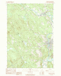
 1989 New Portland1989 Print · USGSThe river valleys of Somerset County appear here in the late eighties as a network of small settlements and rugged timberland. Researchers can trace family sites near New Portland, find various Cem locations, or follow the path of the Carrabassett River.
 - 1989 Map of Embden Pond
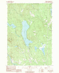 1989 Embden Pond1989 Print · USGSSomerset County's water-rich landscape is captured here in the late twentieth century as it appeared before further modern development. Genealogists and local historians can trace family landmarks and rural infrastructure from the State Fish Hatchery to the Cem near Savage Hill.
 - 1989 Map of Kingfield
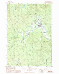 1989 Kingfield1989 Print · USGSKingfield and its timber-driven river valley are captured here in the late eighties, just as the mountain landscape was being mapped for modern planning. Genealogists and historians can trace families near Soule Mill, navigate the Salem Rd corridor, or locate rural cemeteries in the shadow of Vose Mountain.
 - 1989 Map of Strong
 1989 Strong1989 Print · USGSFranklin County settlement and industry are captured here in the late eighties as they follow the banks of the Sandy River. Researchers can trace the layout of Strong, find local landmarks like Porter Lake, and locate several Gravel Pits and Cemeteries.
End of results
Showing maps 1-8 of 8
Top cities near New Portland
- Farmington historical maps
- Madison historical maps
- Norridgewock historical maps
- Anson historical maps
- New Sharon historical maps
- Strong historical maps
See more
Top neighborhoods of New Portland
Frequently asked questions
- What are the different types of historical maps available for New Portland?
- What is the oldest map of New Portland?
- Where can I purchase historical maps of New Portland for my home or office?
- Where can I download high-res historical maps of New Portland?
- Are there historical topographic maps available for New Portland?
- Is there historical aerial imagery available for New Portland?
- Where are historical maps of New Portland sourced from?