2020s Maps of Northport, Maine
Explore 8 historic maps of Northport from the 2020s. These maps offer a rare glimpse into what life looked like during the 2020s — showing old roads, neighborhoods, homes, and landmarks that have changed or disappeared over time.
Whether you're researching your family's past, planning a metal detecting trip, or studying how Northport's landscape evolved across the 2020s, these high-resolution maps are a powerful tool for exploring the history of this region.
- Focus on a specific era: All maps on this page are from the 2020s, giving you a focused view of this time period.
- See what’s changed: Compare century-old streets, trails, and buildings to today's modern landscape using overlays and satellite layers.
- Research with precision: Use these maps for genealogy, historical research, land use analysis, or educational projects.
- View, download, or print: Maps are fully viewable online in high resolution, and can be downloaded or printed for your own records.
Start exploring Northport's history through authentic maps from the 2020s. This is your window into the past.
Northport, ME maps
(8)- 2021 Map of Searsport, 2021 Print
 2021 Searsport2021 Print · USGSCovers Northport, including Belfast, Searsport, and other nearby areas
 - 2021 Map of Islesboro, 2021 Print
 2021 Islesboro2021 Print · USGSCovers Northport, including Lincolnville, Deer Isle, and other nearby areas
 - 2021 Map of Belfast, 2021 Print
 2021 Belfast2021 Print · USGSCovers Northport, including Belfast, Swanville, and other nearby areas
 - 2021 Map of Lincolnville, 2021 Print
 2021 Lincolnville2021 Print · USGSCovers Northport, including Belfast, Camden, and other nearby areas
 - 2024 Map of Belfast, 2024 Print
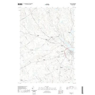
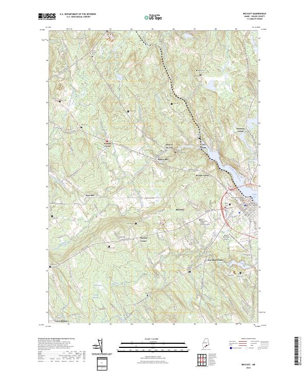 2024 Belfast2024 Print · USGSBelfast and its rural Waldo County hinterlands are shown here in recent years, where the Passagassawakeag River meets the bay. Genealogists and researchers can trace family names through numerous burial sites like Grove Cem and Piper Cem, or locate historic corners such as Bryants Corner.
 - 2024 Map of Lincolnville, 2024 Print
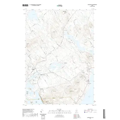
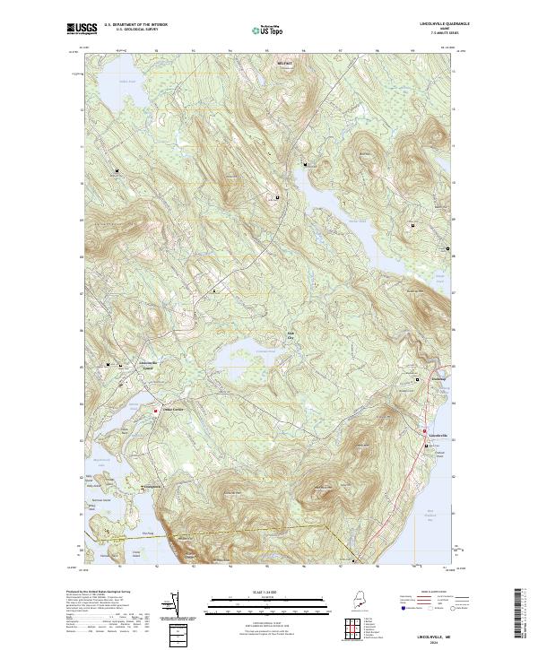 2024 Lincolnville2024 Print · USGSMid-coast Maine at the edge of Waldo County shows a rugged transition from the heights of Mt Megunticook to the waters of Ducktrap Harbor. Genealogists and local historians can locate numerous family burial sites such as Collier Cem and Griffin Cem, alongside old settlements like Slab City.
 - 2024 Map of Searsport, 2024 Print
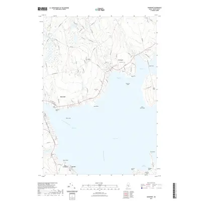
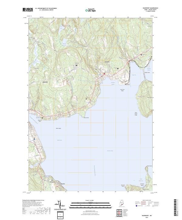 2024 Searsport2024 Print · USGSSearsport and the western reaches of Penobscot Bay are captured here, showcasing the region's coastal settlement and maritime landscape. Researchers can locate numerous family burial sites like Gordon Cem and trace shoreline features from Mack Point to Sears Island.
 - 2024 Map of Islesboro, 2024 Print
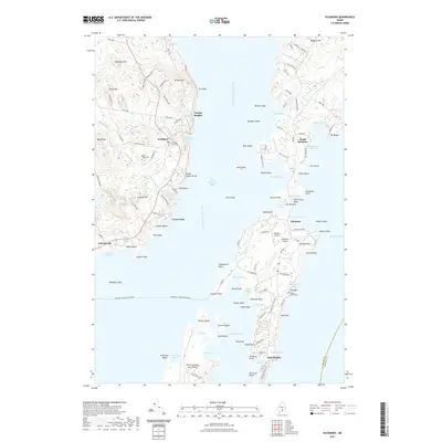
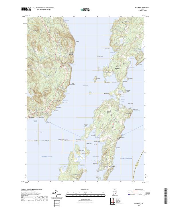 2024 Islesboro2024 Print · USGSMaine's mid-coast islands and shoreline are captured here as they appeared in the early twenty-first century. Genealogists can locate family sites at Maple Grove Cem or Saturday Cove Cem, while maritime historians can trace the Margaret Chase Smith Ferry route and the docks of Dark Harbor.
End of results
Showing maps 1-8 of 8
Top cities near Northport
- Rockland historical maps
- Belfast historical maps
- Warren historical maps
- Camden historical maps
- Rockport historical maps
- Thomaston historical maps
See more
Top neighborhoods of Northport
- Hurds Corner historical maps
- Temple Heights historical maps
- East Northport historical maps
- Greenlaws Corner historical maps
- Crows Nest historical maps
- Bayside historical maps
See more
Frequently asked questions
- What are the different types of historical maps available for Northport?
- What is the oldest map of Northport?
- Where can I purchase historical maps of Northport for my home or office?
- Where can I download high-res historical maps of Northport?
- Are there historical topographic maps available for Northport?
- Is there historical aerial imagery available for Northport?
- Where are historical maps of Northport sourced from?