1970s Maps of Thorndike, Maine
Explore 4 historic maps of Thorndike from the 1970s. These maps offer a rare glimpse into what life looked like during the 1970s — showing old roads, neighborhoods, homes, and landmarks that have changed or disappeared over time.
Whether you're researching your family's past, planning a metal detecting trip, or studying how Thorndike's landscape evolved across the 1970s, these high-resolution maps are a powerful tool for exploring the history of this region.
- Focus on a specific era: All maps on this page are from the 1970s, giving you a focused view of this time period.
- See what’s changed: Compare century-old streets, trails, and buildings to today's modern landscape using overlays and satellite layers.
- Research with precision: Use these maps for genealogy, historical research, land use analysis, or educational projects.
- View, download, or print: Maps are fully viewable online in high resolution, and can be downloaded or printed for your own records.
Start exploring Thorndike's history through authentic maps from the 1970s. This is your window into the past.
Thorndike, ME maps
(4)- 1975 Map of Burnham NE, 1980 Print
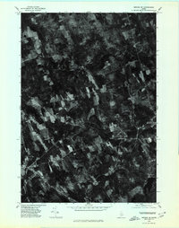
 1975 Burnham NE1980 Print · USGSWaldo County's rural landscape is captured from above in the mid-1970s, revealing the intricate patterns of forest and farmland. Researchers can trace the layout of small settlements like Greens Corner and Reynolds Corner near the shores of Unity Pond.
 - 1975 Map of Brooks NW, 1980 Print
 1975 Brooks NW1980 Print · USGSMid-seventies central Maine comes into sharp focus in this aerial survey of Penobscot and Waldo Counties. Researchers can trace rural property lines and woodlots surrounding North Dixmont, East Troy, and the slopes of Mount Harris.
 - 1975 Map of Burnham SE, 1980 Print
 1975 Burnham SE1980 Print · USGSWaldo County at the height of the 1970s shows a landscape of enduring rural character and organized woodlots. Local historians can trace family locations and land use patterns around Unity, Freedom, and the crossroads at Knox Corner.
 - 1975 Map of Brooks SW, 1980 Print
 1975 Brooks SW1980 Print · USGSWaldo County's rural landscape is preserved in this mid-1970s orthophotograph, revealing the actual texture of the woods and fields in the Maine interior. Researchers can pinpoint specific homesteads and landmarks like Knox Center, Ray Corner, and Lake Passagassawakeag.
End of results
Showing maps 1-4 of 4
Top cities near Thorndike
- Belfast historical maps
- China historical maps
- Pittsfield historical maps
- Winterport historical maps
- Clinton historical maps
- Newport historical maps
See more
Top neighborhoods of Thorndike
Frequently asked questions
- What are the different types of historical maps available for Thorndike?
- What is the oldest map of Thorndike?
- Where can I purchase historical maps of Thorndike for my home or office?
- Where can I download high-res historical maps of Thorndike?
- Are there historical topographic maps available for Thorndike?
- Is there historical aerial imagery available for Thorndike?
- Where are historical maps of Thorndike sourced from?