Old Maps of Perry, Maine for Hiking & Exploration
Hike through history with 39 historic maps of Perry. Explore old trails, ghost towns, and forgotten backroads — perfect for outdoor adventurers and local explorers.
- Rediscover forgotten places: Map out old mining camps, roads, and footpaths that no longer exist on modern maps.
- Layer with modern tools: Combine with LiDAR or satellite views to plan hikes through historical terrain.
- Made for exploration: Popular among hikers, overlanders, and local history lovers.
Use these maps to find adventure and explore the hidden past of Perry.
Perry, ME maps
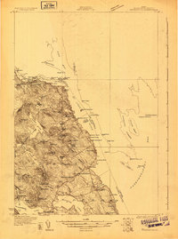
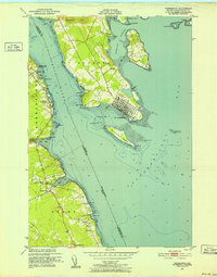
(39)- 1907 Map of Eastport
 1907 Eastport1907 Print · USGSCoastal Washington County is seen here at the height of its maritime and rail era, detailing the intricate shorelines between Eastport and Lubec. Researchers can trace the Washington County Railway through Ayers Junction or locate local landmarks like North Lubec Landing and the Burnt Cove School.
 - 1908 Map of Eastport
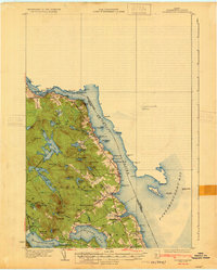
 1908 Eastport1908 Print · USGSMaine's easternmost coastline comes alive in the early twentieth century, showing the bustling island city of Eastport and the sardine-packing hub of Lubec. Genealogists can trace family footprints at rural schoolhouses like Crosby School or follow the Washington County Railway to Ayers Junction.4 unique versions available
 - 1929 Map of Robbinston
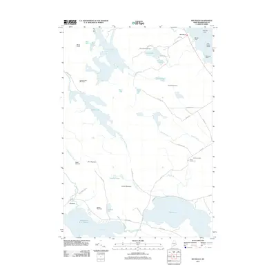
 1929 Robbinston1929 Print · USGSThe Maine-New Brunswick border comes to life in the late twenties as this survey traces the international waters of the St Croix River. Genealogists and historians can locate rural landmarks like South Robbinston Sch, Charlotte Sta, and several coastal lighthouses.3 unique versions available
 - 1931 Map of Robbinston
 1931 Robbinston1931 Print · USGSThe Maine coast near Robbinston and the Canadian border is captured here during the interwar years as a landscape of maritime navigation and rural communities. Genealogists can trace family landmarks and local schools like Bog Brook Sch, Shore Sch, and the riverside village of Red Beach.4 unique versions available
 - 1943 Map of Eastport, 1955 Print
 1943 Eastport1955 Print · USGSCoastal Washington County is defined here by its complex tidal bays and international border during the mid-forties. Genealogists and historians can trace the Maine Central Railroad through Dennysville Station or locate rural landmarks like the West Pembroke Ch and the Pleasant Point Indian Reservation.2 unique versions available
 - 1945 Map of Eastport
 1945 Eastport1945 Print · USGSThe rugged coast of Washington County is captured here at the end of the war, showcasing the maritime hubs of Eastport and Lubec. Genealogists can trace family names across Ayers Junction, locate rural landmarks like the Wilcox Sch, and explore the early bounds of the Moosehorn National Wildlife Refuge.2 unique versions available
 - 1949 Map of Robbinston, 1952 Print
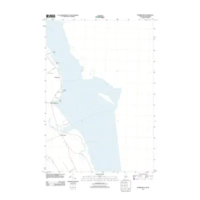
 1949 Robbinston1952 Print · USGSThe international boundary at the St Croix River comes to life in the late 1940s, showing the connection between Maine and New Brunswick. Researchers can trace the Canadian Pacific rail line, locate the Back District Ch, or find the U S Customs post at Robbinston.3 unique versions available
 - 1949 Map of Pembroke, 1952 Print
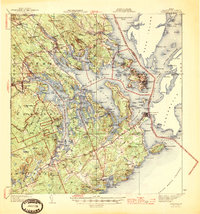
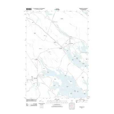
 1949 Pembroke1952 Print · USGSIn the mid-century Maine coast, the tidal rivers and rail lines shaped the community of Pembroke. Trace the Maine Central line through Ayers Junction and find old landmarks like Hillside Cem and the Preston Sch.4 unique versions available
 - 1949 Map of Red Beach, 1952 Print
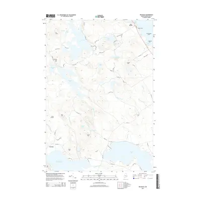
 1949 Red Beach1952 Print · USGSThe St. Croix River waterfront and the rugged lake country of Washington County are shown here in the years following the war. Researchers can locate the South Robbinston Ridge Sch, the Robbinston Ridge Ch, and local landmarks like Little Dochet Island and Fairview Cem.3 unique versions available
 - 1949 Map of Eastport, 1952 Print
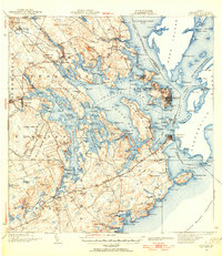
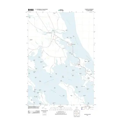
 1949 Eastport1952 Print · USGSThe Maine coast meets the Canadian border in this mid-century survey of the Passamaquoddy Bay islands. Genealogists and historians can trace the waterfront streets of Eastport, the homes of the Pleasant Point Indian Reservation, and the Maine Central rail line.4 unique versions available
 - 1957 Map of Fredericton, 1981 Print
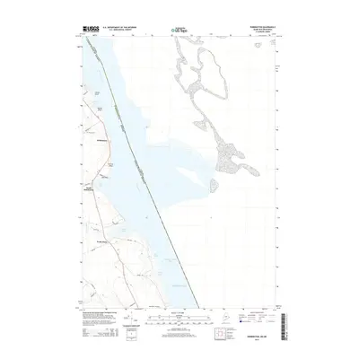
 1957 Fredericton1981 Print · USGSThe New Brunswick and Maine borderlands come into focus in the mid-fifties, dominated by the Saint John River and massive military tracts. Genealogists can locate riverfront hamlets like Maugerville or inland sites like Scotch Settlement along the Canadian Pacific rail line.
 - 1961 Map of Eastport
 1961 Eastport1961 Print · USGSThe maritime borderlands of Maine and New Brunswick are captured here in the early sixties, showing a world defined by the Bay of Fundy. Researchers can trace the Maine Central Railroad to Machiasport or explore remote island villages like Grand Harbour and Welchpool.
 - 1963 Map of Fredericton
 1963 Fredericton1963 Print · USGSThe Saint John River valley and the Maine-New Brunswick border are captured here during the early sixties. Researchers can trace the Canadian Pacific rail lines through rural settlements like Jewetts Mills, Mckeens Corner, and Scotch Settlement.
 - 1969 Map of Eastport
 1969 Eastport1969 Print · USGSThe maritime borderlands of Washington County and New Brunswick appear in detail during the late sixties. Researchers can trace historic rail lines like the Maine Central Railroad and explore coastal settlements from Machias to St. Andrews.
 - 1976 Map of Eastport
 1976 Eastport1976 Print · USGSThe maritime borderlands of Maine and Nova Scotia come alive in this mid-seventies survey of the Downeast coast. Genealogists and historians can trace the shoreline settlements of Eastport, Lubec, and Machias, or cross the channel to find Acadian villages like Church Point and Meteghan Centre.
 - 1985 Map of Machias, 1986 Print
 1985 Machias1986 Print · USGSThe Downeast coast of Maine in the 1980s reveals a landscape of deep-water bays, tidal rivers, and isolated timberlands. Researchers can trace the Maine Central rail line and locate coastal landmarks from Leighton Point to the U.S. Naval Radio Station.
 - 1986 Map of Calais
 1986 Calais1986 Print · USGSCoastal and interior Washington County are captured here in the mid-1980s, where the international border follows the winding St Croix River. Genealogists and historians can trace the rail lines of the Maine Central and find landmarks like Red Beach and Princeton Airport.
 - 1994 Map of Calais
 1994 Calais1994 Print · USGSEastern Maine's river and lake country comes into focus in the 1990s, centered on the international border at Calais and the vast Passamaquoddy Indian Reservation. Researchers can trace the water-linked settlements of Grand Lake Stream, the airfield at Princeton Airport, and the industrial heritage of Woodland.
 - 1994 Map of Machias
 1994 Machias1994 Print · USGSThe Downeast coast of Maine in the 1990s is captured here, from the Narraguagus River to the Canadian border. Genealogists and historians can trace coastal settlements like Jonesboro and Addison or locate the U.S. Naval Radio Station and Moosehorn National Wildlife Refuge.
 - 2011 Map of Red Beach, 2011 Print
 2011 Red Beach2011 Print · USGSCovers Perry, including Calais, Pembroke, and other nearby areas
 - 2011 Map of Robbinston, 2011 Print
 2011 Robbinston2011 Print · USGSCovers Perry, including Calais, Saint Andrews, and other nearby areas
 - 2011 Map of Pembroke, 2011 Print
 2011 Pembroke2011 Print · USGSCovers Perry, including Pembroke, Charlotte, and other nearby areas
 - 2011 Map of Eastport, 2011 Print
 2011 Eastport2011 Print · USGSCovers Perry, including Eastport, Lubec, and other nearby areas
 - 2014 Map of Robbinston, 2014 Print
 2014 Robbinston2014 Print · USGSCovers Perry, including Calais, Saint Andrews, and other nearby areas
 - 2014 Map of Red Beach, 2014 Print
 2014 Red Beach2014 Print · USGSCovers Perry, including Calais, Pembroke, and other nearby areas
Showing maps 1-25 of 39
Top cities near Perry
- Calais historical maps
- Eastport historical maps
- Lubec historical maps
- Pembroke historical maps
- Pleasant Point / Sipayik historical maps
- Robbinston historical maps
See more
Top neighborhoods of Perry
Frequently asked questions
- What are the different types of historical maps available for Perry?
- What is the oldest map of Perry?
- Where can I purchase historical maps of Perry for my home or office?
- Where can I download high-res historical maps of Perry?
- Are there historical topographic maps available for Perry?
- Is there historical aerial imagery available for Perry?
- Where are historical maps of Perry sourced from?