Old Maps of Alfred, Maine for Academic Research
Study the evolution of Alfred with 55 high-resolution historic maps. Whether you're teaching, researching, or modeling changes in land use, these maps provide essential visual documentation of urban, environmental, and geographic change.
- Analyze long-term change: Track patterns in development, transportation, and natural features.
- Ideal for environmental or urban studies: Support academic projects with primary historical map data.
- Use in the classroom or lab: Educators and researchers rely on these maps to bring historical context to life.
These maps are a powerful tool for teaching, research, and visualizing how Alfred has changed over the decades.
Alfred, ME maps
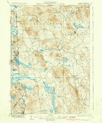
(55)- 1891 Map of Berwick
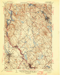
 1891 Berwick1891 Print · USGSThe Maine-New Hampshire borderlands are captured here in the late nineteenth century, defined by the industrial river valleys and growing rail lines. Researchers can trace the early layout of Sanford, locate the mill sites at Emerys Mills, or follow the Rochester and Portland Railroad through the Lebanon hills.
 - 1891 Map of Kennebunk
 1891 Kennebunk1891 Print · USGSCoastal York County comes alive in the late Victorian era as the railroad network expands through the marshes and timberlands. Researchers can trace the dual tracks of the Boston and Maine Railroad and locate vanished stops like Wells Depot or the early industry at Littlefield's Mills.
 - 1891 Map of Buxton
 1891 Buxton1891 Print · USGSThe Saco River valley at the end of the nineteenth century is captured here in detail, showcasing a network of mill villages and early rail lines. Researchers can trace the path of the Portland and Rochester Railroad and locate historic sites like Shaker Village, Salmon Falls, and Nasons Mills.
 - 1891 Map of Newfield
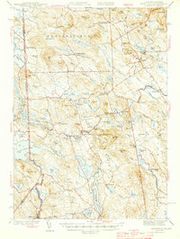
 1891 Newfield1891 Print · USGSThe York County hill country comes to life in the 1890s, when the region was a tapestry of mill towns and scattered farm hamlets. Researchers can trace the early layout of Limerick, the industry at Ossipee Mills, and the border-spanning waters of Great East Pond.
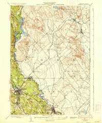
 - 1892 Map of Buxton, 1913 Print
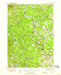
 1892 Buxton1913 Print · USGSSouthern Maine's mill towns and river valleys are captured here in the late nineteenth century as the industrial economy thrived along the Saco River. Genealogists and historians can trace the early layouts of Shaker Village, Nasons Mills, and Salmon Falls before modern development changed these rural landscapes.4 unique versions available
 - 1893 Map of Kennebunk
 1893 Kennebunk1893 Print · USGSThe coastal and inland reaches of York County are documented here in the final decade of the nineteenth century, showing a landscape defined by river power and rail. Genealogists and historians can trace the early layouts of Littlefield's Mills, the bustling Kennebunk Landing, and the tracks of the Boston and Maine Railroad.
 - 1893 Map of Berwick
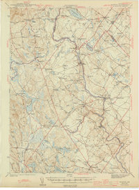
 1893 Berwick1893 Print · USGSThe Maine-New Hampshire borderlands come alive in the late nineteenth century as a hub of water-powered industry and rail transport. Researchers can trace the sprawling rural hamlets of Lebanon and the industrial activity at Great Falls along the Salmon Falls River.6 unique versions available
 - 1893 Map of Buxton
 1893 Buxton1893 Print · USGSThe York County interior flourished in the late nineteenth century as a hub of river-powered industry and rail transport. Genealogists and historians can trace family-named sites and vanished mill hamlets like Shaker Village, Nasons Mills, and Salmon Falls.3 unique versions available
 - 1893 Map of Newfield
 1893 Newfield1893 Print · USGSMaine's borderlands and the York County interior are captured in the late nineteenth century as small-scale industry thrived along the rivers. Researchers can trace historic family lands near Great East Pond or study the early village layouts of Ossipee Mills, South Parsonsfield, and Maplewood.6 unique versions available
 - 1898 Map of Kennebunk
 1898 Kennebunk1898 Print · USGSThe York County coastline and inland mill towns thrive in the late nineteenth century as the railroad era reaches its peak. Genealogists and historians can trace old homesteads and depots near Littlefields Mills, Kennebunk Landing, and the seaside reaches of Ogunquit.6 unique versions available
 - 1933 Map of Berwick
 1933 Berwick1933 Print · USGSThe Salmon Falls River valley in the early thirties was a bustling corridor of rail and river industry between New Hampshire and Maine. Researchers can trace the path of the Boston and Maine RR through Rochester or locate rural landmarks like Hayes Sta and Walnut Grove Ch.
 - 1933 Map of Newfield
 1933 Newfield1933 Print · USGSThe Maine-New Hampshire borderlands in the early 1930s are captured here as a series of connected lakeside settlements. Trace family roots and old property lines near Milton Mills, Spinney Church, and the shores of Great East Lake.
 - 1937 Map of Newfield
 1937 Newfield1937 Print · USGSThe Maine and New Hampshire borderlands are captured here during the late 1930s, showing a landscape defined by riverside villages and glacial lakes. Genealogists and historians can trace family locations near Ossipee Mills, Spuney Ch, and the many hamlets of Parsonsfield.3 unique versions available
 - 1937 Map of Berwick
 1937 Berwick1937 Print · USGSThe Maine-New Hampshire borderlands are captured here in the mid-1930s, showing a landscape defined by the Salmon Falls River and the region's busy rail lines. Researchers can trace old routes to North Rochester PO, Hayes Sta, and the school at S Milton Sch.3 unique versions available
 - 1941 Map of Kennebunk, 1952 Print
 1941 Kennebunk1952 Print · USGSCoastal Maine in the early 1940s reveals a landscape of industrial mill sites and growing seaside resorts connected by the nascent Maine Turnpike. Genealogists can trace family roots through numerous numbered schoolhouses and landmarks like Merriland Ch and Evergreen Cem.2 unique versions available
 - 1941 Map of Berwick, 1957 Print
 1941 Berwick1957 Print · USGSThe borderlands of Maine and New Hampshire come alive in this mid-century survey of the industrial and rural landscape along the Salmon Falls River. Researchers can trace the Boston and Maine rail line through Rindgemere Sta or locate family landmarks like Miller Corner and Lincoln Sch.
 - 1942 Map of Buxton, 1958 Print
 1942 Buxton1958 Print · USGSIn the early 1940s, the river valleys of southern Maine were defined by a tight-knit network of mill towns and rail corridors. Trace family roots and local industry through features like Salmon Falls, Shaw Mills, and the Chadbourne Cem.3 unique versions available
 - 1942 Map of Newfield, 1959 Print
 1942 Newfield1959 Print · USGSThe Maine and New Hampshire borderlands come to life in the early 1940s, showing a network of mill towns and mountain peaks. Researchers can trace family lines through small settlements like South Parsonsfield, locate the Spinney Ch, or explore the shores of Great East Lake and Mousam Lake.
 - 1944 Map of Buxton
 1944 Buxton1944 Print · USGSThe Saco River valley during the mid-forties reveals a landscape of mill towns and interconnected rural hamlets. Genealogists and local historians can trace the foundations of Bar Mills, locate the Chadbourne Cem, or follow the path of the Boston and Maine railroad.3 unique versions available
 - 1944 Map of Berwick
 1944 Berwick1944 Print · USGSThe Maine-New Hampshire borderlands are captured here during the wartime era, showing the industrial and rural landscapes of York and Strafford counties. Genealogists can trace family names at Blaisdell Corners or locate the Evergreen Cem and numerous rural schools like Washington Sch.3 unique versions available
 - 1944 Map of Newfield
 1944 Newfield1944 Print · USGSYork County and the New Hampshire borderlands are captured here during the mid-1940s, showing a landscape of mill towns and interconnected lakes. Genealogists and historians can trace family-named sites like Dearborn Mtn and Stevens Cor or explore the early layouts of Limerick and Milton Mills.2 unique versions available
 - 1944 Map of Kennebunk
 1944 Kennebunk1944 Print · USGSCoastal Maine thrives along the rivers and rails of York County in the early 1940s. Genealogists and historians can trace family roots through numerous local landmarks, from Evergreen Cem and Merriland Ch to the many numbered schoolhouses like School No 10.2 unique versions available
 - 1949 Map of Portland
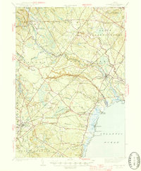
 1949 Portland1949 Print · USGSCoastal Maine and the New Hampshire interior are shown in detail during the late forties, from the bustling harbors to the lakeside villages. Researchers can trace historical rail networks like the Boston & Maine RR and locate coastal defenses such as Fort Preble.3 unique versions available
 - 1956 Map of Kennebunk, 1959 Print
 1956 Kennebunk1959 Print · USGSCoastal York County during the mid-fifties shows a fascinating mix of old mill culture and new turnpike development. Researchers can trace family history through dozens of named locations like Hobbs Crossing, Parsonage Corner, and Bartlett Mills.4 unique versions available
 - 1956 Map of Portland, 1963 Print
 1956 Portland1963 Print · USGSSouthern Maine and eastern New Hampshire are captured here in the mid-fifties, during a time of major highway expansion and military growth. You can trace the path of the Maine Turnpike and locate landmarks like the Portsmouth Naval Shipyard and Sebago Lake.4 unique versions available
Showing maps 1-25 of 55
Top cities near Alfred
- Rochester historical maps
- Biddeford historical maps
- Sanford historical maps
- Saco historical maps
- Gorham historical maps
- Somersworth historical maps
See more
Top neighborhoods of Alfred
- North Alfred historical maps
- Alfred Mills historical maps
- Hazel Dell Apartments historical maps
- Colonial Mobile Home Park historical maps
- Wood's Edge Apartments historical maps
Frequently asked questions
- What are the different types of historical maps available for Alfred?
- What is the oldest map of Alfred?
- Where can I purchase historical maps of Alfred for my home or office?
- Where can I download high-res historical maps of Alfred?
- Are there historical topographic maps available for Alfred?
- Is there historical aerial imagery available for Alfred?
- Where are historical maps of Alfred sourced from?