2020s Maps of Lyman, Maine
Explore 8 historic maps of Lyman from the 2020s. These maps offer a rare glimpse into what life looked like during the 2020s — showing old roads, neighborhoods, homes, and landmarks that have changed or disappeared over time.
Whether you're researching your family's past, planning a metal detecting trip, or studying how Lyman's landscape evolved across the 2020s, these high-resolution maps are a powerful tool for exploring the history of this region.
- Focus on a specific era: All maps on this page are from the 2020s, giving you a focused view of this time period.
- See what’s changed: Compare century-old streets, trails, and buildings to today's modern landscape using overlays and satellite layers.
- Research with precision: Use these maps for genealogy, historical research, land use analysis, or educational projects.
- View, download, or print: Maps are fully viewable online in high resolution, and can be downloaded or printed for your own records.
Start exploring Lyman's history through authentic maps from the 2020s. This is your window into the past.
Lyman, ME maps
(8)- 2021 Map of Alfred, 2021 Print
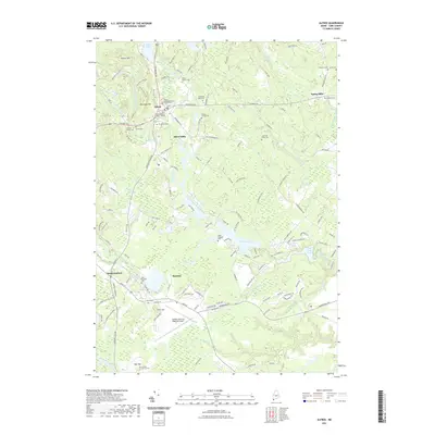 2021 Alfred2021 Print · USGSCovers Lyman, including Sanford, Kennebunk, and other nearby areas
 - 2021 Map of Bar Mills, 2021 Print
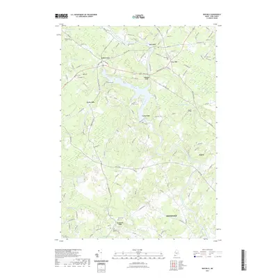 2021 Bar Mills2021 Print · USGSCovers Lyman, including Biddeford, Saco, and other nearby areas
 - 2021 Map of Waterboro, 2021 Print
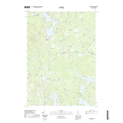 2021 Waterboro2021 Print · USGSCovers Lyman, including Waterboro, Hollis, and other nearby areas
 - 2021 Map of Kennebunk, 2021 Print
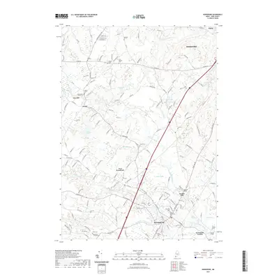 2021 Kennebunk2021 Print · USGSCovers Lyman, including Biddeford, Saco, and other nearby areas
 - 2024 Map of Kennebunk, 2024 Print
 2024 Kennebunk2024 Print · USGSCoastal Maine's interior mill towns and family farmsteads are documented in this contemporary survey of York County. Genealogists and historians can trace family burial sites like Burbank Taylor Cem and historic mill locations at Days Mill or Bartlett Mills.
 - 2024 Map of Bar Mills, 2024 Print
 2024 Bar Mills2024 Print · USGSYork County's river-driven heritage is on full display here in the early twenty-first century, centered on the powerful Saco River. Researchers can trace old family footprints across the Dennett Lot and Hanson Lot or locate burial sites like Riverside Cem and Tory Hill Cem.
 - 2024 Map of Waterboro, 2024 Print
 2024 Waterboro2024 Print · USGSModern-day York County retains its deep ancestral roots in this contemporary survey of the Waterboro area. Family historians can trace dozens of small burial plots like the Day Family Cem and Cyrus King Hamilton Cem near the shores of Little Ossipee Pond.
 - 2024 Map of Alfred, 2024 Print
 2024 Alfred2024 Print · USGSThe York County landscape in the early twenty-first century shows a mix of civic tradition and modern infrastructure. Genealogists can trace family heritage through numerous burial sites like Evergreen Cem and the Roberts Cem, while exploring the layout of Alfred and Sanford.
End of results
Showing maps 1-8 of 8
Top cities near Lyman
- Biddeford historical maps
- Scarborough historical maps
- Sanford historical maps
- Saco historical maps
- Windham historical maps
- Gorham historical maps
See more
Top neighborhoods of Lyman
Frequently asked questions
- What are the different types of historical maps available for Lyman?
- What is the oldest map of Lyman?
- Where can I purchase historical maps of Lyman for my home or office?
- Where can I download high-res historical maps of Lyman?
- Are there historical topographic maps available for Lyman?
- Is there historical aerial imagery available for Lyman?
- Where are historical maps of Lyman sourced from?