2020s Maps of Old Orchard Beach, Maine
Explore 8 historic maps of Old Orchard Beach from the 2020s. These maps offer a rare glimpse into what life looked like during the 2020s — showing old roads, neighborhoods, homes, and landmarks that have changed or disappeared over time.
Whether you're researching your family's past, planning a metal detecting trip, or studying how Old Orchard Beach's landscape evolved across the 2020s, these high-resolution maps are a powerful tool for exploring the history of this region.
- Focus on a specific era: All maps on this page are from the 2020s, giving you a focused view of this time period.
- See what’s changed: Compare century-old streets, trails, and buildings to today's modern landscape using overlays and satellite layers.
- Research with precision: Use these maps for genealogy, historical research, land use analysis, or educational projects.
- View, download, or print: Maps are fully viewable online in high resolution, and can be downloaded or printed for your own records.
Start exploring Old Orchard Beach's history through authentic maps from the 2020s. This is your window into the past.
Old Orchard Beach, ME maps
(8)- 2021 Map of Biddeford Pool, 2021 Print
 2021 Biddeford Pool2021 Print · USGSCovers Old Orchard Beach, including Biddeford, Scarborough, and other nearby areas
 - 2021 Map of Biddeford, 2021 Print
 2021 Biddeford2021 Print · USGSCovers Old Orchard Beach, including Biddeford, Saco, and other nearby areas
 - 2021 Map of Prouts Neck, 2021 Print
 2021 Prouts Neck2021 Print · USGSCovers Old Orchard Beach, including South Portland, Scarborough, and other nearby areas
 - 2021 Map of Old Orchard Beach, 2021 Print
 2021 Old Orchard Beach2021 Print · USGSCovers Old Orchard Beach, including Biddeford, Scarborough, and other nearby areas
 - 2024 Map of Biddeford Pool, 2024 Print
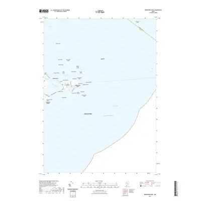
 2024 Biddeford Pool2024 Print · USGSThe York County coastline comes into sharp focus in this recent survey of the marshes and islands surrounding Biddeford Pool. Researchers can trace the layout of Hills Beach, find the Biddeford Pool Cem, and explore the tidal reaches of the Rachel Carson National Wildlife Refuge.
 - 2024 Map of Old Orchard Beach, 2024 Print
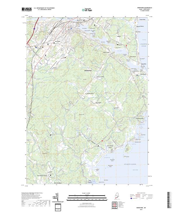
 2024 Old Orchard Beach2024 Print · USGSCoastal development meets preserved marshlands in this modern look at the shoreline from Old Orchard Beach to West Scarborough. Researchers can trace dozens of family-named landmarks and burial sites, from the Dearing Graveyard to the McKenney Cem.
 - 2024 Map of Biddeford, 2024 Print
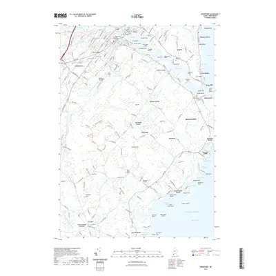
 2024 Biddeford2024 Print · USGSThe York County coast comes into sharp focus in this contemporary survey of the Saco River estuary and the city of Biddeford. Genealogists and historians can trace numerous burial sites like Laurel Hill Cem and old crossroads such as Tea Kettle Corner and Town House Corners.
 - 2024 Map of Prouts Neck, 2024 Print
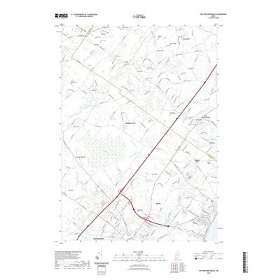
 2024 Prouts Neck2024 Print · USGSCoastal Maine transitions from the suburbs of South Portland to the marshes of Scarborough in this detailed modern survey. Genealogists can locate unique family burial sites like Olde Spurwink Plantation Cem and the Harmon - Waterhouse Cem.
End of results
Showing maps 1-8 of 8
Top cities near Old Orchard Beach
- Portland historical maps
- South Portland historical maps
- Biddeford historical maps
- Scarborough historical maps
- Westbrook historical maps
- Saco historical maps
See more
Top neighborhoods of Old Orchard Beach
- Ocean Park historical maps
- Old Orchard Beach Town Square historical maps
- Surfside historical maps
- Dunegrass Golf Community historical maps
- Milliken Mills historical maps
Frequently asked questions
- What are the different types of historical maps available for Old Orchard Beach?
- What is the oldest map of Old Orchard Beach?
- Where can I purchase historical maps of Old Orchard Beach for my home or office?
- Where can I download high-res historical maps of Old Orchard Beach?
- Are there historical topographic maps available for Old Orchard Beach?
- Is there historical aerial imagery available for Old Orchard Beach?
- Where are historical maps of Old Orchard Beach sourced from?