2020s Maps of Cumberland, Maryland
Explore 3 historic maps of Cumberland from the 2020s. These maps offer a rare glimpse into what life looked like during the 2020s — showing old roads, neighborhoods, homes, and landmarks that have changed or disappeared over time.
Whether you're researching your family's past, planning a metal detecting trip, or studying how Cumberland's landscape evolved across the 2020s, these high-resolution maps are a powerful tool for exploring the history of this region.
- Focus on a specific era: All maps on this page are from the 2020s, giving you a focused view of this time period.
- See what’s changed: Compare century-old streets, trails, and buildings to today's modern landscape using overlays and satellite layers.
- Research with precision: Use these maps for genealogy, historical research, land use analysis, or educational projects.
- View, download, or print: Maps are fully viewable online in high resolution, and can be downloaded or printed for your own records.
Start exploring Cumberland's history through authentic maps from the 2020s. This is your window into the past.
Cumberland, MD maps
(3)- 2023 Map of Evitts Creek, 2023 Print
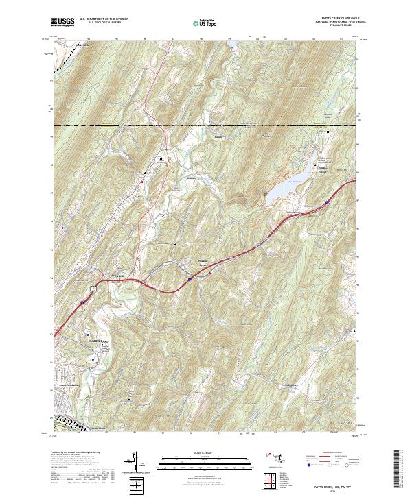 2023 Evitts Creek2023 Print · USGSThe rugged ridge-and-valley landscape east of Cumberland comes into focus in this recent survey. Local historians can trace family roots through sites like the Robinette Family Cem and Wolfe Mill or follow the path of Evitts Creek toward Lake Habeeb.
 - 2023 Map of Cumberland, 2023 Print
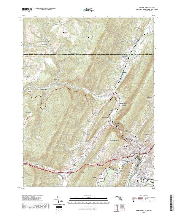 2023 Cumberland2023 Print · USGSCumberland and the Potomac River valley are shown in high detail at the dawn of the 2020s. Genealogists can locate family sites like Wellersburg Church Cem and Sixmile House near the historic passage of The Narrows.
 - 2023 Map of Cresaptown, 2023 Print
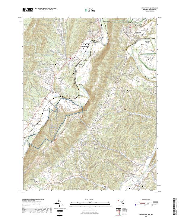 2023 Cresaptown2023 Print · USGSThe Potomac River valley on the Maryland-West Virginia border shows a complex mix of industrial history and modern aviation in this recent survey. Researchers can trace family plots like Abe Cem and Inkeep Cem or locate the sprawling Allegany Ballistics Lab.
End of results
Showing maps 1-3 of 3
Top cities near Cumberland
- Frostburg historical maps
- Keyser historical maps
- La Vale historical maps
- Bel Air historical maps
- Fairhope Township historical maps
- Lonaconing historical maps
See more
Top neighborhoods of Cumberland
- Cumberland Heights historical maps
- South Cumberland historical maps
- Decatur Heights historical maps
- Downtown historical maps
- North End historical maps
- Olde North End historical maps
See more
Frequently asked questions
- What are the different types of historical maps available for Cumberland?
- What is the oldest map of Cumberland?
- Where can I purchase historical maps of Cumberland for my home or office?
- Where can I download high-res historical maps of Cumberland?
- Are there historical topographic maps available for Cumberland?
- Is there historical aerial imagery available for Cumberland?
- Where are historical maps of Cumberland sourced from?