Old Maps of Accident, Maryland for Genealogy
Trace your family roots with 25 historic maps of Accident. These high-res maps reveal old neighborhoods, homesites, landmarks, and streets — helping you uncover where your ancestors lived and how the area evolved over time.
- Explore historic neighborhoods: Identify where your relatives may have lived in the 1800s or 1900s.
- Compare maps over time: Trace the changes in streets, buildings, and landmarks for multi-generational research.
- Perfect for genealogy & ancestry research: Used by family historians and researchers to map out lineage and migration.
These maps are an incredible resource for exploring your personal connection to Accident's past.
Accident, MD maps
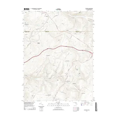
(25)- 1900 Map of Accident
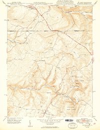
 1900 Accident1900 Print · USGSGarrett County highlands at the turn of the century reveal a landscape of mountain settlements and river-valley industry. Genealogists can trace family roots through the Blooming Rose Settlement, early milling sites like Speelman Mills, and the Baltimore and Ohio RR corridor.6 unique versions available
 - 1947 Map of McHenry, 1965 Print
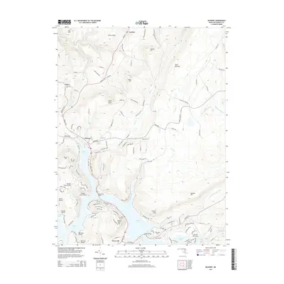
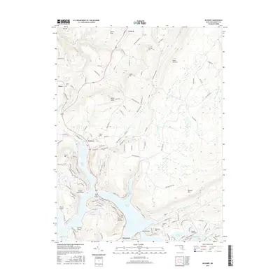
 1947 McHenry1965 Print · USGSGarrett County's high country and the early shoreline of the lake are captured here just after the war. Local researchers can trace family roots through rural landmarks like Beachy Sch, Glendale Cem, and the settlement of Accident.4 unique versions available
 - 1947 Map of Accident, 1982 Print
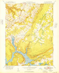
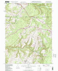
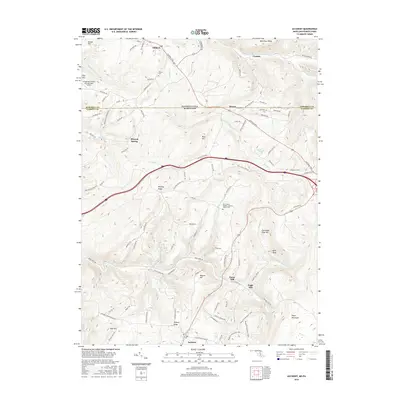
 1947 Accident1982 Print · USGSMaryland's high plateau comes into focus at the middle of the century, centered on the historic National Road and the uniquely named town of Accident. Genealogists and local historians can trace family-named landmarks like Kaese Mill, Sausman Mine, and several rural Cem locations throughout the Bear Creek valley.2 unique versions available
 - 1948 Map of Cumberland
 1948 Cumberland1948 Print · USGSMid-century Appalachia and the Shenandoah Valley are shown in detail, documenting the industrial and transportation hubs of the tri-state area. Genealogists can trace family roots through settlements like Double Tollgate and Bunker Hill or along the Baltimore & Ohio RR.3 unique versions available
 - 1948 Map of Accident, 1966 Print
 1948 Accident1966 Print · USGSGarrett County's high ridges and small mountain communities are captured here in the late 1940s as the regional timber and milling economy thrived. Researchers can trace historic family locations like Turney Cem, local industry at the Swanton Mine, and early transport along the National Pike.2 unique versions available
 - 1949 Map of McHenry
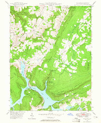
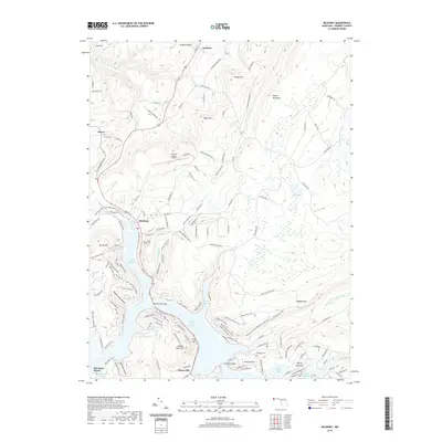
 1949 McHenry1949 Print · USGSGarrett County's mountainous lake country is captured here in the late 1940s as the shoreline of Deep Creek Lake continued to shape local life. Genealogists and historians can locate old landmarks like Beachy Sch, the Thayerville Lookout Tower, and family burials at Glendale Cem.
 - 1949 Map of Accident
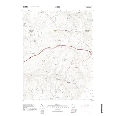
 1949 Accident1949 Print · USGSThe Maryland-Pennsylvania borderlands near Accident are captured here in the late 1940s, showing a rural landscape of ridges and milling sites. Genealogists and historians can trace local family landmarks like Turney Cem, the Rich Sch, and old industry at Kaese Mill.2 unique versions available
 - 1952 Map of Cumberland
 1952 Cumberland1952 Print · USGSThe Potomac Highlands and the Shenandoah Valley are revealed in this early 1950s survey of the Appalachian interior. Researchers can trace the river-and-rail corridors connecting Cumberland, Winchester, and the recreational waters of Deep Creek Lake.
 - 1956 Map of Cumberland, 1966 Print
 1956 Cumberland1966 Print · USGSThe tri-state Highlands in the mid-1950s show a landscape shaped by coal, timber, and the massive presence of the Baltimore & Ohio RR. Researchers can trace the industrial corridor from Cumberland through the Allegheny Mountains to mountain retreats like Deep Creek Lake.6 unique versions available
 - 1957 Map of Cumberland
 1957 Cumberland1957 Print · USGSThe Potomac River valley and the ridges of the Allegheny Front define this mid-century landscape at the intersection of Maryland, West Virginia, and Pennsylvania. Trace the steam-era rail lines of the Baltimore and Ohio RR or locate rural landmarks like St Stephens Church and Stony River Dam.
 - 1961 Map of Cumberland
 1961 Cumberland1961 Print · USGSThe tri-state highlands of Maryland, West Virginia, and Pennsylvania are shown in the mid-twentieth century as a complex landscape of ridges and river valleys. Researchers can trace the winding Potomac River and find old rail-and-river towns like Cumberland, Keyser, and Morgantown.
 - 1962 Map of Cumberland
 1962 Cumberland1962 Print · USGSThe central Appalachians meet at the height of the mid-century industrial era, showing the rugged topography between Morgantown and Winchester. Genealogists can trace family lands near Fort Necessity or along the vital Baltimore & Ohio RR corridors.
 - 1977 Map of Accident, 1979 Print
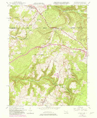
 1977 Accident1979 Print · USGSWestern Maryland's agricultural landscape is seen in detail during the late seventies through this aerial survey of Garrett County. Genealogists and local historians can trace the specific layouts of family farms and homesteads near Accident and the slopes of Rich Hill.
 - 1979 Map of Morgantown, 1983 Print
 1979 Morgantown1983 Print · USGSThe northern Appalachian borderlands are captured here in the late seventies, showing the tri-state area of West Virginia, Pennsylvania, and Maryland. Genealogists and historians can trace the Mason and Dixon Line through mountain settlements like Markleysburg and across the Youghiogheny River Lake.
 - 1994 Map of Accident, 1999 Print
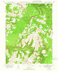
 1994 Accident1999 Print · USGSThe Maryland-Pennsylvania borderlands near Accident are shown here as they appeared in the 1990s, centered on the historic National Road corridor. Researchers can locate family landmarks like Turney Cem and the sites of Eagle Mill and Kaese Mill.
 - 2011 Map of McHenry, 2011 Print
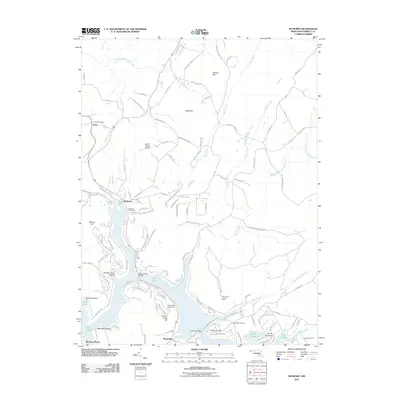 2011 McHenry2011 Print · USGSCovers Accident, including Thayerville, McHenry, and other nearby areas
 - 2011 Map of Accident, 2011 Print
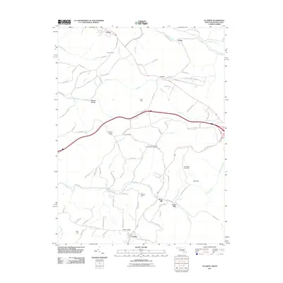 2011 Accident2011 Print · USGSCovers Accident, including Addison, Strawn, and other nearby areas
 - 2014 Map of Accident, 2014 Print
 2014 Accident2014 Print · USGSCovers Accident, including Addison, Strawn, and other nearby areas
 - 2014 Map of McHenry, 2014 Print
 2014 McHenry2014 Print · USGSCovers Accident, including Thayerville, McHenry, and other nearby areas
 - 2016 Map of McHenry, 2016 Print
 2016 McHenry2016 Print · USGSCovers Accident, including Thayerville, McHenry, and other nearby areas
 - 2016 Map of Accident, 2016 Print
 2016 Accident2016 Print · USGSCovers Accident, including Addison, Strawn, and other nearby areas
 - 2019 Map of McHenry, 2019 Print
 2019 McHenry2019 Print · USGSCovers Accident, including Thayerville, McHenry, and other nearby areas
 - 2019 Map of Accident, 2019 Print
 2019 Accident2019 Print · USGSCovers Accident, including Addison, Strawn, and other nearby areas
 - 2023 Map of Accident, 2023 Print
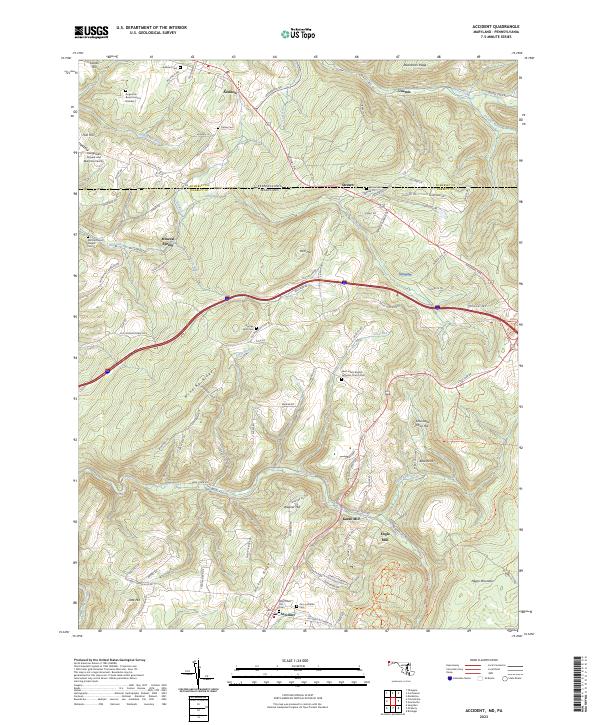 2023 Accident2023 Print · USGSGarrett County's high ridges and border valleys are shown here in detail during the early twenty-first century. Genealogists can trace family names through numerous remote burial sites like Augustine Burial Ground Number 1 and local industry at Kaese Mill.
 - 2023 Map of McHenry, 2023 Print
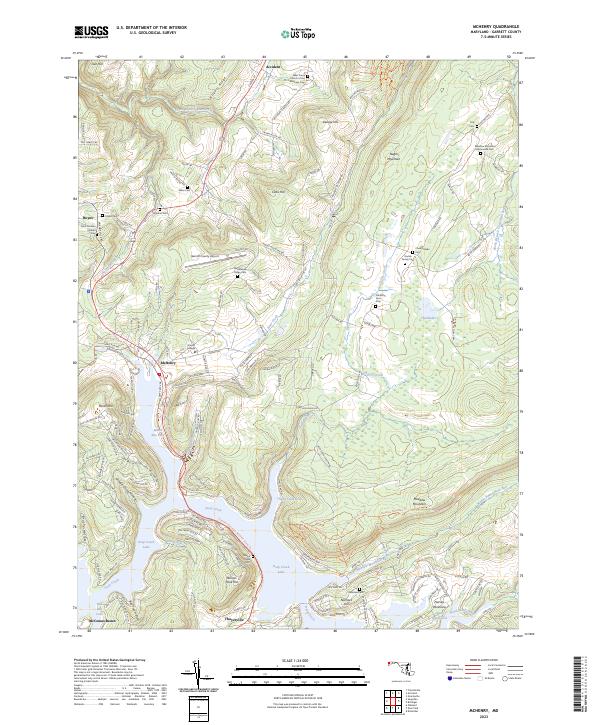 2023 McHenry2023 Print · USGSGarrett County's lakeside communities and high mountain ridges are mapped here in the contemporary era. Researchers can trace family history through numerous small burial grounds like Bumblebee Ridge Cem or locate landmarks near McHenry and Deep Creek Lake.
End of results
Showing maps 1-25 of 25
Top cities near Accident
- Mountain Lake Park historical maps
- Oakland historical maps
- Terra Alta historical maps
- Confluence historical maps
- Grantsville historical maps
- Friendsville historical maps
See more
Frequently asked questions
- What are the different types of historical maps available for Accident?
- What is the oldest map of Accident?
- Where can I purchase historical maps of Accident for my home or office?
- Where can I download high-res historical maps of Accident?
- Are there historical topographic maps available for Accident?
- Is there historical aerial imagery available for Accident?
- Where are historical maps of Accident sourced from?