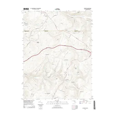
2014 Map of Accident
USGS Topo · Published 2014About this map
Accident and the surrounding high country of the Allegheny Mountains are detailed here along the border of Maryland and Pennsylvania. This 2014 survey captures a landscape defined by the historic National Pike and the Garrett Hwy, which thread through prominent landforms like Winding Ridge and Negro Mountain. The area maintains its agricultural and milling character, evidenced by the locations of Kaese Mill and Engle Mill along the winding course of Bear Creek. Genealogy researchers will find several localized landmarks, including the Saint John's English Lutheran Church Cem and the Turney Cem near the northern settlement of Addison. The terrain is punctuated by distinctive heights such as Chocolate Drop Hill and Bald Knob, while smaller communities like Unamis and Strawn sit right on the Pennsylvania Maryland state line.
Find a feature on this map
81 named features on this map. Tap any name to fly to it.
Don’t see what you’re looking for? This feature index may not catch every label — zoom into the map to look around manually.
Map Details
Editions of this 2014 Accident Map
This is the sole edition of this map. No revisions or reprints were ever made.
Other maps of this area

1899 · Grantsville
USGS Topo · 1:62,500

1900 · Accident
USGS Topo · 1:62,500

1904 · Grantsville
USGS Topo · 1:62,500

1921 · Meyersdale
USGS Topo · 1:62,500

1922 · Confluence
USGS Topo · 1:62,500

1931 · Confluence
USGS Topo · 1:62,500

1933 · Confluence
USGS Topo · 1:62,500

1939 · Meyersdale
USGS Topo · 1:62,500

1944 · Meyersdale
USGS Topo · 1:62,500

1946 · Grantsville
USGS Topo · 1:24,000