Old Maps of Barnesville, Maryland for Academic Research
Study the evolution of Barnesville with 28 high-resolution historic maps. Whether you're teaching, researching, or modeling changes in land use, these maps provide essential visual documentation of urban, environmental, and geographic change.
- Analyze long-term change: Track patterns in development, transportation, and natural features.
- Ideal for environmental or urban studies: Support academic projects with primary historical map data.
- Use in the classroom or lab: Educators and researchers rely on these maps to bring historical context to life.
These maps are a powerful tool for teaching, research, and visualizing how Barnesville has changed over the decades.
Barnesville, MD maps
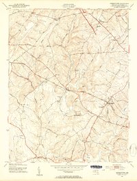
(28)- 1893 Map of Frederick
 1893 Frederick1893 Print · USGSMaryland's Piedmont region at the end of the nineteenth century reveals a landscape defined by the Potomac River and the rise of rail transit. Researchers can trace the path of the Chesapeake and Ohio Canal or locate local hubs like Poolesville and Buckeystown.
 - 1894 Map of Frederick
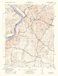
 1894 Frederick1894 Print · USGSMaryland's Piedmont region in the late nineteenth century was a complex network of river crossings and railway junctions. Researchers can trace the path of the Baltimore & Ohio R. R. past Sugar Loaf Mtn. and locate historic river sites like Nolands Ferry.5 unique versions available
 - 1908 Map of Seneca
 1908 Seneca1908 Print · USGSThe Potomac River valley at the turn of the century shows a vital landscape of canal commerce and emerging rail lines. Genealogists and historians can trace family-named sites across the Maryland-Virginia border, from Poolesville to river crossings at Whites Ferry and Edwards Ferry.7 unique versions available
 - 1944 Map of Germantown
 1944 Germantown1944 Print · USGSUpper Montgomery County appears as a collection of rural crossroads and rail stops during the mid-forties. Genealogists and local historians can trace family locations near Old Germantown, Bucklodge Sta, and historic sites like Cloppers Mill.
 - 1944 Map of Poolesville
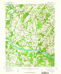
 1944 Poolesville1944 Print · USGSMaryland's agricultural heartland and the Potomac riverfront are detailed here during the mid-1940s, just as the rural landscape began its modern shift. Researchers can trace the path of the Chesapeake and Ohio Canal and locate old crossroads at Beallsville, Poolesville, and Jerusalem.2 unique versions available
 - 1944 Map of Seneca, 1963 Print
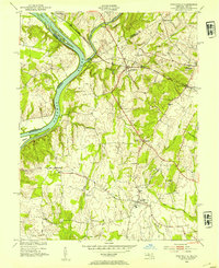
 1944 Seneca1963 Print · USGSUpper Montgomery County and the Potomac River valley are captured here just before the expansion of the D.C. suburbs. Researchers can trace the legacy of river commerce and rail travel through the Chesapeake and Ohio Canal, the Monocacy Aqueduct, and the Baltimore and Ohio RR line.
 - 1948 Map of Baltimore
 1948 Baltimore1948 Print · USGSMaryland and Pennsylvania crossroads are captured in the late 1940s, showing a landscape defined by historic rail lines and major military installations. Genealogists can trace family connections in Gettysburg, Westminster, and near the U.S. Naval Academy in Annapolis.2 unique versions available
 - 1952 Map of Poolesville, 1954 Print
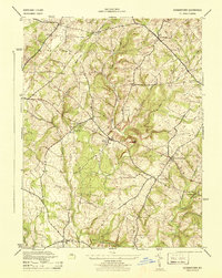
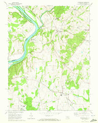
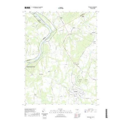
 1952 Poolesville1954 Print · USGSMontgomery County was still primarily a landscape of rail-stops and river-crossings in the early fifties. Local historians can trace the intersection of the Baltimore and Ohio railroad with rural life at Dickerson and Barnesville.3 unique versions available
 - 1953 Map of Germantown, 1954 Print
 1953 Germantown1954 Print · USGSUpper Montgomery County thrives as a network of rail-side villages and farming crossroads in the early fifties. Genealogists and local historians can trace family locations near Boyds, Old Germantown, and rural landmarks like St Marks Ch or Taylor Sch.6 unique versions available
 - 1954 Map of Baltimore
 1954 Baltimore1954 Print · USGSThe Mid-Atlantic region in the early fifties shows a landscape of growing suburban centers and heavy rail corridors. Trace mid-century transit networks and military landmarks from the Aberdeen Proving Ground to the Gettysburg National Military Park.
 - 1956 Map of Baltimore
 1956 Baltimore1956 Print · USGSMid-century Maryland and Pennsylvania are captured here during a period of massive suburban and military growth across the Chesapeake region. Genealogists and historians can trace the rail corridors of the Baltimore & Ohio RR and locate landmarks like Fort McHenry or the Aberdeen Proving Ground.
 - 1957 Map of Baltimore, 1964 Print
 1957 Baltimore1964 Print · USGSMaryland and Southern Pennsylvania are shown during the mid-century expansion of the Baltimore-Washington corridor. Researchers can trace the extensive rail lines of the Baltimore & Ohio RR and locate sites like Fort Detrick and Gettysburg National Military Park.5 unique versions available
 - 1961 Map of Baltimore
 1961 Baltimore1961 Print · USGSMaryland and Pennsylvania are captured at a mid-century peak of industrial and military expansion. Genealogists and historians can trace rail corridors like the Western Maryland Ry or locate regional landmarks such as Camp Detrick and Kent Island.
 - 1970 Map of Poolesville, 1972 Print
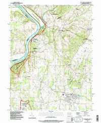
 1970 Poolesville1972 Print · USGSUpper Montgomery County and the Potomac River shoreline are detailed here in the 1970s, showcasing a landscape of historic canal engineering and rural crossroads. You can trace the Chesapeake and Ohio Canal to the Monocacy Aqueduct or find local landmarks like Elijah Ch and Mt Pleasant Cem.2 unique versions available
 - 1984 Map of Frederick, 1985 Print
 1984 Frederick1985 Print · USGSMaryland's Piedmont and the Potomac River valley are shown here in the mid-eighties as suburban growth began to meet historic rural landscapes. Genealogists and historians can trace the paths of the Baltimore and Ohio RR or locate the boundaries of Antietam National Battlefield and Fort Detrick.
 - 1988 Map of Poolesville, 1996 Print
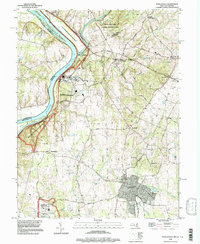
 1988 Poolesville1996 Print · USGSUpper Montgomery County and the Potomac River corridor are captured here in the late eighties, showing a landscape defined by historic canal engineering and rural crossroads. Researchers can trace the C & O Canal National Historic Park and the Monocacy Aqueduct alongside old settlements like Jerusalem and Beallsville.
 - 1989 Map of Baltimore
 1989 Baltimore1989 Print · USGSThe Mid-Atlantic corridor in the late eighties is captured here, from the Baltimore harbor to the Blue Ridge foothills. Researchers can trace the sprawling footprints of Aberdeen Proving Ground, the historic grounds of Gettysburg National Military Park, and the winding Susquehanna River.
 - 1995 Map of Poolesville, 1997 Print
 1995 Poolesville1997 Print · USGSUpper Montgomery County during the mid-1990s reflects a landscape of river-bend history and rural preservation. Genealogists and historians can trace the foundations of Poolesville, locate old burials at Mt Pleasant Cem, and follow the historic Towpath along the Potomac.
 - 2011 Map of Germantown, 2011 Print
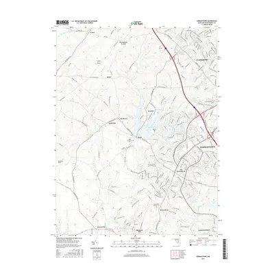
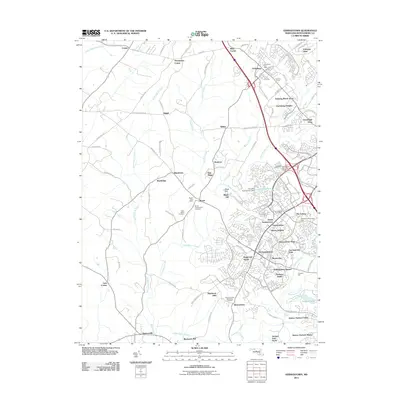 2011 Germantown2011 Print · USGSCovers Barnesville, including Germantown, Clarksburg, and other nearby areas
 - 2011 Map of Poolesville, 2011 Print
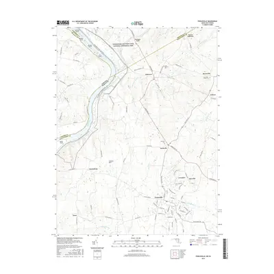
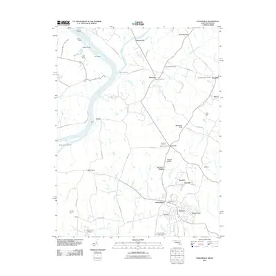 2011 Poolesville2011 Print · USGSCovers Barnesville, including Poolesville, Dickerson, and other nearby areas
 - 2014 Map of Germantown, 2014 Print
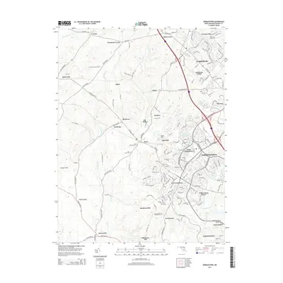 2014 Germantown2014 Print · USGSCovers Barnesville, including Germantown, Clarksburg, and other nearby areas
 - 2014 Map of Poolesville, 2014 Print
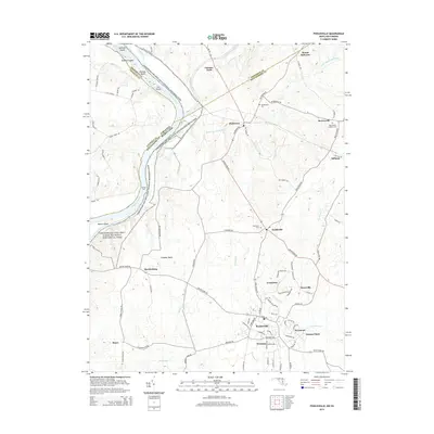 2014 Poolesville2014 Print · USGSCovers Barnesville, including Poolesville, Dickerson, and other nearby areas
 - 2016 Map of Poolesville, 2016 Print
 2016 Poolesville2016 Print · USGSCovers Barnesville, including Poolesville, Dickerson, and other nearby areas
 - 2016 Map of Germantown, 2016 Print
 2016 Germantown2016 Print · USGSCovers Barnesville, including Germantown, Clarksburg, and other nearby areas
 - 2019 Map of Poolesville, 2019 Print
 2019 Poolesville2019 Print · USGSCovers Barnesville, including Poolesville, Dickerson, and other nearby areas
Showing maps 1-25 of 28
Top cities near Barnesville
- Germantown historical maps
- Frederick historical maps
- Gaithersburg historical maps
- Bethesda historical maps
- Rockville historical maps
- Leesburg historical maps
See more
Frequently asked questions
- What are the different types of historical maps available for Barnesville?
- What is the oldest map of Barnesville?
- Where can I purchase historical maps of Barnesville for my home or office?
- Where can I download high-res historical maps of Barnesville?
- Are there historical topographic maps available for Barnesville?
- Is there historical aerial imagery available for Barnesville?
- Where are historical maps of Barnesville sourced from?