Old Maps of Woodstream, Maryland for Metal Detecting
Plan your next treasure hunt with 20 historic maps of Woodstream. Find old homesites, ghost towns, trails, and gathering spots that may be lost to time — perfect for identifying promising metal detecting locations.
- Locate forgotten sites: Uncover places like long-lost settlements, abandoned rail lines, or gathering spots.
- Plan better hunts: Use map overlays combined with LiDAR or satellite views to narrow in on historically rich areas.
- Made for detectorists: Thousands of hobbyists use these maps to discover relics, coins, and hidden history.
Use these historic maps to boost your research and find new opportunities beneath the surface of Woodstream.
Woodstream, MD maps
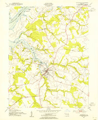
(20)- 1898 Map of Tolchester
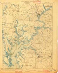
 1898 Tolchester1898 Print · USGSThe upper Chesapeake Bay and its tidal tributaries are shown in the late 1890s, when steamships and railroads still dominated regional commerce. Trace the landings and rail stops that fueled the bay economy, from Buck Neck Landing to Stillpond Sta. and the historic Harford Furnace.
 - 1901 Map of Chestertown
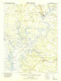
 1901 Chestertown1901 Print · USGSThe Eastern Shore of Maryland comes alive in this turn-of-the-century survey of the Chester River and its surrounding necks. Genealogists and historians can trace the early rail lines and numerous river landings like Spaniards Landing, Tolchester Beach, and Leary's Mill Whf.4 unique versions available
 - 1903 Map of Tolchester
 1903 Tolchester1903 Print · USGSThe upper Chesapeake Bay at the turn of the century shows a bustling maritime landscape where steamship wharves and major rail lines met. Researchers can trace defunct stops like Baldwin Sta. and Clayton Sta. or locate historic landings such as Rockhall Landing and Quaker Wharf.
 - 1908 Map of Tolchester
 1908 Tolchester1908 Print · USGSChesapeake Bay life at the turn of the century centered on a complex network of tidewater landings and strategic railroad lines. Researchers can trace historic family settlements and maritime landmarks like Fort Howard, Harford Furnace, and the Sevenfoot Knoll LH.4 unique versions available
 - 1920 Map of Chestertown
 1920 Chestertown1920 Print · USGSThe Eastern Shore of Maryland in the early twentieth century reveals a world of steamships and shoreline industry. Trace old family landings and rail stops like Learys Mill Whf, Centerville Ldg, and the Maryland and Delaware RR.
 - 1943 Map of Centerville
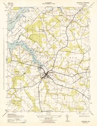 1943 Centerville1943 Print · USGSThis wartime survey of the Maryland Eastern Shore captures the rural character of Queen Anne's County just before mid-century. Genealogists can trace the footprint of family-named landmarks like Ashland Indian Town and rural junctions such as Starkey Corner and Brownsville.
 - 1948 Map of Baltimore
 1948 Baltimore1948 Print · USGSMaryland and Pennsylvania crossroads are captured in the late 1940s, showing a landscape defined by historic rail lines and major military installations. Genealogists can trace family connections in Gettysburg, Westminster, and near the U.S. Naval Academy in Annapolis.2 unique versions available
 - 1951 Map of Chestertown
 1951 Chestertown1951 Print · USGSThe Chesapeake Bay shoreline and Chester River necks appear in high detail during the early fifties. Genealogists and historians can trace family locations through numerous country landmarks like Wesley Chapel Cem, Starkey Corner, and Tolchester Beach.2 unique versions available
 - 1954 Map of Baltimore
 1954 Baltimore1954 Print · USGSThe Mid-Atlantic region in the early fifties shows a landscape of growing suburban centers and heavy rail corridors. Trace mid-century transit networks and military landmarks from the Aberdeen Proving Ground to the Gettysburg National Military Park.
 - 1954 Map of Centreville, 1955 Print
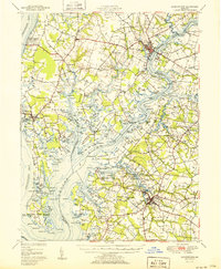
 1954 Centreville1955 Print · USGSThe Queen Anne's County seat and its surrounding Tidewater necks are captured in the mid-1950s, showing a landscape defined by river landings and rural churches. Genealogists and local historians can trace family locations near Centreville, Starkey Corner, and the Kennard Sch.3 unique versions available
 - 1956 Map of Baltimore
 1956 Baltimore1956 Print · USGSMid-century Maryland and Pennsylvania are captured here during a period of massive suburban and military growth across the Chesapeake region. Genealogists and historians can trace the rail corridors of the Baltimore & Ohio RR and locate landmarks like Fort McHenry or the Aberdeen Proving Ground.
 - 1957 Map of Baltimore, 1964 Print
 1957 Baltimore1964 Print · USGSMaryland and Southern Pennsylvania are shown during the mid-century expansion of the Baltimore-Washington corridor. Researchers can trace the extensive rail lines of the Baltimore & Ohio RR and locate sites like Fort Detrick and Gettysburg National Military Park.5 unique versions available
 - 1961 Map of Baltimore
 1961 Baltimore1961 Print · USGSMaryland and Pennsylvania are captured at a mid-century peak of industrial and military expansion. Genealogists and historians can trace rail corridors like the Western Maryland Ry or locate regional landmarks such as Camp Detrick and Kent Island.
 - 1984 Map of Baltimore
 1984 Baltimore1984 Print · USGSThe Baltimore and Annapolis corridor in the mid-eighties shows a landscape of rapid suburban growth and deep-seated maritime history. Researchers can trace the massive footprints of the U S Naval Academy, Fort George G Meade, and Goddard Space Flight Ctr.
 - 1989 Map of Baltimore
 1989 Baltimore1989 Print · USGSThe Mid-Atlantic corridor in the late eighties is captured here, from the Baltimore harbor to the Blue Ridge foothills. Researchers can trace the sprawling footprints of Aberdeen Proving Ground, the historic grounds of Gettysburg National Military Park, and the winding Susquehanna River.
 - 2011 Map of Centreville, 2011 Print
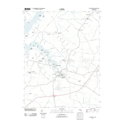 2011 Centreville2011 Print · USGSCovers Woodstream, including Centreville, Indian Town, and other nearby areas
 - 2014 Map of Centreville, 2014 Print
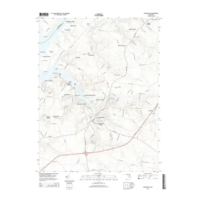 2014 Centreville2014 Print · USGSCovers Woodstream, including Centreville, Indian Town, and other nearby areas
 - 2017 Map of Centreville, 2017 Print
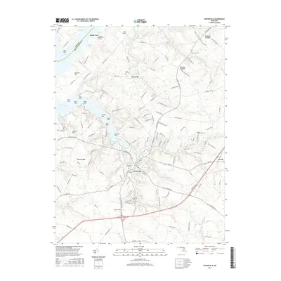 2017 Centreville2017 Print · USGSCovers Woodstream, including Centreville, Indian Town, and other nearby areas
 - 2019 Map of Centreville, 2019 Print
 2019 Centreville2019 Print · USGSCovers Woodstream, including Centreville, Indian Town, and other nearby areas
 - 2023 Map of Centreville, 2023 Print
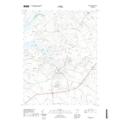
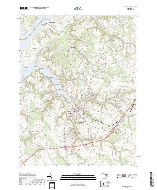 2023 Centreville2023 Print · USGSThe Maryland Eastern Shore's agricultural and maritime legacy is on display in this contemporary study of Centreville and the Corsica River shoreline. Genealogists can trace family landmarks and burial sites at Chesterfield Cem or the historic Queen Anne's County Courthouse.
End of results
Showing maps 1-20 of 20
Top cities near Woodstream
- Stevensville historical maps
- Chestertown historical maps
- Centreville historical maps
- Chester historical maps
- Grasonville historical maps
- Kingstown historical maps
See more
Frequently asked questions
- What are the different types of historical maps available for Woodstream?
- What is the oldest map of Woodstream?
- Where can I purchase historical maps of Woodstream for my home or office?
- Where can I download high-res historical maps of Woodstream?
- Are there historical topographic maps available for Woodstream?
- Is there historical aerial imagery available for Woodstream?
- Where are historical maps of Woodstream sourced from?