Old Maps of Sharpsburg, Maryland for Metal Detecting
Plan your next treasure hunt with 29 historic maps of Sharpsburg. Find old homesites, ghost towns, trails, and gathering spots that may be lost to time — perfect for identifying promising metal detecting locations.
- Locate forgotten sites: Uncover places like long-lost settlements, abandoned rail lines, or gathering spots.
- Plan better hunts: Use map overlays combined with LiDAR or satellite views to narrow in on historically rich areas.
- Made for detectorists: Thousands of hobbyists use these maps to discover relics, coins, and hidden history.
Use these historic maps to boost your research and find new opportunities beneath the surface of Sharpsburg.
Sharpsburg, MD maps
(29)- 1884 Map of Harpers Ferry
 1884 Harpers Ferry1884 Print · USGSThe confluence of the Potomac and Shenandoah rivers is captured in the mid-1880s, documenting a landscape of strategic gaps and vital transit corridors. Researchers can trace the path of the Chesapeake and Ohio Canal and locate historic river crossings like Conrad Ferry and Castleman Ferry.
 - 1891 Map of Harpers Ferry
 1891 Harpers Ferry1891 Print · USGSThe tri-state borderlands of the Potomac and Shenandoah valleys were a vital hub of transport and trade in the late 1800s. Researchers can trace historic river crossings like Castlemans Ferry, follow the route of the Chesapeake and Ohio Canal, or locate family-named settlements like Oatlands and Taylorstown.
 - 1893 Map of Harpers Ferry, 1898 Print
 1893 Harpers Ferry1898 Print · USGSThe tri-state region of the Potomac and Shenandoah valleys is captured here in the late nineteenth century, showing a landscape defined by water and rail. Trace the historic Chesapeake and Ohio Canal or locate local landmarks like Snyder Mills and Harpers Ferry.7 unique versions available
 - 1908 Map of Middletown
 1908 Middletown1908 Print · USGSThe Potomac River valley in the early twentieth century shows a landscape defined by the convergence of major rail lines and the historic Chesapeake and Ohio Canal. Genealogists and historians can trace the foundations of Eakles Mills, Burkittsville, and Washington Junction.
 - 1910 Map of Antietam
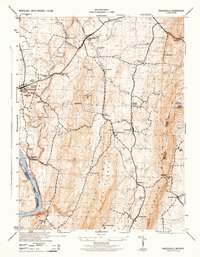
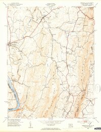
 1910 Antietam1910 Print · USGSMaryland's borderlands and the Potomac River valley are captured here in the early twentieth century. Genealogists can locate family landmarks like Garretts Mill, trace the Chesapeake and Ohio Canal, or find historic sites including Dunkard Church.6 unique versions available
 - 1914 Map of Martinsburg
 1914 Martinsburg1914 Print · USGSThe eastern panhandle of West Virginia comes alive in this survey, showing a landscape defined by the Potomac River and burgeoning rail hubs. Genealogists can trace family footprints through dozens of schools and churches, from Shepherdstown to the Snyder Hill Riverside School and John Browns Cave.3 unique versions available
 - 1916 Map of Martinsburg
 1916 Martinsburg1916 Print · USGSThe Eastern Panhandle of West Virginia comes to life in the years before the Great War, showing a bustling hub of rail activity and river commerce. Genealogists and historians can trace family roots through schoolhouses like Sutton School and old settlements such as Middleway and Summit Point.4 unique versions available
 - 1944 Map of Keddysville
 1944 Keddysville1944 Print · USGSMaryland's Civil War landscape and rural hubs appear in transition during the mid-forties. Genealogists and historians can trace family locations near Antietam National Cemetery, old stops along the Baltimore and Ohio, or the path of the Chesapeake and Ohio Canal.2 unique versions available
 - 1944 Map of Shepherdstown
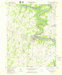
 1944 Shepherdstown1944 Print · USGSShepherdstown and Sharpsburg sit on opposite banks of the Potomac during the mid-1940s, a landscape defined by the river’s deep meanders and the canal era. Trace the Chesapeake and Ohio Canal (Abandoned) and old rural landmarks like Millers Sawmill or Fairview School.
 - 1944 Map of Martinsburg, 1964 Print
 1944 Martinsburg1964 Print · USGSThe West Virginia Panhandle is captured during the mid-1940s, revealing a landscape of vital rail junctions and Potomac River crossings. Genealogists and historians can trace the foundations of Shepherdstown and Martinsburg, alongside landmarks like Martin Chapel and the Newton D Baker General Hospital.
 - 1948 Map of Baltimore
 1948 Baltimore1948 Print · USGSMaryland and Pennsylvania crossroads are captured in the late 1940s, showing a landscape defined by historic rail lines and major military installations. Genealogists can trace family connections in Gettysburg, Westminster, and near the U.S. Naval Academy in Annapolis.2 unique versions available
 - 1953 Map of Shepherdstown, 1954 Print
 1953 Shepherdstown1954 Print · USGSThe Potomac River and its dramatic loops at Terrapin Neck define the border between West Virginia and Maryland in the early fifties. Genealogists and local historians can trace landmarks like Shepherd College, Antietam Station, and Marvin Chapel.4 unique versions available
 - 1953 Map of Keedysville, 1954 Print
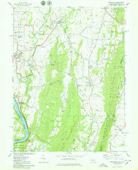
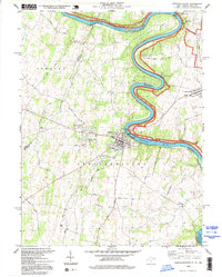
 1953 Keedysville1954 Print · USGSThe hallowed ground of the Antietam Battlefield and the ridges of South Mountain are captured here in the early fifties. Local historians can trace the Appalachian Trail, the Baltimore and Ohio rail line, and landmarks like Burnside Bridge.5 unique versions available
 - 1954 Map of Baltimore
 1954 Baltimore1954 Print · USGSThe Mid-Atlantic region in the early fifties shows a landscape of growing suburban centers and heavy rail corridors. Trace mid-century transit networks and military landmarks from the Aberdeen Proving Ground to the Gettysburg National Military Park.
 - 1956 Map of Baltimore
 1956 Baltimore1956 Print · USGSMid-century Maryland and Pennsylvania are captured here during a period of massive suburban and military growth across the Chesapeake region. Genealogists and historians can trace the rail corridors of the Baltimore & Ohio RR and locate landmarks like Fort McHenry or the Aberdeen Proving Ground.
 - 1957 Map of Baltimore, 1964 Print
 1957 Baltimore1964 Print · USGSMaryland and Southern Pennsylvania are shown during the mid-century expansion of the Baltimore-Washington corridor. Researchers can trace the extensive rail lines of the Baltimore & Ohio RR and locate sites like Fort Detrick and Gettysburg National Military Park.5 unique versions available
 - 1961 Map of Baltimore
 1961 Baltimore1961 Print · USGSMaryland and Pennsylvania are captured at a mid-century peak of industrial and military expansion. Genealogists and historians can trace rail corridors like the Western Maryland Ry or locate regional landmarks such as Camp Detrick and Kent Island.
 - 1978 Map of Keedysville
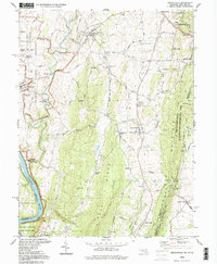
 1978 Keedysville1978 Print · USGSMaryland's Civil War landscape and river heritage are captured here in the late seventies. Family historians and researchers can trace local landmarks like Antietam Nat Cem, the Baltimore and Ohio Railroad, and the Townsend Monument.4 unique versions available
 - 1978 Map of Shepherdstown, 1979 Print
 1978 Shepherdstown1979 Print · USGSThe Potomac River bends through this 1970s survey of the West Virginia-Maryland border near Shepherdstown. Researchers can trace the grounds of Shepherd College, the Antietam National Battlefield Site, and historic burial grounds like Elmwood Cem.2 unique versions available
 - 1984 Map of Frederick, 1985 Print
 1984 Frederick1985 Print · USGSMaryland's Piedmont and the Potomac River valley are shown here in the mid-eighties as suburban growth began to meet historic rural landscapes. Genealogists and historians can trace the paths of the Baltimore and Ohio RR or locate the boundaries of Antietam National Battlefield and Fort Detrick.
 - 1989 Map of Baltimore
 1989 Baltimore1989 Print · USGSThe Mid-Atlantic corridor in the late eighties is captured here, from the Baltimore harbor to the Blue Ridge foothills. Researchers can trace the sprawling footprints of Aberdeen Proving Ground, the historic grounds of Gettysburg National Military Park, and the winding Susquehanna River.
 - 1994 Map of Keedysville, 1999 Print
 1994 Keedysville1999 Print · USGSThe Washington County countryside and the hallowed grounds of Antietam are captured here during the late twentieth century. Researchers can trace ancestral connections and local landmarks through detailed records of the Antietam Nat Cem, the old Rohrersville Sch, and settlements like Eakles Mills.
 - 1994 Map of Shepherdstown, 1999 Print
 1994 Shepherdstown1999 Print · USGSThe Potomac River valley in the mid-1990s reveals a landscape rich in Civil War history and canal-era legacy. Genealogists and historians can trace local landmarks like Shepherd College, the Antietam National Battlefield Site, and family routes such as Powell Road.
 - 2011 Map of Keedysville, 2011 Print
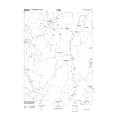 2011 Keedysville2011 Print · USGSCovers Sharpsburg, including Boonsboro, Keedysville, and other nearby areas
 - 2014 Map of Keedysville, 2014 Print
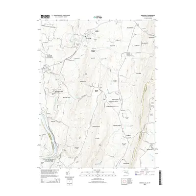 2014 Keedysville2014 Print · USGSCovers Sharpsburg, including Boonsboro, Keedysville, and other nearby areas
Showing maps 1-25 of 29
Top cities near Sharpsburg
- Hagerstown historical maps
- Martinsburg historical maps
- Halfway historical maps
- Robinwood historical maps
- Brunswick historical maps
- Charles Town historical maps
See more
Frequently asked questions
- What are the different types of historical maps available for Sharpsburg?
- What is the oldest map of Sharpsburg?
- Where can I purchase historical maps of Sharpsburg for my home or office?
- Where can I download high-res historical maps of Sharpsburg?
- Are there historical topographic maps available for Sharpsburg?
- Is there historical aerial imagery available for Sharpsburg?
- Where are historical maps of Sharpsburg sourced from?