1900s (20th Century) Maps of Parker Heights, Maryland
Explore 13 historic maps of Parker Heights from the 1900s (20th Century). These maps offer a rare glimpse into what life looked like during the 1900s — showing old roads, neighborhoods, homes, and landmarks that have changed or disappeared over time.
Whether you're researching your family's past, planning a metal detecting trip, or studying how Parker Heights's landscape evolved across the 1900s, these high-resolution maps are a powerful tool for exploring the history of this region.
- Focus on a specific era: All maps on this page are from the 1900s, giving you a focused view of this time period.
- See what’s changed: Compare century-old streets, trails, and buildings to today's modern landscape using overlays and satellite layers.
- Research with precision: Use these maps for genealogy, historical research, land use analysis, or educational projects.
- View, download, or print: Maps are fully viewable online in high resolution, and can be downloaded or printed for your own records.
Start exploring Parker Heights's history through authentic maps from the 1900s. This is your window into the past.
Parker Heights, MD maps
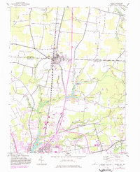
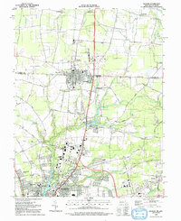
(13)- 1901 Map of Salisbury
 1901 Salisbury1901 Print · USGSWicomico County at the turn of the century centered on the steamboat and rail traffic through Salisbury. Trace historic family-named locations and rural infrastructure like Fooks School, Minksville, and the steam route at Shad Pt.4 unique versions available
 - 1942 Map of Delmar, 1983 Print
 1942 Delmar1983 Print · USGSThe border community of Delmar is shown during its mid-century development as a rail and highway hub on the Delaware-Maryland line. Genealogists and local historians can trace family locations near St George, the Charity church, and the Wicomico River headwaters.
 - 1943 Map of Delmar
 1943 Delmar1943 Print · USGSThe Maryland-Delaware border region comes alive in this wartime survey of the rail and water networks connecting the two states. Genealogists can trace family locations near the State Game Farm or the rural settlements of Charity and Five Points.
 - 1946 Map of Salisbury, 1948 Print
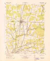
 1946 Salisbury1948 Print · USGSThe Delmarva Peninsula in the late nineteen-forties shows a landscape defined by its deep river arteries and emerging coastal defenses. Genealogists and historians can trace rail-connected towns like Federalsburg or locate maritime landmarks such as the Ocean City Seaplane Base and Fort Miles Military Reservation.4 unique versions available
 - 1947 Map of Salisbury, 1948 Print
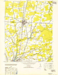
 1947 Salisbury1948 Print · USGSThe Delmarva Peninsula in the late forties reveals a coastal landscape of maritime defense and growing seaside towns. Trace the post-war footprint of Salisbury, the strategic Fort Miles Military Reservation, and the Ocean City Seaplane Base.
 - 1948 Map of Salisbury, 1951 Print
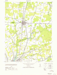
 1948 Salisbury1951 Print · USGSThe Delmarva Peninsula in the late 1940s is shown here as a busy network of rail-towns and coastal outposts. Researchers can trace the legacy of the Pennsylvania Railroad through inland hubs like Georgetown or the maritime reaches of Crisfield and Cape May.
 - 1953 Map of Delmar
 1953 Delmar1953 Print · USGSMid-century Delmar and Salisbury appear here during a period of transition for the Eastern Shore. Genealogists and historians can trace family locations near Johnson Pond, the rail lines of the Pennsylvania, and rural communities like Walston or Five Points.
 - 1957 Map of Salisbury
 1957 Salisbury1957 Print · USGSThe Delmarva Peninsula in the mid-1950s reveals a landscape of coastal defenses and rail-driven commerce. Researchers can trace the Pennsylvania railroad lines or locate historic landmarks like the Fenwick Island Lighthouse and St Martin church.
 - 1961 Map of Salisbury
 1961 Salisbury1961 Print · USGSThe Delmarva Peninsula comes into focus in the early sixties, showing the vital road and rail networks connecting the Chesapeake to the Atlantic. Genealogists and historians can trace family-named landings and coastal landmarks from Crisfield to the Brandywine Shoal Lighthouse.
 - 1965 Map of Salisbury
 1965 Salisbury1965 Print · USGSThe Delmarva Peninsula in the mid-1960s is depicted here as a landscape of coastal defenses and maritime hubs. Genealogists and local historians can trace the foundations of bayside towns like Crisfield and the tactical positioning of the Fort Miles Military Reservation and Cape May Naval Air Station.
 - 1971 Map of Delmar
 1971 Delmar1971 Print · USGSThe border town of Delmar and northern Salisbury appear here during the mid-twentieth century as rail and air transport reshaped the Delmarva landscape. Trace the Pennsylvania railroad line, the Salisbury Airport, and the Charity church.
 - 1983 Map of Salisbury, 1984 Print
 1983 Salisbury1984 Print · USGSThe Lower Eastern Shore was a landscape of tide and timber in the early eighties, from the bustling streets of Salisbury to the wild coast of Assateague Island. Researchers can trace the rail-and-road network of the Conrail and U S Highway 50 while locating historic centers like Princess Anne and Crisfield.
 - 1992 Map of Delmar
 1992 Delmar1992 Print · USGSSpanning the border between Delaware and Maryland in the 1990s, this area shows the rail-centered growth of Delmar and the expanding suburbs of Salisbury. Genealogists can trace family names through Oliphant Cem and Nichols Cem or locate historic sites like Leonards Mill.
End of results
Showing maps 1-13 of 13
Top cities near Parker Heights
- Salisbury historical maps
- Fruitland historical maps
- Delmar historical maps
- Laurel historical maps
- Princess Anne historical maps
- Millsboro historical maps
See more
Frequently asked questions
- What are the different types of historical maps available for Parker Heights?
- What is the oldest map of Parker Heights?
- Where can I purchase historical maps of Parker Heights for my home or office?
- Where can I download high-res historical maps of Parker Heights?
- Are there historical topographic maps available for Parker Heights?
- Is there historical aerial imagery available for Parker Heights?
- Where are historical maps of Parker Heights sourced from?