1940s Maps of Berkshire County, Massachusetts
Explore 54 historic maps of Berkshire County from the 1940s. These maps offer a rare glimpse into what life looked like during the 1940s — showing old roads, neighborhoods, homes, and landmarks that have changed or disappeared over time.
Whether you're researching your family's past, planning a metal detecting trip, or studying how Berkshire County's landscape evolved across the 1940s, these high-resolution maps are a powerful tool for exploring the history of this region.
- Focus on a specific era: All maps on this page are from the 1940s, giving you a focused view of this time period.
- See what’s changed: Compare century-old streets, trails, and buildings to today's modern landscape using overlays and satellite layers.
- Research with precision: Use these maps for genealogy, historical research, land use analysis, or educational projects.
- View, download, or print: Maps are fully viewable online in high resolution, and can be downloaded or printed for your own records.
Start exploring Berkshire County's history through authentic maps from the 1940s. This is your window into the past.
Berkshire County, MA maps
(54)- 1943 Map of Holyoke
 1943 Holyoke1943 Print · USGSThe Pioneer Valley and the eastern Berkshires are captured here in the early 1940s, showing a robust network of river-side industry and hill-country forests. Researchers can locate vanished landmarks and institutional grounds like Northampton State Hospital, Barnes Airport, and the Nat Gd Rifle Range.
 - 1943 Map of Brattleboro
 1943 Brattleboro1943 Print · USGSSouthern Vermont and the Massachusetts border area appear in this mid-century survey as a landscape of timbered peaks and river-connected villages. Genealogists can trace family roots through markers like Arms Cem or follow the rails at Dummerston Sta and Putney Sta.
 - 1943 Map of Housatonic
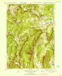
 1943 Housatonic1943 Print · USGSThe Berkshires and the Housatonic Valley are captured during the war years, showing a landscape of traditional Shaker settlements and growing industrial centers. Trace the routes of the NY NH & H RR and explore sites like Shaker Village, Richmond Furnace, and Rockdale Mills.
 - 1944 Map of State Line, 1954 Print
 1944 State Line1954 Print · USGSThe New York and Massachusetts border during the mid-1940s reveals a landscape of industrial hamlets and mountain schools. Genealogists and historians can trace the rail corridors of the Boston and Albany or locate Red Rock Sch and Richmond Furnace.3 unique versions available
 - 1944 Map of Hancock, 1956 Print
 1944 Hancock1956 Print · USGSThe Taconic borderlands of Massachusetts and New York are captured here in the mid-1940s, showing a landscape of high ridges and rural valleys. Genealogists and hikers can trace old roads to sites like Balance Rock Sch, the Fire Tower on Brodie Mountain, and landmarks like Widow Whites Peak.2 unique versions available
 - 1944 Map of Williamstown, 1957 Print
 1944 Williamstown1957 Print · USGSBerkshire County at the end of the war years reveals a valley shaped by the prestigious Williams College and the manufacturing centers along the Hoosic River. Genealogists and historians can locate family plots at East Lawn Cem or trace the early industrial layout of Blackinton and Braytonville.
 - 1944 Map of North Adams, 1958 Print
 1944 North Adams1958 Print · USGSBerkshire County's industrial valleys and steep mountain passes are captured here during the mid-forties. Genealogists and historians can trace rail-side neighborhoods like Zylonite, locate family plots in Miller Cem, or find the high-altitude Boston Central Shaft.
 - 1944 Map of Pittsfield West, 1958 Print
 1944 Pittsfield West1958 Print · USGSThe western Berkshires and the edge of Pittsfield are captured here in the mid-1940s as a landscape of rail-linked villages and highland trails. Researchers can locate family roots near Shaker Village or trace early infrastructure at the Pittsfield Airport and Barkerville.
 - 1944 Map of Windsor, 1958 Print
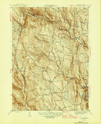
 1944 Windsor1958 Print · USGSBerkshire County in the mid-1940s reveals a rugged upland landscape of mountain peaks and winding river valleys before modern development. Genealogists and hikers can trace the path of the Appalachian Trail near Stafford Hill and locate long-standing landmarks like Tannery Falls and Savoy Center.
 - 1944 Map of Rowe, 1958 Print
 1944 Rowe1958 Print · USGSThe Deerfield River valley and the Berkshire highlands come alive in this mid-century survey of the Massachusetts-Vermont border. Researchers can trace the path of the Hoosac Tunnel, the Mohawk Trail, and rural cemeteries like Sherman Cem and West Cem.
 - 1944 Map of Cheshire, 1958 Print
 1944 Cheshire1958 Print · USGSThe Hoosic River valley is captured here in the mid-1940s, showing a landscape defined by the Boston and Albany Railroad and upland dairy farming. Researchers can trace historic mill hamlets like Arnoldsville and Cheshire Harbor or locate the Stone Sch.2 unique versions available
 - 1944 Map of Pittsfield East, 1958 Print
 1944 Pittsfield East1958 Print · USGSThe industrial heart of the Berkshires during the mid-1940s is defined here by the river-and-rail corridor connecting Pittsfield and Dalton. Local historians can trace the paths of the Boston and Albany railroad and locate landmarks like Wahconah Falls Brook and Silver Lake.
 - 1944 Map of Berlin, 1958 Print
 1944 Berlin1958 Print · USGSRensselaer County at the close of World War II shows a high-country landscape where the Rutland railroad and the Little Hoosic River defined local life. Genealogists and hikers can trace old valley settlements like Center Berlin and Cherryplain, or find historic trails leading toward Berlin Mtn.
 - 1945 Map of East Lee, 1956 Print
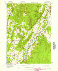
 1945 East Lee1956 Print · USGSThe Berkshires at the end of the Second World War reveal a landscape of industrial river towns and high mountain reservoirs. Genealogists and hikers can trace the legacy of the New York New Haven and Hartford railroad and the early footprint of the Massachusetts Turnpike near East Lee and Goose Pond.2 unique versions available
 - 1945 Map of Peru, 1958 Print
 1945 Peru1958 Print · USGSIn the Berkshire Highlands at the end of the Second World War, this landscape shows the quiet character of rural Massachusetts hill towns. Genealogists and hikers can trace the original paths of Buttermilk Road, the remote Peru Cem, and the historic transit line of the Boston and Albany RR.
 - 1945 Map of Becket, 1958 Print
 1945 Becket1958 Print · USGSThe Berkshire highlands come alive in this post-war study of the river-and-rail corridor. Genealogists and historians can trace the path of the Boston & Albany RR through settlements like Bancroft or locate family sites near Becket Center and the Washington Cem.
 - 1946 Map of Windsor
 1946 Windsor1946 Print · USGSBerkshire County mountain life is captured here in the mid-1940s, showing a landscape of high ridges and rural outposts. Researchers can trace the original path of the Appalachian Trail or locate family sites near Bush Cem and Cherry Hill Sch.
 - 1946 Map of Cheshire
 1946 Cheshire1946 Print · USGSMid-century Berkshire County is captured here during the post-war era, showing the intersection of industrial rail lines and steep mountain terrain. Genealogists and historians can trace the Boston and Albany rail stops through Cheshire Harbor, Farnams, and the Stone Sch.
 - 1946 Map of Worthington
 1946 Worthington1946 Print · USGSHampshire County townships are mapped here in the mid-1940s, showing a landscape of steep hills and winding river branches. Trace family roots at Center Cem or North Cem, and locate old mountain crossroads like Worthington Corners.2 unique versions available
 - 1946 Map of Williamstown
 1946 Williamstown1946 Print · USGSThe northern Berkshires come alive in the mid-1940s, showing the intersection of academic life and the industrial rail corridor. Genealogists and hikers can trace the original paths of the Appalachian Trail and find family-named landmarks like Theil Farm or the historic Sand Spring.
 - 1946 Map of Pittsfield West
 1946 Pittsfield West1946 Print · USGSThe western Berkshires of the mid-1940s are shown here at a moment when communal history and industrial growth converged. Researchers can trace the layout of Shaker Village, locate ancestors at St Josephs Cem, or follow the New York Central RR past Barkerville.
 - 1946 Map of State Line
 1946 State Line1946 Print · USGSThe Berkshires meet the New York border in the late 1940s, where heavy rail lines and old iron works define the mountain passes. Genealogists can trace family footprints through high-elevation settlements like Austerlitz and Williamsville or locate rural landmarks such as Red Rock Sch and Richmond Furnace.
 - 1946 Map of Monterey, 1957 Print
 1946 Monterey1957 Print · USGSThe Berkshire highlands of Monterey and Tyringham are captured here just after the war, showing a landscape of secluded valleys and hill farms. Researchers can trace the Appalachian Trail through the summits and locate local landmarks like Old Center Cem and Lake Garfield.
 - 1946 Map of Otis, 1958 Print
 1946 Otis1958 Print · USGSThe Berkshire highlands in the mid-1940s are defined here by a network of rural roads and water bodies centered on the expansive Otis Reservoir. Researchers can trace the layout of early communities through landmarks like the Beech Plain Sch, Norton Cem, and the historic Knox Trail.
 - 1946 Map of South Sandisfield, 1958 Print
 1946 South Sandisfield1958 Print · USGSThe Massachusetts-Connecticut borderlands during the mid-forties show a landscape of high forests and scattered upland villages. Researchers can trace family sites at Montville Cem or St Marys Cem and locate local centers like Southfield and North Norfolk.
Showing maps 1-25 of 54
Top cities of Berkshire County
- Pittsfield historical maps
- North Adams historical maps
- Adams historical maps
- Williamstown historical maps
- Great Barrington historical maps
- Dalton historical maps
See more
Frequently asked questions
- What are the different types of historical maps available for Berkshire County?
- What is the oldest map of Berkshire County?
- Where can I purchase historical maps of Berkshire County for my home or office?
- Where can I download high-res historical maps of Berkshire County?
- Are there historical topographic maps available for Berkshire County?
- Is there historical aerial imagery available for Berkshire County?
- Where are historical maps of Berkshire County sourced from?