1900s (20th Century) Maps of Lenox Station, Lenox
Explore 16 historic maps of Lenox Station from the 1900s (20th Century). These maps offer a rare glimpse into what life looked like during the 1900s — showing old roads, neighborhoods, homes, and landmarks that have changed or disappeared over time.
Whether you're researching your family's past, planning a metal detecting trip, or studying how Lenox Station's landscape evolved across the 1900s, these high-resolution maps are a powerful tool for exploring the history of this region.
- Focus on a specific era: All maps on this page are from the 1900s, giving you a focused view of this time period.
- See what’s changed: Compare century-old streets, trails, and buildings to today's modern landscape using overlays and satellite layers.
- Research with precision: Use these maps for genealogy, historical research, land use analysis, or educational projects.
- View, download, or print: Maps are fully viewable online in high resolution, and can be downloaded or printed for your own records.
Start exploring Lenox Station's history through authentic maps from the 1900s. This is your window into the past.
Lenox Station, Lenox maps
(16)- 1900 Map of Housatonic
 1900 Housatonic1900 Print · USGSThe Berkshires and the Housatonic Valley are captured here at a moment of industrial and social transition during the late Victorian era. Genealogists and historians can trace the early rail networks of the Boston and Albany R.R. through old settlements like Shaker Village and Lenox Furnace.5 unique versions available
 - 1943 Map of Housatonic
 1943 Housatonic1943 Print · USGSThe Berkshires and the Housatonic Valley are captured during the war years, showing a landscape of traditional Shaker settlements and growing industrial centers. Trace the routes of the NY NH & H RR and explore sites like Shaker Village, Richmond Furnace, and Rockdale Mills.
 - 1945 Map of East Lee, 1956 Print
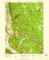 1945 East Lee1956 Print · USGSThe Berkshires at the end of the Second World War reveal a landscape of industrial river towns and high mountain reservoirs. Genealogists and hikers can trace the legacy of the New York New Haven and Hartford railroad and the early footprint of the Massachusetts Turnpike near East Lee and Goose Pond.2 unique versions available
 - 1948 Map of East Lee
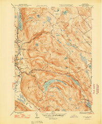 1948 East Lee1948 Print · USGSThe industrial Housatonic valley and the forested heights of October Mountain are captured here during the late 1940s. Genealogists and hikers can trace the original route of the Appalachian Trail or locate family properties near Lenoxdale, East Lee, and West Becket.2 unique versions available
 - 1948 Map of Albany, 1951 Print
 1948 Albany1951 Print · USGSThe Hudson and Connecticut River valleys are captured here in the late 1940s, showing the vital rail and water corridors of the Northeast. You can trace the Boston and Maine tracks past Mt Greylock or locate early settlements like Great Barrington and Bennington.
 - 1950 Map of East Lee
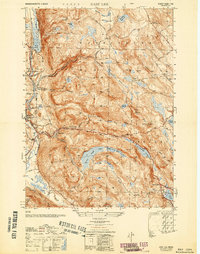 1950 East Lee1950 Print · USGSThe industrial corridor of the Housatonic Valley meets the high peaks of the Berkshires in the mid-century. Genealogists and historians can trace the rail-side growth of Lenoxdale or locate vanished upland homesteads near October Mountain and Upper Goose Pond.
 - 1956 Map of Albany, 1968 Print
 1956 Albany1968 Print · USGSThe industrial heart of the Northeast is revealed in the mid-1950s, from the Hudson Valley to the Connecticut River. Researchers can trace the legacy of the Quabbin Reservoir, locate Westover Air Force Base, or follow the Rutland RR through the Green Mountains.2 unique versions available
 - 1957 Map of Albany
 1957 Albany1957 Print · USGSThe Tri-State region and Connecticut River Valley are captured here during a period of significant postwar growth and infrastructure expansion. Genealogists and historians can trace the rail-and-river economy through landmarks like the Boston and Maine railroad, Quabbin Reservoir, and Westover Air Force Base.
 - 1958 Map of East Lee, 1960 Print
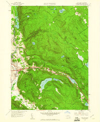 1958 East Lee1960 Print · USGSThe Berkshire highlands and the Housatonic valley meet in this mid-century survey as the modern turnpike era begins. Researchers can trace the New York New Haven & Hartford Railroad through Lenox Dale or locate the St Marys Sch in Lee.
 - 1959 Map of Albany
 1959 Albany1959 Print · USGSThe Hudson and Connecticut River valleys are captured here during the late fifties, showing the region's dense rail networks and massive water projects. Researchers can trace the New York State Thruway or locate local landmarks like Mt Greylock and the Quabbin Reservoir.
 - 1962 Map of Albany
 1962 Albany1962 Print · USGSThe Hudson and Connecticut River valleys meet the Green Mountains and Berkshires in this mid-century overview of the Northeast. Genealogists and historians can trace the industrial hearts of Albany and Springfield or locate features like Quabbin Reservoir and Westover Air Force Base.
 - 1973 Map of East Lee, 1974 Print
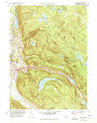 1973 East Lee1974 Print · USGSThe Berkshires in the early seventies reveal a rugged landscape of state forests and river-valley industry. Trace the historic route of the Penn Central railroad through Lenox Dale or locate the path of the Appalachian Trail near Goose Pond.3 unique versions available
 - 1975 Map of East Lee, 1981 Print
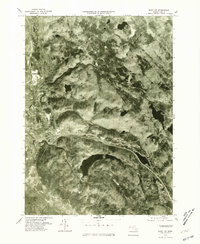 1975 East Lee1981 Print · USGSThe Berkshire highlands in the mid-seventies appear in sharp detail, showing the industrial river valley transitioning into wooded hills. Researchers can trace the path of the Housatonic River through Lenox Dale or locate the shorelines of Goose Pond and Greenwater Pond.
 - 1986 Map of Pittsfield
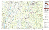 1986 Pittsfield1986 Print · USGSThe Berkshires and the Hudson Valley meet in the mid-1980s, documenting a cross-border landscape of mountain forests and river towns. Genealogists and historians can trace the paths of Conrail and the Taconic State Parkway as they pass through Stockbridge, Great Barrington, and Kinderhook.2 unique versions available
 - 1987 Map of East Lee
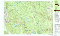 1987 East Lee1987 Print · USGSThe Berkshires come to life in the late eighties as conservation lands and major transportation arteries define the landscape. Trace the Appalachian Trail through the hills or locate historic sites like the Jacobs Pillow School and Theatre and Becket Center.
 - 1997 Map of East Lee, 1999 Print
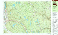 1997 East Lee1999 Print · USGSThe Berkshires in the late twentieth century remain a sanctuary of state forests and mountain trails. Genealogists and hikers can trace the Appalachian Trail past Washington Cem or locate the famed Jacob's Pillow School and Theatre.
End of results
Showing maps 1-16 of 16
Top cities near Lenox Station
- Pittsfield historical maps
- Great Barrington historical maps
- Dalton historical maps
- Lee historical maps
- Lenox historical maps
- Nassau historical maps
See more
Frequently asked questions
- What are the different types of historical maps available for Lenox Station?
- What is the oldest map of Lenox Station?
- Where can I purchase historical maps of Lenox Station for my home or office?
- Where can I download high-res historical maps of Lenox Station?
- Are there historical topographic maps available for Lenox Station?
- Is there historical aerial imagery available for Lenox Station?
- Where are historical maps of Lenox Station sourced from?