2000s (21st Century) Maps of Peru, Massachusetts
Explore 10 historic maps of Peru from the 2000s (21st Century). These maps offer a rare glimpse into what life looked like during the 2000s — showing old roads, neighborhoods, homes, and landmarks that have changed or disappeared over time.
Whether you're researching your family's past, planning a metal detecting trip, or studying how Peru's landscape evolved across the 2000s, these high-resolution maps are a powerful tool for exploring the history of this region.
- Focus on a specific era: All maps on this page are from the 2000s, giving you a focused view of this time period.
- See what’s changed: Compare century-old streets, trails, and buildings to today's modern landscape using overlays and satellite layers.
- Research with precision: Use these maps for genealogy, historical research, land use analysis, or educational projects.
- View, download, or print: Maps are fully viewable online in high resolution, and can be downloaded or printed for your own records.
Start exploring Peru's history through authentic maps from the 2000s. This is your window into the past.
Peru, MA maps
(10)- 2012 Map of Peru, 2012 Print
 2012 Peru2012 Print · USGSCovers Peru, including Dalton, Hinsdale, and other nearby areas
 - 2012 Map of Worthington, 2012 Print
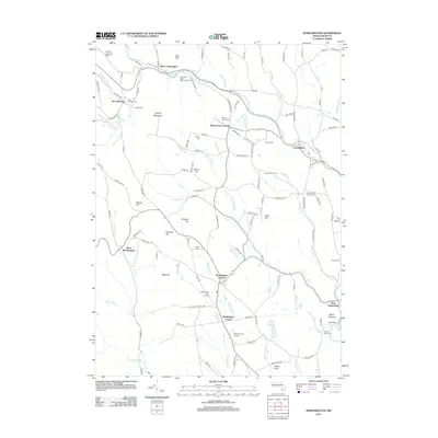 2012 Worthington2012 Print · USGSCovers Peru, including Chesterfield, Worthington, and other nearby areas
 - 2015 Map of Peru, 2015 Print
 2015 Peru2015 Print · USGSCovers Peru, including Dalton, Hinsdale, and other nearby areas
 - 2015 Map of Worthington, 2015 Print
 2015 Worthington2015 Print · USGSCovers Peru, including Chesterfield, Worthington, and other nearby areas
 - 2018 Map of Peru, 2018 Print
 2018 Peru2018 Print · USGSCovers Peru, including Dalton, Hinsdale, and other nearby areas
 - 2018 Map of Worthington, 2018 Print
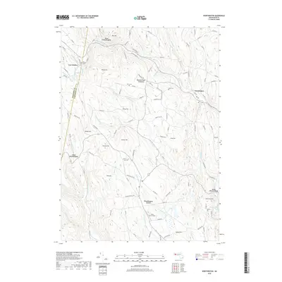 2018 Worthington2018 Print · USGSCovers Peru, including Chesterfield, Worthington, and other nearby areas
 - 2021 Map of Peru, 2021 Print
 2021 Peru2021 Print · USGSCovers Peru, including Dalton, Hinsdale, and other nearby areas
 - 2021 Map of Worthington, 2021 Print
 2021 Worthington2021 Print · USGSCovers Peru, including Chesterfield, Worthington, and other nearby areas
 - 2024 Map of Peru, 2024 Print
 2024 Peru2024 Print · USGSThe high Berkshires around Peru and Hinsdale are shown in modern detail just as they appear today. Researchers can locate family plots at Wentworth Cem and North Cem or trace the seasonal camp footprints surrounding Ashmere Lake.
 - 2024 Map of Worthington, 2024 Print
 2024 Worthington2024 Print · USGSHampshire County highlands appear in high detail during the early 2020s, showing a landscape defined by the Westfield River and historic hill towns. Genealogists can locate family plots at Village Cem or North Cem and trace the winding paths of Berkshire Trl.
End of results
Showing maps 1-10 of 10
Top cities near Peru
- Pittsfield historical maps
- North Adams historical maps
- Adams historical maps
- Williamstown historical maps
- Great Barrington historical maps
- Dalton historical maps
See more
Top neighborhoods of Peru
Frequently asked questions
- What are the different types of historical maps available for Peru?
- What is the oldest map of Peru?
- Where can I purchase historical maps of Peru for my home or office?
- Where can I download high-res historical maps of Peru?
- Are there historical topographic maps available for Peru?
- Is there historical aerial imagery available for Peru?
- Where are historical maps of Peru sourced from?