1970s Maps of Freetown, Massachusetts
Explore 7 historic maps of Freetown from the 1970s. These maps offer a rare glimpse into what life looked like during the 1970s — showing old roads, neighborhoods, homes, and landmarks that have changed or disappeared over time.
Whether you're researching your family's past, planning a metal detecting trip, or studying how Freetown's landscape evolved across the 1970s, these high-resolution maps are a powerful tool for exploring the history of this region.
- Focus on a specific era: All maps on this page are from the 1970s, giving you a focused view of this time period.
- See what’s changed: Compare century-old streets, trails, and buildings to today's modern landscape using overlays and satellite layers.
- Research with precision: Use these maps for genealogy, historical research, land use analysis, or educational projects.
- View, download, or print: Maps are fully viewable online in high resolution, and can be downloaded or printed for your own records.
Start exploring Freetown's history through authentic maps from the 1970s. This is your window into the past.
Freetown, MA maps
(7)- 1977 Map of Assonet
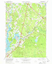 1977 Assonet1977 Print · USGSCoastal Massachusetts at the height of the 1970s shows a landscape of tidal rivers and growing infrastructure near the Bristol and Plymouth county lines. Genealogists and local historians can trace family plots at Old Quaker Cem or Richmond Cem and locate landmarks like Old Town Landing.3 unique versions available
 - 1977 Map of Assawompset Pond, 1981 Print
 1977 Assawompset Pond1981 Print · USGSSoutheastern Massachusetts in the late seventies is captured here through detailed orthophotography of its vast lake system. Genealogists and researchers can trace local landmarks like Masons Corner, Lakeville, and the waters of Assawompset Pond.
 - 1977 Map of Fall River East, 1981 Print
 1977 Fall River East1981 Print · USGSEastern Fall River and Westport come into focus during the late seventies, showing the transition from textile-era industrial sites to modern infrastructure. Trace old land patterns near Westport Factory, Hixville, and the shores of North Watuppa Pond.
 - 1977 Map of New Bedford North, 1981 Print
 1977 New Bedford North1981 Print · USGSCoastal Massachusetts at the end of the 1970s reveals a landscape of industrial harbor towns and expanding northern woods. Trace the dense street grids of New Bedford and Fairhaven or locate early development near Acushnet and Braleys.
 - 1978 Map of Assawompset Pond, 1979 Print
 1978 Assawompset Pond1979 Print · USGSSoutheastern Massachusetts in the late seventies reveals a landscape defined by the great ponds and the cranberry industry. Researchers can trace family sites near Lakeville or locate historic burying grounds like Strowbridge Cem and Wapanucket Cem.
 - 1979 Map of Taunton
 1979 Taunton1979 Print · USGSSoutheastern Massachusetts in the late seventies reveals a landscape of industrial river towns and sprawling state institutions. Local historians can trace the development of Taunton and its neighboring villages, locating sites like Wheaton College, Raynham Racetrack, and the Mayflower Hill Cem.
 - 1979 Map of New Bedford North
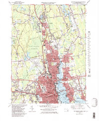 1979 New Bedford North1979 Print · USGSThe industrial waterfront of New Bedford and Fairhaven is shown here in the late seventies alongside the vast protected wetlands of the interior. Trace family roots and local history through dozens of named landmarks like Sacred Heart Cem, Acushnet Sch, and the New Bedford Municipal Airport.2 unique versions available
End of results
Showing maps 1-7 of 7
Top cities near Freetown
- New Bedford historical maps
- Fall River historical maps
- Taunton historical maps
- Attleboro historical maps
- Dartmouth historical maps
- Bridgewater historical maps
See more
Top neighborhoods of Freetown
- Masons Corner historical maps
- Buffington Corner historical maps
- Camp Welch historical maps
- Braleys historical maps
- East Freetown historical maps
- Assonet historical maps
See more
Frequently asked questions
- What are the different types of historical maps available for Freetown?
- What is the oldest map of Freetown?
- Where can I purchase historical maps of Freetown for my home or office?
- Where can I download high-res historical maps of Freetown?
- Are there historical topographic maps available for Freetown?
- Is there historical aerial imagery available for Freetown?
- Where are historical maps of Freetown sourced from?