Old Maps of Ipswich, Massachusetts for Genealogy
Trace your family roots with 38 historic maps of Ipswich. These high-res maps reveal old neighborhoods, homesites, landmarks, and streets — helping you uncover where your ancestors lived and how the area evolved over time.
- Explore historic neighborhoods: Identify where your relatives may have lived in the 1800s or 1900s.
- Compare maps over time: Trace the changes in streets, buildings, and landmarks for multi-generational research.
- Perfect for genealogy & ancestry research: Used by family historians and researchers to map out lineage and migration.
These maps are an incredible resource for exploring your personal connection to Ipswich's past.
Ipswich, MA maps
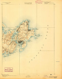
(38)- 1886 Map of Gloucester
 1886 Gloucester1886 Print · USGSCape Ann at the close of the nineteenth century reveals a landscape defined by its deep granite quarries and world-famous fishing fleet. Trace the ancestral footprints of maritime families in Gloucester and Rockport, or locate long-lost stops like West Gloucester Station along the Boston and Maine Railroad.
 - 1888 Map of Gloucester
 1888 Gloucester1888 Print · USGSCape Ann's maritime landscape at the peak of the Victorian era shows a rugged coast of granite quarries and fishing ports. Trace the early tracks of the Boston and Maine Railroad and locate vanished landmarks like Freshwater Cove Village or the light at Thatchers Island.
 - 1888 Map of Salem
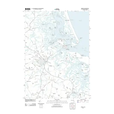
 1888 Salem1888 Print · USGSThe North Shore in the late nineteenth century is captured here in its era of peak rail development. Genealogists and historians can trace family-named sites like Doles Corner and institutions such as Dummer Academy or the Insane Asylum.
 - 1893 Map of Salem
 1893 Salem1893 Print · USGSCoastal Massachusetts at the end of the nineteenth century reveals a landscape defined by industrial rail lines and ancient marshlands. Genealogists and historians can trace family-named hills and early institutional sites like Dummer Academy, the Insane Asylum, and the Ipswich Light.11 unique versions available
 - 1893 Map of Gloucester
 1893 Gloucester1893 Print · USGSCape Ann's rugged maritime communities were firmly established by the 1890s, centered on the bustling port of Gloucester. Researchers can trace the coastal neighborhoods of Lanesville and Annisquam or locate family landmarks like Freshwater Cove Village and the Boston and Maine Railroad line.9 unique versions available
 - 1917 Map of Salem
 1917 Salem1917 Print · USGSCoastal Massachusetts at the end of the Great War reveals a landscape of maritime commerce and rail-connected villages. Trace the local economy from Salem Harbor to Ipswich Light, or locate historic sites like Dummer Academy and the Insane Asylum.
 - 1918 Map of Gloucester, 1921 Print
 1918 Gloucester1921 Print · USGSCape Ann's rugged shoreline and maritime villages are captured here during the first World War. Trace early twentieth-century coastal life through landmarks like Squam Light, the West Gloucester Sta., and family-named points like Wheeler Point.
 - 1919 Map of Salem
 1919 Salem1919 Print · USGSThe North Shore and its rail-connected towns are captured here during the height of the steam era. Genealogists and historians can trace the local landscape through landmarks like Dummer Academy, the Insane Asylum, and the vanished Box Factory.2 unique versions available
 - 1943 Map of Cape Ann
 1943 Cape Ann1943 Print · USGSCoastal Massachusetts and New Hampshire appear here during the wartime era, showing the maritime and rail infrastructure that defined the North Shore. Genealogists can trace family names across Asbury Grove, Merrimacport, and the Boston & Maine RR rail corridor.
 - 1944 Map of Georgetown
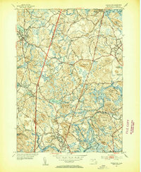
 1944 Georgetown1944 Print · USGSCoastal Massachusetts during the mid-forties reveals a landscape of wooded state forests and traditional village centers. Researchers can trace family roots through Harmony Cem, the halls of Dummer Academy, or along the old Boston and Maine rail line.2 unique versions available
 - 1945 Map of Ipswich
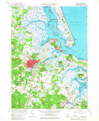
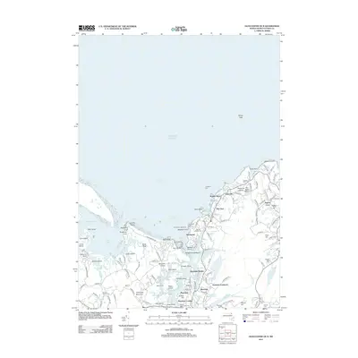
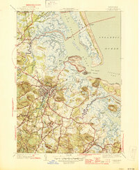 1945 Ipswich1945 Print · USGSIpswich and the surrounding Essex County coast are detailed here in the mid-1940s, highlighting a landscape defined by tidal rivers and barrier islands. Genealogists and historians can locate family landmarks such as Heartbreak Hill, the Mount Cem, and the Boston and Maine Railroad corridor.3 unique versions available
 - 1948 Map of Boston
 1948 Boston1948 Print · USGSEastern Massachusetts and southern New Hampshire appear at an industrial peak in the late 1940s, just as suburban growth began to accelerate. Genealogists and historians can trace rail lines like the Boston and Albany RR or locate coastal landmarks like Graves Lighthouse and Fort Devens.2 unique versions available
 - 1950 Map of Ipswich, 1956 Print
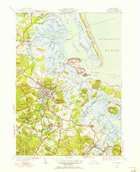 1950 Ipswich1956 Print · USGSCoastal Massachusetts is seen here in the mid-century as a land of expansive salt marshes and historic harbor towns. Genealogists and historians can trace family-named hills and early settlements from Ipswich and Rowley to landmarks like Castle Hill and Nourse Cem.3 unique versions available
 - 1953 Map of Georgetown, 1954 Print
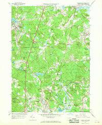
 1953 Georgetown1954 Print · USGSMid-century Essex County is captured here at a time of rural stability and emerging suburban growth. Genealogists and researchers can trace family lands near South Byfield (PO), the historic Dummer Academy, and the Rowley Burial Ground.4 unique versions available
 - 1956 Map of Boston, 1967 Print
 1956 Boston1967 Print · USGSThe Massachusetts coastline and industrial interior are seen here during the mid-century peak of suburban and highway expansion. Researchers can trace historic harbor defenses like Fort Revere, local landmarks such as Faneuil Hall, and the vast Parker River National Wildlife Refuge.6 unique versions available
 - 1958 Map of Boston
 1958 Boston1958 Print · USGSEastern Massachusetts and southern New Hampshire are shown at the height of the industrial era, before the full expansion of the interstate system. Trace coastal defenses at Fort Warren, historic rail lines like the Boston and Maine, and the development of the Mass. 128 corridor.2 unique versions available
 - 1961 Map of Boston
 1961 Boston1961 Print · USGSThe Massachusetts coastline and its industrial interior are detailed here in the mid-twentieth century, from the Monadnock highlands to Cape Cod. Researchers can trace the rail routes of the Boston and Maine or locate landmarks like Fort Devens and the Wachusett Reservoir.2 unique versions available
 - 1966 Map of Ipswich, 1967 Print
 1966 Ipswich1967 Print · USGSThe North Shore coast in the mid-sixties reveals a intricate landscape of salt marshes and historic town centers. Researchers can trace the legacy of family estates and religious institutions at Castle Hill, Locust Grove Cem, and the Sacred Heart Juniorate.3 unique versions available
 - 1966 Map of Georgetown, 1968 Print
 1966 Georgetown1968 Print · USGSCoastal Massachusetts at the dawn of the interstate era shows a mix of historical academy grounds and new highway developments. Trace family roots at the Rowley Burial Ground or locate landmarks like the Governor Dummer Academy and Asbury Grove.2 unique versions available
 - 1984 Map of Gloucester
 1984 Gloucester1984 Print · USGSCoastal Massachusetts and the New Hampshire borderlands are shown here in the mid-eighties, from the granite shores of Cape Ann to the Merrimack River. Researchers can trace the legacy of maritime trade and higher education at Salem State College or follow the Boston and Maine rail lines through Ipswich and Beverly.
 - 1984 Map of Rockport
 1984 Rockport1984 Print · USGSCape Ann's rugged Atlantic coastline and granite quarrying history are on full display in this mid-eighties record. Genealogists and historians can trace the Boston and Maine railroad line through Rockport and locate family plots at Beech Grove Cem or Locust Grove Cem.2 unique versions available
 - 1985 Map of Ipswich, 1986 Print
 1985 Ipswich1986 Print · USGSThe North Shore of Massachusetts is shown in the mid-eighties as a landscape of ancient coastal towns and protected wetlands. Researchers can trace local heritage at Rowley Burial Ground, explore the grounds of Governor Dummer Academy, or locate the cottages of Asbury Grove.3 unique versions available
 - 1997 Map of Ipswich, 1999 Print
 1997 Ipswich1999 Print · USGSCoastal Massachusetts and its expansive salt marshes are frozen in time just before the turn of the millennium. Researchers can trace historic local sites like Governor Dummer Academy, the Ipswich Light, and the secluded religious settlement at Asbury Grove.
 - 2012 Map of Gloucester OE N, 2012 Print
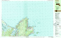
 2012 Gloucester OE N2012 Print · USGSCovers Ipswich, including Gloucester, Rockport, and other nearby areas
 - 2012 Map of Ipswich, 2012 Print
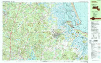
 2012 Ipswich2012 Print · USGSCovers Ipswich, including Gloucester, Hamilton, and other nearby areas
Showing maps 1-25 of 38
Top cities near Ipswich
- Lynn historical maps
- Haverhill historical maps
- Peabody historical maps
- Salem historical maps
- Beverly historical maps
- Gloucester historical maps
See more
Top neighborhoods of Ipswich
Frequently asked questions
- What are the different types of historical maps available for Ipswich?
- What is the oldest map of Ipswich?
- Where can I purchase historical maps of Ipswich for my home or office?
- Where can I download high-res historical maps of Ipswich?
- Are there historical topographic maps available for Ipswich?
- Is there historical aerial imagery available for Ipswich?
- Where are historical maps of Ipswich sourced from?