Old Maps of Rockport, Massachusetts for Hiking & Exploration
Hike through history with 32 historic maps of Rockport. Explore old trails, ghost towns, and forgotten backroads — perfect for outdoor adventurers and local explorers.
- Rediscover forgotten places: Map out old mining camps, roads, and footpaths that no longer exist on modern maps.
- Layer with modern tools: Combine with LiDAR or satellite views to plan hikes through historical terrain.
- Made for exploration: Popular among hikers, overlanders, and local history lovers.
Use these maps to find adventure and explore the hidden past of Rockport.
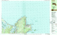
Rockport, MA maps
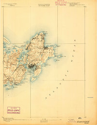
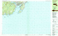
(32)- 1886 Map of Gloucester
 1886 Gloucester1886 Print · USGSCape Ann at the close of the nineteenth century reveals a landscape defined by its deep granite quarries and world-famous fishing fleet. Trace the ancestral footprints of maritime families in Gloucester and Rockport, or locate long-lost stops like West Gloucester Station along the Boston and Maine Railroad.
 - 1888 Map of Gloucester
 1888 Gloucester1888 Print · USGSCape Ann's maritime landscape at the peak of the Victorian era shows a rugged coast of granite quarries and fishing ports. Trace the early tracks of the Boston and Maine Railroad and locate vanished landmarks like Freshwater Cove Village or the light at Thatchers Island.
 - 1893 Map of Gloucester
 1893 Gloucester1893 Print · USGSCape Ann's rugged maritime communities were firmly established by the 1890s, centered on the bustling port of Gloucester. Researchers can trace the coastal neighborhoods of Lanesville and Annisquam or locate family landmarks like Freshwater Cove Village and the Boston and Maine Railroad line.9 unique versions available
 - 1918 Map of Gloucester, 1921 Print
 1918 Gloucester1921 Print · USGSCape Ann's rugged shoreline and maritime villages are captured here during the first World War. Trace early twentieth-century coastal life through landmarks like Squam Light, the West Gloucester Sta., and family-named points like Wheeler Point.
 - 1943 Map of Cape Ann
 1943 Cape Ann1943 Print · USGSCoastal Massachusetts and New Hampshire appear here during the wartime era, showing the maritime and rail infrastructure that defined the North Shore. Genealogists can trace family names across Asbury Grove, Merrimacport, and the Boston & Maine RR rail corridor.
 - 1945 Map of Rockport
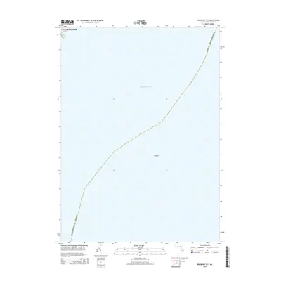
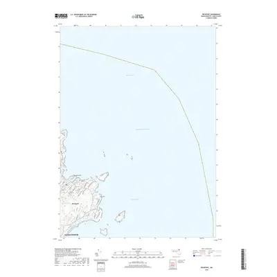
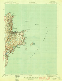 1945 Rockport1945 Print · USGSThe tip of Cape Ann appears here just as the wartime era ended, showing a coastal landscape defined by quarrying roots and maritime necessity. Genealogists and historians can trace the Boston and Main rail line, Beach Grove Cem, and prominent beacons like the Cape Ann Lighthouse.4 unique versions available
 - 1947 Map of Rockport
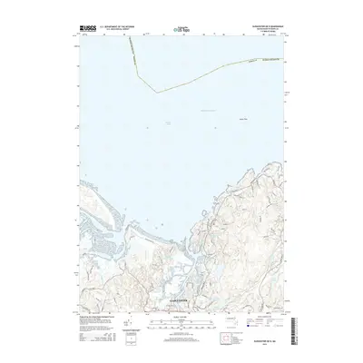
 1947 Rockport1947 Print · USGSThe tip of the Cape Ann peninsula is captured here just after the war, showing a landscape defined by granite shores and maritime navigation. Local historians can trace the docks of Pigeon Cove or locate the historic North Tower and Cape Ann Lighthouse on Thacher Island.
 - 1948 Map of Boston
 1948 Boston1948 Print · USGSEastern Massachusetts and southern New Hampshire appear at an industrial peak in the late 1940s, just as suburban growth began to accelerate. Genealogists and historians can trace rail lines like the Boston and Albany RR or locate coastal landmarks like Graves Lighthouse and Fort Devens.2 unique versions available
 - 1949 Map of Rockport, 1958 Print
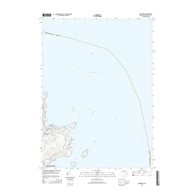
 1949 Rockport1958 Print · USGSCape Ann's eastern tip is shown here in the late 1940s, highlighting the maritime character of Rockport and the industrial terminal of the Boston and Main railroad. Researchers can trace historic landmarks like the Cape Ann Lighthouse on Thacher Island and the residential layout around Pigeon Cove.
 - 1956 Map of Boston, 1967 Print
 1956 Boston1967 Print · USGSThe Massachusetts coastline and industrial interior are seen here during the mid-century peak of suburban and highway expansion. Researchers can trace historic harbor defenses like Fort Revere, local landmarks such as Faneuil Hall, and the vast Parker River National Wildlife Refuge.6 unique versions available
 - 1958 Map of Boston
 1958 Boston1958 Print · USGSEastern Massachusetts and southern New Hampshire are shown at the height of the industrial era, before the full expansion of the interstate system. Trace coastal defenses at Fort Warren, historic rail lines like the Boston and Maine, and the development of the Mass. 128 corridor.2 unique versions available
 - 1960 Map of Rockport, 1962 Print
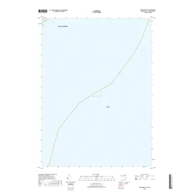
 1960 Rockport1962 Print · USGSCape Ann's eastern tip is revealed here in the early sixties, showing a maritime landscape shaped by granite quarrying and coastal navigation. Researchers can locate family plots at Beech Grove Cem, trace the rail line of the Boston and Maine, and see the iconic Cape Ann Lighthouse on Thacher Island.2 unique versions available
 - 1961 Map of Boston
 1961 Boston1961 Print · USGSThe Massachusetts coastline and its industrial interior are detailed here in the mid-twentieth century, from the Monadnock highlands to Cape Cod. Researchers can trace the rail routes of the Boston and Maine or locate landmarks like Fort Devens and the Wachusett Reservoir.2 unique versions available
 - 1973 Map of Rockport, 1976 Print
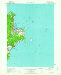
 1973 Rockport1976 Print · USGSCape Ann's rugged granite coast is captured here in the early seventies, detailing the historic seafaring villages of Rockport and Pigeon Cove. Genealogists and historians can trace the Boston and Maine rail line, locate family plots at Beach Grove Cem, and spot maritime landmarks like the Cape Ann Lighthouse on Thacher Island.3 unique versions available
 - 1984 Map of Gloucester
 1984 Gloucester1984 Print · USGSCoastal Massachusetts and the New Hampshire borderlands are shown here in the mid-eighties, from the granite shores of Cape Ann to the Merrimack River. Researchers can trace the legacy of maritime trade and higher education at Salem State College or follow the Boston and Maine rail lines through Ipswich and Beverly.
 - 1984 Map of Gloucester
 1984 Gloucester1984 Print · USGSGloucester and the rocky Cape Ann shoreline are shown in the mid-eighties as the region’s maritime and residential character was firmly established. Researchers can trace historic family burial sites at West Parish Cem, locate the Hammond Museum, and follow the Boston and Maine rail line into the heart of the city.
 - 1984 Map of Rockport
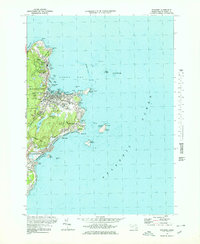
 1984 Rockport1984 Print · USGSCape Ann's rugged Atlantic coastline and granite quarrying history are on full display in this mid-eighties record. Genealogists and historians can trace the Boston and Maine railroad line through Rockport and locate family plots at Beech Grove Cem or Locust Grove Cem.2 unique versions available
 - 2012 Map of Rockport OE S, 2012 Print
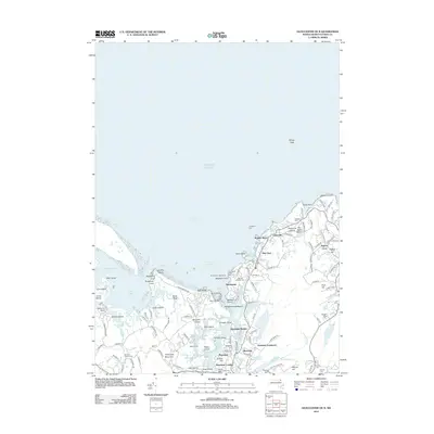
 2012 Rockport OE S2012 Print · USGSCovers Rockport, including Gloucester, Essex County, and other nearby areas
 - 2012 Map of Gloucester OE N, 2012 Print
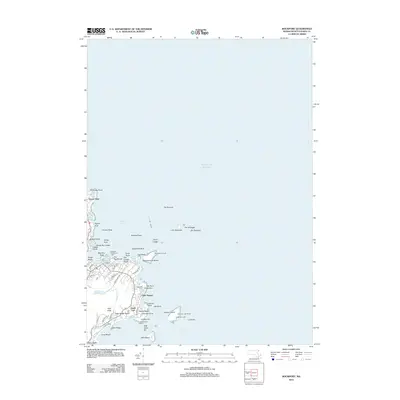
 2012 Gloucester OE N2012 Print · USGSCovers Rockport, including Gloucester, Ipswich, and other nearby areas
 - 2012 Map of Rockport, 2012 Print
 2012 Rockport2012 Print · USGSCovers Rockport, including Gloucester, Eden Square, and other nearby areas
 - 2015 Map of Rockport OE S, 2015 Print
 2015 Rockport OE S2015 Print · USGSCovers Rockport, including Gloucester, Essex County, and other nearby areas
 - 2015 Map of Gloucester OE N, 2015 Print
 2015 Gloucester OE N2015 Print · USGSCovers Rockport, including Gloucester, Ipswich, and other nearby areas
 - 2015 Map of Rockport, 2015 Print
 2015 Rockport2015 Print · USGSCovers Rockport, including Gloucester, Eden Square, and other nearby areas
 - 2018 Map of Rockport OE S, 2018 Print
 2018 Rockport OE S2018 Print · USGSCovers Rockport, including Gloucester, Essex County, and other nearby areas
 - 2018 Map of Rockport, 2018 Print
 2018 Rockport2018 Print · USGSCovers Rockport, including Gloucester, Eden Square, and other nearby areas
Showing maps 1-25 of 32
Top cities near Rockport
- Salem historical maps
- Beverly historical maps
- Gloucester historical maps
- Marblehead historical maps
- Newburyport historical maps
- Ipswich historical maps
See more
Top neighborhoods of Rockport
- Ocean View historical maps
- Eden Square historical maps
- Pigeon Cove historical maps
- Lands End historical maps
- Bearskin Neck historical maps
Frequently asked questions
- What are the different types of historical maps available for Rockport?
- What is the oldest map of Rockport?
- Where can I purchase historical maps of Rockport for my home or office?
- Where can I download high-res historical maps of Rockport?
- Are there historical topographic maps available for Rockport?
- Is there historical aerial imagery available for Rockport?
- Where are historical maps of Rockport sourced from?