2000s (21st Century) Maps of Montague, Massachusetts
Explore 10 historic maps of Montague from the 2000s (21st Century). These maps offer a rare glimpse into what life looked like during the 2000s — showing old roads, neighborhoods, homes, and landmarks that have changed or disappeared over time.
Whether you're researching your family's past, planning a metal detecting trip, or studying how Montague's landscape evolved across the 2000s, these high-resolution maps are a powerful tool for exploring the history of this region.
- Focus on a specific era: All maps on this page are from the 2000s, giving you a focused view of this time period.
- See what’s changed: Compare century-old streets, trails, and buildings to today's modern landscape using overlays and satellite layers.
- Research with precision: Use these maps for genealogy, historical research, land use analysis, or educational projects.
- View, download, or print: Maps are fully viewable online in high resolution, and can be downloaded or printed for your own records.
Start exploring Montague's history through authentic maps from the 2000s. This is your window into the past.
Montague, MA maps
(10)- 2012 Map of Greenfield, 2012 Print
 2012 Greenfield2012 Print · USGSCovers Montague, including Greenfield, Deerfield, and other nearby areas
 - 2012 Map of Millers Falls, 2012 Print
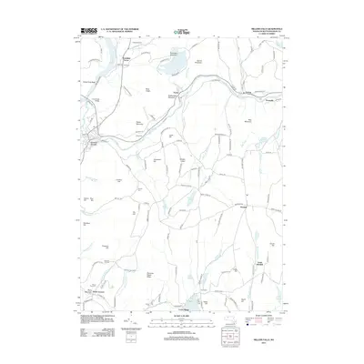 2012 Millers Falls2012 Print · USGSCovers Montague, including Northfield, Leverett, and other nearby areas
 - 2015 Map of Millers Falls, 2015 Print
 2015 Millers Falls2015 Print · USGSCovers Montague, including Northfield, Leverett, and other nearby areas
 - 2015 Map of Greenfield, 2015 Print
 2015 Greenfield2015 Print · USGSCovers Montague, including Greenfield, Deerfield, and other nearby areas
 - 2018 Map of Millers Falls, 2018 Print
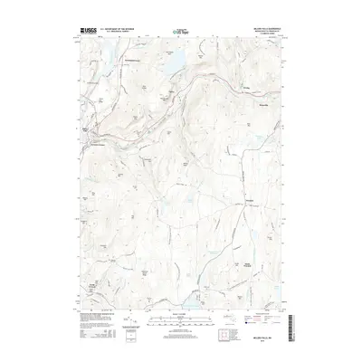
 2018 Millers Falls2018 Print · USGSCovers Montague, including Northfield, Leverett, and other nearby areas
 - 2018 Map of Greenfield, 2018 Print
 2018 Greenfield2018 Print · USGSCovers Montague, including Greenfield, Deerfield, and other nearby areas
 - 2021 Map of Millers Falls, 2021 Print
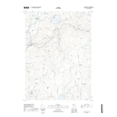
 2021 Millers Falls2021 Print · USGSCovers Montague, including Northfield, Leverett, and other nearby areas
 - 2021 Map of Greenfield, 2021 Print
 2021 Greenfield2021 Print · USGSCovers Montague, including Greenfield, Deerfield, and other nearby areas
 - 2024 Map of Greenfield, 2024 Print
 2024 Greenfield2024 Print · USGSCentral Franklin County is documented here at the meeting of the Connecticut and Deerfield Rivers. Researchers can locate numerous burial sites like Old Albany Cem and High Street Cem or trace the industrial Power Canal in Turners Falls.
 - 2024 Map of Millers Falls, 2024 Print
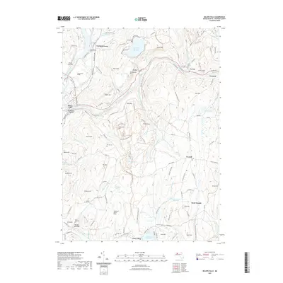
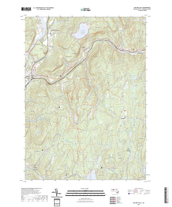 2024 Millers Falls2024 Print · USGSThe Millers River valley in Franklin County remains a landscape of industrial heritage and steep wooded ridges. Researchers can trace family history at Northfield Farms Cem or locate old settlements like Stoneville and Grounts Corner.
End of results
Showing maps 1-10 of 10
Top cities near Montague
- Amherst historical maps
- Northampton historical maps
- Greenfield historical maps
- Belchertown historical maps
- Ware historical maps
- Orange historical maps
See more
Top neighborhoods of Montague
- Grounts Corner historical maps
- Montague City historical maps
- Montague Station historical maps
- Turners Falls historical maps
- Lake Pleasant historical maps
- Millers Falls historical maps
See more
Frequently asked questions
- What are the different types of historical maps available for Montague?
- What is the oldest map of Montague?
- Where can I purchase historical maps of Montague for my home or office?
- Where can I download high-res historical maps of Montague?
- Are there historical topographic maps available for Montague?
- Is there historical aerial imagery available for Montague?
- Where are historical maps of Montague sourced from?