1940s Maps of Boxborough, Massachusetts
Explore 10 historic maps of Boxborough from the 1940s. These maps offer a rare glimpse into what life looked like during the 1940s — showing old roads, neighborhoods, homes, and landmarks that have changed or disappeared over time.
Whether you're researching your family's past, planning a metal detecting trip, or studying how Boxborough's landscape evolved across the 1940s, these high-resolution maps are a powerful tool for exploring the history of this region.
- Focus on a specific era: All maps on this page are from the 1940s, giving you a focused view of this time period.
- See what’s changed: Compare century-old streets, trails, and buildings to today's modern landscape using overlays and satellite layers.
- Research with precision: Use these maps for genealogy, historical research, land use analysis, or educational projects.
- View, download, or print: Maps are fully viewable online in high resolution, and can be downloaded or printed for your own records.
Start exploring Boxborough's history through authentic maps from the 1940s. This is your window into the past.
Boxborough, MA maps
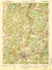
(10)- 1940 Map of Westford
 1940 Westford1940 Print · USGSWestford and Littleton appear at the outbreak of World War II as a network of rail-side mill villages and family-held hills. Genealogists can trace old cemeteries like Westlawn Cem, rural depots at Westford Sta, and the layout of Littleton Common.
 - 1941 Map of Westford
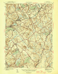
 1941 Westford1941 Print · USGSMiddlesex County in the late 1930s shows a landscape of industrious mill villages and hilltop farms connected by the Boston and Maine line. Trace the rail routes through Graniteville, locate the grounds of Westlawn Cem, or explore the shores of Forge Pond.2 unique versions available
 - 1943 Map of Boston
 1943 Boston1943 Print · USGSGreater Boston and its southern suburbs appear here during the mobilization of the early 1940s. Genealogists and historians can trace the early footprints of Commonwealth Airport, military sites like Fort Winthrop, and local institutions such as Pondville State Hospital.
 - 1943 Map of Maynard
 1943 Maynard1943 Print · USGSMiddlesex County at the height of the Second World War shows a landscape defined by the Assabet River and a thriving rail economy. Genealogists and local historians can trace family plots at Mt Hope Cem or study the grounds of the Concord Reformatory.2 unique versions available
 - 1943 Map of Lowell
 1943 Lowell1943 Print · USGSCentral New England industrial hubs and rural borderlands are mapped here during the early 1940s. Genealogists can trace family names across Mt Misery, Barrett Hill, and small settlements like Collinsville or North Pelham.
 - 1943 Map of Fitchburg
 1943 Fitchburg1943 Print · USGSSouthern New Hampshire and northern Massachusetts are captured during the war years, showing a landscape of river-powered mill towns and mountain trails. You can trace family roots in Peterboro, locate the historic Groton School, or study the rail lines of the Boston & Maine RR.
 - 1943 Map of Quinsigamond
 1943 Quinsigamond1943 Print · USGSCentral Massachusetts and its bordering states appear here during the Second World War as a powerhouse of rail infrastructure and public institutions. Researchers can trace the legacy of the region through landmarks like Grafton State Hospital, the Wachusett Reservoir, and the deep industrial roots of the Blackstone River.
 - 1943 Map of Hudson
 1943 Hudson1943 Print · USGSThe townships of Middlesex and Worcester Counties are shown here during the early 1940s as rural crossroads began to evolve. Genealogists and local historians can trace family-named sites like Potash Hill, find the Old Quaker Ch, and locate old schoolhouses like Emerson Sch.4 unique versions available
 - 1946 Map of Westford
 1946 Westford1946 Print · USGSMiddlesex County in the mid-1940s shows a landscape of busy rail corridors and established villages. Researchers can trace historic family names and sites like Fairview Cem, the Clay Pit, and rail stops at Westford Sta or Carlisle Sta.2 unique versions available
 - 1948 Map of Boston
 1948 Boston1948 Print · USGSEastern Massachusetts and southern New Hampshire appear at an industrial peak in the late 1940s, just as suburban growth began to accelerate. Genealogists and historians can trace rail lines like the Boston and Albany RR or locate coastal landmarks like Graves Lighthouse and Fort Devens.2 unique versions available
End of results
Showing maps 1-10 of 10
Top cities near Boxborough
- Worcester historical maps
- Lowell historical maps
- Nashua historical maps
- Framingham historical maps
- Leominster historical maps
- Billerica historical maps
See more
Frequently asked questions
- What are the different types of historical maps available for Boxborough?
- What is the oldest map of Boxborough?
- Where can I purchase historical maps of Boxborough for my home or office?
- Where can I download high-res historical maps of Boxborough?
- Are there historical topographic maps available for Boxborough?
- Is there historical aerial imagery available for Boxborough?
- Where are historical maps of Boxborough sourced from?