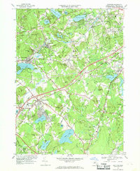
1960s Maps of Groton, Massachusetts
Explore 7 historic maps of Groton from the 1960s. These maps offer a rare glimpse into what life looked like during the 1960s — showing old roads, neighborhoods, homes, and landmarks that have changed or disappeared over time.
Whether you're researching your family's past, planning a metal detecting trip, or studying how Groton's landscape evolved across the 1960s, these high-resolution maps are a powerful tool for exploring the history of this region.
- Focus on a specific era: All maps on this page are from the 1960s, giving you a focused view of this time period.
- See what’s changed: Compare century-old streets, trails, and buildings to today's modern landscape using overlays and satellite layers.
- Research with precision: Use these maps for genealogy, historical research, land use analysis, or educational projects.
- View, download, or print: Maps are fully viewable online in high resolution, and can be downloaded or printed for your own records.
Start exploring Groton's history through authentic maps from the 1960s. This is your window into the past.
Groton, MA maps
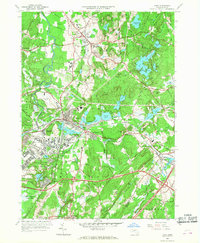
(7)- 1961 Map of Boston
 1961 Boston1961 Print · USGSThe Massachusetts coastline and its industrial interior are detailed here in the mid-twentieth century, from the Monadnock highlands to Cape Cod. Researchers can trace the rail routes of the Boston and Maine or locate landmarks like Fort Devens and the Wachusett Reservoir.2 unique versions available
 - 1965 Map of Pepperell, 1967 Print
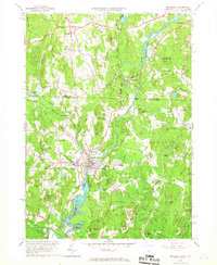 1965 Pepperell1967 Print · USGSThe Nashua River Valley comes alive in the mid-1960s as it spans the border between New Hampshire and Massachusetts. Genealogists and historians can trace the Boston and Maine Railroad, locate the Covered Bridge, and find old burials at Blood Cem or South Cem.3 unique versions available
 - 1965 Map of Townsend, 1967 Print
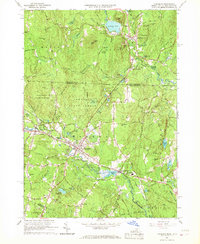 1965 Townsend1967 Print · USGSTownsend and Brookline are captured in the mid-1960s as the rail and river corridor through the Squannacook River valley remained central to local life. Researchers can trace historic family landmarks and civic sites like Lakeview Cem, Daniels Academy, and the Boston and Maine rail line.5 unique versions available
 - 1965 Map of Shirley, 1968 Print
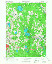 1965 Shirley1968 Print · USGSShirley and the surrounding Worcester County uplands are captured here in the mid-sixties as military operations and industrial growth intersected. Genealogists and historians can trace the footprint of Fort Devens, the State Industrial Sch for Boys, and the village layout of Shirley Center.3 unique versions available
 - 1965 Map of Nashua South, 1968 Print
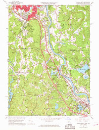 1965 Nashua South1968 Print · USGSThe Merrimack River valley and the expanding outskirts of Nashua come into sharp focus in the mid-sixties. Genealogists and local historians can trace the foundations of Dunstable and Tyngsborough, locating Evergreen Cem and Whidden Corner.7 unique versions available
 - 1966 Map of Ayer, 1968 Print
 1966 Ayer1968 Print · USGSMiddlesex County in the mid-sixties reveals a landscape of massive military installations and storied academic institutions. Researchers can locate Shaker Village, trace the Boston and Maine rail lines, and find landmarks like the Harvard University Observatory.3 unique versions available
 - 1966 Map of Westford, 1969 Print
 1966 Westford1969 Print · USGSMiddlesex County in the mid-1960s shows a landscape of rail-side industrial villages and expanding school campuses. Genealogists and historians can trace sites like Russian Cem, the Westford Academy, and the old depot at Brookside Station.2 unique versions available
End of results
Showing maps 1-7 of 7
Top cities near Groton
- Lowell historical maps
- Nashua historical maps
- Leominster historical maps
- Fitchburg historical maps
- Chelmsford historical maps
- Dracut historical maps
See more
Top neighborhoods of Groton
Frequently asked questions
- What are the different types of historical maps available for Groton?
- What is the oldest map of Groton?
- Where can I purchase historical maps of Groton for my home or office?
- Where can I download high-res historical maps of Groton?
- Are there historical topographic maps available for Groton?
- Is there historical aerial imagery available for Groton?
- Where are historical maps of Groton sourced from?