Old Maps of Millis, Massachusetts for Academic Research
Study the evolution of Millis with 34 high-resolution historic maps. Whether you're teaching, researching, or modeling changes in land use, these maps provide essential visual documentation of urban, environmental, and geographic change.
- Analyze long-term change: Track patterns in development, transportation, and natural features.
- Ideal for environmental or urban studies: Support academic projects with primary historical map data.
- Use in the classroom or lab: Educators and researchers rely on these maps to bring historical context to life.
These maps are a powerful tool for teaching, research, and visualizing how Millis has changed over the decades.
Millis, MA maps
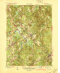
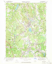
(34)- 1887 Map of Franklin
 1887 Franklin1887 Print · USGSNorfolk County at the peak of the industrial rail era shows a complex landscape of mill villages and expanding transit lines. Trace the development of City Mills, follow the Old Colony R. R. Wrentham Branch, or locate old landmarks like Burnt Swamp Corner.
 - 1889 Map of Franklin
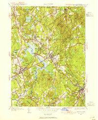
 1889 Franklin1889 Print · USGSThe industrial and rail hubs of Norfolk County are detailed in the late 1880s, documenting a time of rapid growth for mill towns and village centers. Researchers can trace historic station stops and hamlets like City Mills, Unionville, and Whitney Sta.
 - 1893 Map of Franklin
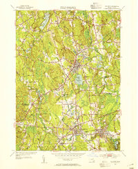
 1893 Franklin1893 Print · USGSEastern Massachusetts at the close of the nineteenth century was a landscape of busy rail junctions and riverside mill towns. Researchers can trace the era's industrial footprint through sites like City Mills, Medfield Junc., and the isolated Burnt Swamp Corner.8 unique versions available
 - 1919 Map of Franklin
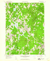
 1919 Franklin1919 Print · USGSEastern Massachusetts at the end of the Great War was a landscape defined by its river-powered mill towns and expanding rail corridors. Genealogists and local historians can trace family roots through industrial hamlets like City Mills, Unionville, and Sheldonville.2 unique versions available
 - 1921 Map of Franklin, 1942 Print
 1921 Franklin1942 Print · USGSThe Charles River valley was a network of bustling rail junctions and mill villages in the years following the Great War. You can trace the development of towns like Franklin and Medway or locate smaller centers such as City Mills and Unionville.
 - 1940 Map of Medfield
 1940 Medfield1940 Print · USGSMedfield and the surrounding Charles River valley appear here just before the Second World War, showing a landscape of small villages and large institutional grounds. Researchers can trace the old rail beds of the New York New Haven and Hartford and find local landmarks like Schoolhouse No 14 and the Medfield State Hospital.2 unique versions available
 - 1941 Map of Holliston
 1941 Holliston1941 Print · USGSThe town of Holliston and the surrounding river valleys are captured here just before the mid-century suburban expansion. Genealogists and historians can trace rail-era landmarks like Braggville Sta, local institutions like the Wilder Sch, and old burial grounds including Lake Grove Cem.
 - 1942 Map of Holliston
 1942 Holliston1942 Print · USGSHolliston and the surrounding river valleys of Middlesex and Norfolk counties are captured here just before the mid-century suburban shift. Genealogists can locate family landmarks like the Wilder Sch, St Marys Cem, and the historic Braggville Sta along the rail lines.2 unique versions available
 - 1943 Map of Boston
 1943 Boston1943 Print · USGSGreater Boston and its southern suburbs appear here during the mobilization of the early 1940s. Genealogists and historians can trace the early footprints of Commonwealth Airport, military sites like Fort Winthrop, and local institutions such as Pondville State Hospital.
 - 1945 Map of Medfield, 1954 Print
 1945 Medfield1954 Print · USGSThe Charles River valley and its rail-connected towns appear here during the mid-forties. Genealogists and historians can trace family locations near Medfield State Hospital, Farm St Sta, and Vine Lake Cem.3 unique versions available
 - 1946 Map of Medfield
 1946 Medfield1946 Print · USGSPost-war Norfolk County is captured here just as local rail service and institutional life centered on the Medfield State Hospital remained vital. Trace family lands near Pine Hill Cem or follow the New Haven and Hartford RR through Medfield Junction.2 unique versions available
 - 1948 Map of Boston
 1948 Boston1948 Print · USGSEastern Massachusetts and southern New Hampshire appear at an industrial peak in the late 1940s, just as suburban growth began to accelerate. Genealogists and historians can trace rail lines like the Boston and Albany RR or locate coastal landmarks like Graves Lighthouse and Fort Devens.2 unique versions available
 - 1953 Map of Holliston, 1954 Print
 1953 Holliston1954 Print · USGSMid-century Holliston and Medway are captured here just as the post-war era transformed these historic mill and rail towns. Local historians can trace the routes of the Boston & Albany RR, locate family plots in St Marys Cem, and find the old Braggville Sch.4 unique versions available
 - 1956 Map of Boston, 1967 Print
 1956 Boston1967 Print · USGSThe Massachusetts coastline and industrial interior are seen here during the mid-century peak of suburban and highway expansion. Researchers can trace historic harbor defenses like Fort Revere, local landmarks such as Faneuil Hall, and the vast Parker River National Wildlife Refuge.6 unique versions available
 - 1957 Map of Medfield, 1960 Print
 1957 Medfield1960 Print · USGSMid-century Norfolk County is captured here during a period of suburban expansion along the Charles River. Researchers can trace the rail infrastructure of the New Haven Railroad and locate local landmarks like the Medfield State Hospital and St Stephens Priory.2 unique versions available
 - 1958 Map of Boston
 1958 Boston1958 Print · USGSEastern Massachusetts and southern New Hampshire are shown at the height of the industrial era, before the full expansion of the interstate system. Trace coastal defenses at Fort Warren, historic rail lines like the Boston and Maine, and the development of the Mass. 128 corridor.2 unique versions available
 - 1961 Map of Boston
 1961 Boston1961 Print · USGSThe Massachusetts coastline and its industrial interior are detailed here in the mid-twentieth century, from the Monadnock highlands to Cape Cod. Researchers can trace the rail routes of the Boston and Maine or locate landmarks like Fort Devens and the Wachusett Reservoir.2 unique versions available
 - 1969 Map of Holliston, 1971 Print
 1969 Holliston1971 Print · USGSMiddlesex and Norfolk Counties come into focus during this era of suburban refinement and established rail transit. Genealogists and local historians can trace family plots and early landmarks at Indian Cem, Braggville Station, and West Medway.2 unique versions available
 - 1970 Map of Medfield, 1972 Print
 1970 Medfield1972 Print · USGSMedfield and Millis are shown during a period of transition in the early seventies, as suburban growth met the legacy of the area's older institutional and rail infrastructure. Researchers can trace the extensive Medfield State Hospital grounds, historic burial sites like Vine Lake Cemetery, and the Penn Central rail lines.2 unique versions available
 - 1977 Map of Holliston, 1981 Print
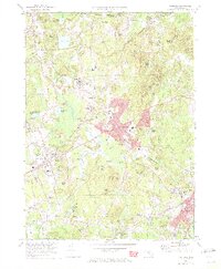
 1977 Holliston1981 Print · USGSHolliston and the surrounding Massachusetts towns are shown in sharp photographic detail during the late seventies. Researchers can trace property boundaries and land development near Holliston, West Medway, and the banks of the Charles River.
 - 1977 Map of Medfield, 1981 Print
 1977 Medfield1981 Print · USGSNorfolk County is seen through the lens of late-seventies aerial photography, capturing the area's transition between rural roots and suburban growth. Trace local land use and development patterns near Medfield, Millis, and the winding Charles River.
 - 1985 Map of Boston, 1986 Print
 1985 Boston1986 Print · USGSThe Massachusetts urban core and its expanding suburbs are captured in the mid-eighties, showing the reach of the Mass Turnpike and Route 128. Genealogists and historians can trace the evolution of towns from Lexington to Waltham, locating landmarks like Harvard University and Minute Man National Historical Park.
 - 1987 Map of Medfield
 1987 Medfield1987 Print · USGSThe Charles River valley communities of Norfolk and Middlesex Counties reached a peak of suburban and institutional maturity during the 1980s. Local researchers can trace the footprint of the Medfield State Hospital, locate family plots in Lake Grove Cem, or follow the CONRAIL line through Gooch Corners and Millis.2 unique versions available
 - 1989 Map of Boston
 1989 Boston1989 Print · USGSGreater Boston and the central Massachusetts corridor appear here in the late eighties as suburban growth reshaped the region. Genealogists and historians can trace the transit networks between Boston, Worcester, and Quincy, while locating landmarks like Bunker Hill Monument and Wachusett Reservoir.2 unique versions available
 - 2012 Map of Medfield, 2012 Print
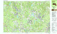
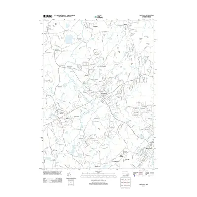 2012 Medfield2012 Print · USGSCovers Millis, including Natick, Walpole, and other nearby areas
Showing maps 1-25 of 34
Top cities near Millis
- Boston historical maps
- Cambridge historical maps
- Newton historical maps
- Framingham historical maps
- Brookline historical maps
- Waltham historical maps
See more
Top neighborhoods of Millis
Frequently asked questions
- What are the different types of historical maps available for Millis?
- What is the oldest map of Millis?
- Where can I purchase historical maps of Millis for my home or office?
- Where can I download high-res historical maps of Millis?
- Are there historical topographic maps available for Millis?
- Is there historical aerial imagery available for Millis?
- Where are historical maps of Millis sourced from?