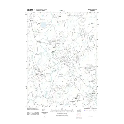
2012 Map of Medfield
USGS Topo · Published 2012About this map
The Charles River winds through the heart of this Norfolk County landscape, defining the boundaries and drainage for Medfield, Millis, and Sherborn. The 2012 survey illustrates a region where colonial-era roots meet modern infrastructure, notably at the historic Medfield Junction where rail lines converge. The map is particularly detailed regarding local heritage sites, documenting several early interment grounds such as the Central Burying Ground and the Old South Burying Ground.
Find a feature on this map
297 named features on this map. Tap any name to fly to it.
Don’t see what you’re looking for? This feature index may not catch every label — zoom into the map to look around manually.
Map Details
Editions of this 2012 Medfield Map
This is the sole edition of this map. No revisions or reprints were ever made.
Other maps of this area

1886 · Dedham
USGS Topo · 1:62,500

1886 · Framingham
USGS Topo · 1:62,500

1887 · Franklin
USGS Topo · 1:62,500

1889 · Franklin
USGS Topo · 1:62,500

1889 · Framingham
USGS Topo · 1:62,500

1893 · Franklin
USGS Topo · 1:62,500

1893 · Boston
USGS Topo · 1:62,500

1894 · Dedham
USGS Topo · 1:62,500

1894 · Framingham
USGS Topo · 1:62,500

1903 · Boston
USGS Topo · 1:62,500