
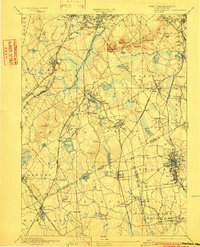
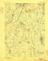
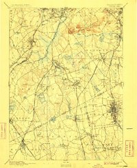
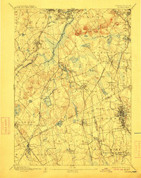
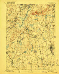
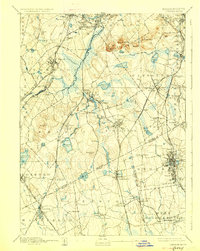
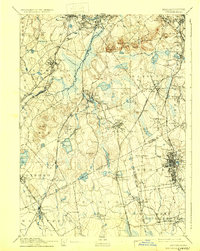
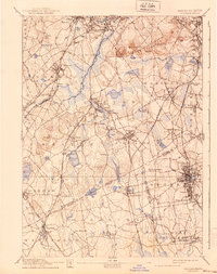
1894 Map of Dedham
USGS Topo · Published 1894About this map
The Neponset River and its various tributaries define the industrial and natural landscape south of Boston, flowing through a series of mill-driven settlements and marshlands. This survey reveals a complex late-19th-century transportation network where the Main Line and Providence Division intersect with local spurs like the Stoughton Branch. In the north, the Blue Hills range dominates the terrain, featuring Great Blue Hill and Chickataubut Hill, providing a stark contrast to the rapidly developing railroad hubs of Readville and Canton Junction.
Find a feature on this map
130 named features on this map. Tap any name to fly to it.
Don’t see what you’re looking for? This feature index may not catch every label — zoom into the map to look around manually.
Map Details
Editions of this 1894 Dedham Map
10 editions found

Other maps of this area

1885 · Abington
USGS Topo · 1:62,500

1885 · Middleboro
USGS Topo · 1:62,500

1885 · Taunton
USGS Topo · 1:62,500

1886 · Dedham
USGS Topo · 1:62,500

1886 · Framingham
USGS Topo · 1:62,500

1887 · Franklin
USGS Topo · 1:62,500

1887 · Providence
USGS Topo · 1:62,500

1888 · Taunton
USGS Topo · 1:62,500

1888 · Middleboro
USGS Topo · 1:62,500

1888 · Abington
USGS Topo · 1:62,500