1900s (20th Century) Maps of East Bridgewater, Massachusetts
Explore 26 historic maps of East Bridgewater from the 1900s (20th Century). These maps offer a rare glimpse into what life looked like during the 1900s — showing old roads, neighborhoods, homes, and landmarks that have changed or disappeared over time.
Whether you're researching your family's past, planning a metal detecting trip, or studying how East Bridgewater's landscape evolved across the 1900s, these high-resolution maps are a powerful tool for exploring the history of this region.
- Focus on a specific era: All maps on this page are from the 1900s, giving you a focused view of this time period.
- See what’s changed: Compare century-old streets, trails, and buildings to today's modern landscape using overlays and satellite layers.
- Research with precision: Use these maps for genealogy, historical research, land use analysis, or educational projects.
- View, download, or print: Maps are fully viewable online in high resolution, and can be downloaded or printed for your own records.
Start exploring East Bridgewater's history through authentic maps from the 1900s. This is your window into the past.
East Bridgewater, MA maps
(26)- 1916 Map of Middleboro
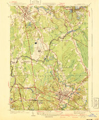
 1916 Middleboro1916 Print · USGSSoutheastern Massachusetts at the height of its rail-and-mill era shows a dense network of stations and wetlands. Trace the Old Colony Railroad lines to sites like Haskins Station, Paper Mill Village, and the Lakeville State Sanatarium.
 - 1918 Map of Middleboro, 1921 Print
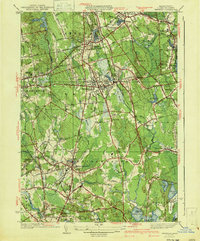
 1918 Middleboro1921 Print · USGSSoutheastern Massachusetts at the end of the Great War reveals a landscape defined by cranberry bogs, cedar swamps, and a dense network of Old Colony Railroad lines. Genealogists and historians can trace rail stops like Haskins Station, the grounds of the Lakeville State Sanatarium, and old villages like The Green.
 - 1920 Map of Abington
 1920 Abington1920 Print · USGSThe South Shore was a bustling network of rail and industry at the end of the Great War. You can trace the path of the Hanover Branch and Old Colony RR, or find historic sites like the Old Oaken Bucket Homestead and Weymouth Landing.
 - 1936 Map of Whitman
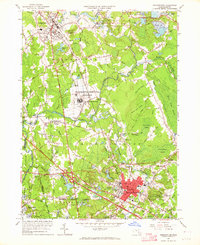
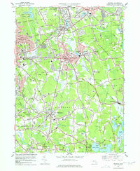
 1936 Whitman1936 Print · USGSPlymouth County towns like Whitman and Abington are shown during the mid-1930s as they balanced industrial works with growing residential neighborhoods. Trace local family history through numerous landmarks like St Patricks Cem, Union Cong Ch, and Jones Pond Sch.
 - 1937 Map of Middleboro
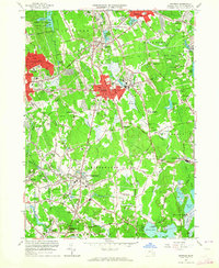
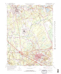
 1937 Middleboro1937 Print · USGSThe rail-and-river hub of Middleborough and its surrounding cranberry bogs are frozen in time just before the war. Researchers can trace family roots at Purchase Cem, locate the Thompsonville Sch, or follow the New York New Haven and Hartford railroad line.
 - 1940 Map of Bridgewater
 1940 Bridgewater1940 Print · USGSSoutheastern Massachusetts at the dawn of the 1940s reveals a landscape shaped by state institutions and the cranberry industry. Researchers can trace family sites near The Green, find the Fair Grounds, or locate old schoolhouses like the Pleasant Street School.3 unique versions available
 - 1941 Map of Whitman
 1941 Whitman1941 Print · USGSThe Plymouth County interior is shown in the early 1940s, as traditional rail corridors and cranberry agriculture defined the local economy. Genealogists can locate family landmarks like St James Cem, Beaver Sch, and the Fireworks works near West Hanover.3 unique versions available
 - 1942 Map of New Bedford
 1942 New Bedford1942 Print · USGSSoutheastern Massachusetts at the start of the 1940s shows a region defined by maritime defense and industrial rail corridors. Genealogists and historians can trace the massive Camp Edwards boundary, old rail stops like Rock Station, and vanished local industry at Paper Mill Village.2 unique versions available
 - 1947 Map of Providence, 1948 Print
 1947 Providence1948 Print · USGSSouthern New England is captured in the mid-1940s, showing a landscape defined by busy industrial ports and expanding military installations. Researchers can trace the rail lines of the N.Y. N.H. & H. RR or locate coastal defenses like Fort Adams and Quonset Point.5 unique versions available
 - 1948 Map of Boston
 1948 Boston1948 Print · USGSEastern Massachusetts and southern New Hampshire appear at an industrial peak in the late 1940s, just as suburban growth began to accelerate. Genealogists and historians can trace rail lines like the Boston and Albany RR or locate coastal landmarks like Graves Lighthouse and Fort Devens.2 unique versions available
 - 1948 Map of Providence, 1951 Print
 1948 Providence1951 Print · USGSSouthern New England’s coastal reaches are captured here in the late 1940s, from the industrial heart of Providence to the tip of Provincetown. Genealogists and historians can trace rail lines like the Central Vermont Railway and locate active military sites such as Otis Air Force Base and Fort Rodman.
 - 1948 Map of Whitman, 1957 Print
 1948 Whitman1957 Print · USGSPost-war Plymouth County comes alive in this survey of a landscape shaped by rail and water. Researchers can trace local roots through St James Cem, find old schoolhouses like Central St Sch, or locate the Fireworks industry near West Hanover.
 - 1949 Map of Bridgewater, 1957 Print
 1949 Bridgewater1957 Print · USGSMiddleborough and Bridgewater appear here at a mid-century turning point, shaped by rail corridors and the cranberry industry. Genealogists can locate family names at Mt Prospect Cem or trace rural education at the North Lakeville Sch and Pleasant Street Sch.
 - 1956 Map of Boston, 1967 Print
 1956 Boston1967 Print · USGSThe Massachusetts coastline and industrial interior are seen here during the mid-century peak of suburban and highway expansion. Researchers can trace historic harbor defenses like Fort Revere, local landmarks such as Faneuil Hall, and the vast Parker River National Wildlife Refuge.6 unique versions available
 - 1957 Map of Providence
 1957 Providence1957 Print · USGSCoastal New England at the height of the mid-century era shows a landscape shaped by maritime industry and Cold War defense. Genealogists and historians can trace the reach of the New York, New Haven & Hartford RR and locate legacy sites like Fort Adams and Quonset Point Naval Air Station.
 - 1958 Map of Boston
 1958 Boston1958 Print · USGSEastern Massachusetts and southern New Hampshire are shown at the height of the industrial era, before the full expansion of the interstate system. Trace coastal defenses at Fort Warren, historic rail lines like the Boston and Maine, and the development of the Mass. 128 corridor.2 unique versions available
 - 1958 Map of Providence
 1958 Providence1958 Print · USGSThe Rhode Island and Massachusetts coastlines are shown in detail during the late 1950s, from the urban cores to the tips of the islands. Researchers can trace the mid-century footprint of Quonset Point Naval Air Station, the defense works at Fort Adams, and the rail network of the New York, New Haven and Hartford RR.
 - 1961 Map of Boston
 1961 Boston1961 Print · USGSThe Massachusetts coastline and its industrial interior are detailed here in the mid-twentieth century, from the Monadnock highlands to Cape Cod. Researchers can trace the rail routes of the Boston and Maine or locate landmarks like Fort Devens and the Wachusett Reservoir.2 unique versions available
 - 1962 Map of Bridgewater, 1964 Print
 1962 Bridgewater1964 Print · USGSPlymouth County enters a period of post-war suburban and industrial growth as the rail lines of the New York New Haven and Hartford still anchor the local economy. Trace the footprints of Paper Mill Village, the Lakeville State Sanatorium, and old local landmarks like the Pratt Free Sch.3 unique versions available
 - 1962 Map of Whitman, 1964 Print
 1962 Whitman1964 Print · USGSSoutheastern Massachusetts' shoe-making and cranberry-growing centers are caught in a period of steady suburban growth. Genealogists can trace family plots at St Patricks Cemetery and Colebrook Cemetery or locate early civic landmarks like the Dyer Sch.2 unique versions available
 - 1963 Map of Providence
 1963 Providence1963 Print · USGSSouthern New England's coastal and industrial heartland is captured here in the early sixties, from the Rhode Island mainland to the far reaches of the Cape. Researchers can trace mid-century growth in Providence or locate landmarks on Marthas Vineyard and Nantucket Island.
 - 1977 Map of Whitman, 1978 Print
 1977 Whitman1978 Print · USGSPlymouth County in the late seventies is a landscape of established rail corridors and industrial waterworks. Researchers can trace family sites near St Patricks Cemetery, Massasoit College, or the extensive Cranberry Bogs bordering Hanson.4 unique versions available
 - 1977 Map of Bridgewater, 1978 Print
 1977 Bridgewater1978 Print · USGSBridgewater and Middleboro appear in the late seventies as significant rail and river hubs south of Brockton. Genealogists and local historians can trace family plots at St Marys Cem or locate the Pratt Free Sch and Paper Mill Village.3 unique versions available
 - 1984 Map of Provincetown, 1986 Print
 1984 Provincetown1986 Print · USGSThe Massachusetts coastline and the tip of Cape Cod appear here during the mid-eighties, highlighting the region's dense coastal settlements and maritime defenses. You can locate family landmarks in Marshfield, trace the grounds of the North Truro Air Force Station, and explore the islands of Boston Harbor like Peddocks Island.2 unique versions available
 - 1986 Map of New Bedford
 1986 New Bedford1986 Print · USGSSoutheastern Massachusetts and the Cape are shown here during the mid-eighties, a period of notable coastal growth and modernization. Researchers can trace the development of maritime hubs like Woods Hole and New Bedford or locate landmarks within Myles Standish State Forest.
Showing maps 1-25 of 26
Top cities near East Bridgewater
- Boston historical maps
- Brockton historical maps
- Quincy historical maps
- Plymouth historical maps
- Taunton historical maps
- Weymouth historical maps
See more
Top neighborhoods of East Bridgewater
- Beaver historical maps
- Curtisville historical maps
- Elmwood historical maps
- Elmwood Station historical maps
- Northville historical maps
- Eastville historical maps
See more
Frequently asked questions
- What are the different types of historical maps available for East Bridgewater?
- What is the oldest map of East Bridgewater?
- Where can I purchase historical maps of East Bridgewater for my home or office?
- Where can I download high-res historical maps of East Bridgewater?
- Are there historical topographic maps available for East Bridgewater?
- Is there historical aerial imagery available for East Bridgewater?
- Where are historical maps of East Bridgewater sourced from?