2020s Maps of Alger County, Michigan
Explore 34 historic maps of Alger County from the 2020s. These maps offer a rare glimpse into what life looked like during the 2020s — showing old roads, neighborhoods, homes, and landmarks that have changed or disappeared over time.
Whether you're researching your family's past, planning a metal detecting trip, or studying how Alger County's landscape evolved across the 2020s, these high-resolution maps are a powerful tool for exploring the history of this region.
- Focus on a specific era: All maps on this page are from the 2020s, giving you a focused view of this time period.
- See what’s changed: Compare century-old streets, trails, and buildings to today's modern landscape using overlays and satellite layers.
- Research with precision: Use these maps for genealogy, historical research, land use analysis, or educational projects.
- View, download, or print: Maps are fully viewable online in high resolution, and can be downloaded or printed for your own records.
Start exploring Alger County's history through authentic maps from the 2020s. This is your window into the past.
Alger County, MI maps
(34)- 2020 Map of Shingleton, 2020 Print
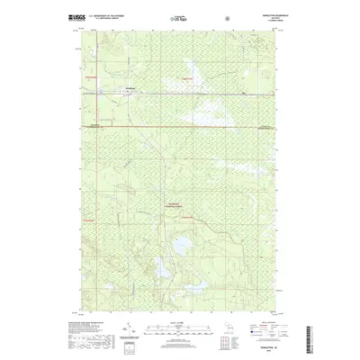 2020 Shingleton2020 Print · USGSCovers Alger County, including Star, Shingleton, and other nearby areas
 - 2023 Map of Grand Marais SE, 2023 Print
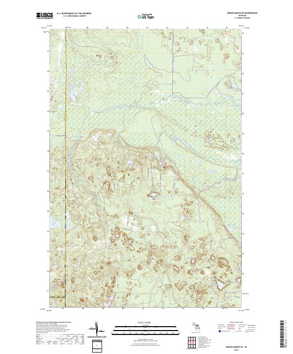 2023 Grand Marais SE2023 Print · USGSUpper Peninsula wilderness in eastern Luce County is defined here by the winding North Branch Two Hearted River and its vast wetlands. Researchers can trace historic access routes like McCloud Grade and locate remote water bodies including Potters Lake and Dairy Lake.
 - 2023 Map of Nawakwa Lake, 2023 Print
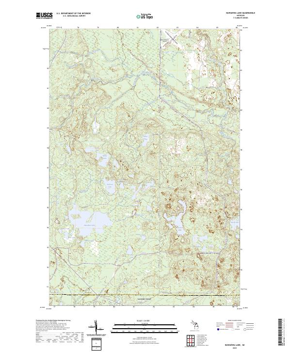 2023 Nawakwa Lake2023 Print · USGSThe Alger-Schoolcraft county line near the turn of the twenty-first century reveals a landscape defined by water and woods. Trace family camp locations near Nawakwa Lake, the old Mccloud Grade, or the small settlement at Lavender Corner.
 - 2023 Map of Grand Marais NE, 2023 Print
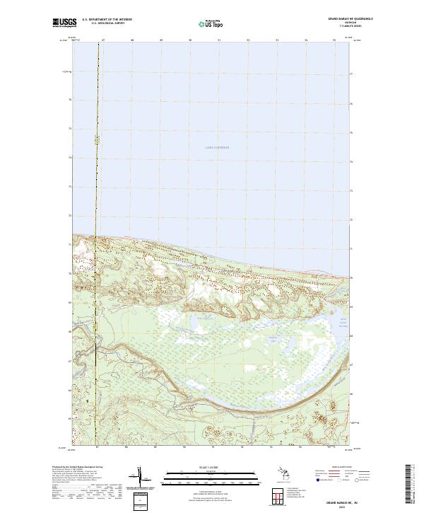 2023 Grand Marais NE2023 Print · USGSThe Lake Superior shoreline in Luce County is captured here in a contemporary look at its intricate coastal wetlands and trail networks. Researchers and hikers can trace the North Country National Scenic Trail and the shifting waters of the Blind Sucker Flooding and Dead Sucker River.
 - 2023 Map of Chatham, 2023 Print
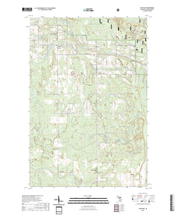 2023 Chatham2023 Print · USGSNorthern Michigan timber and farming communities thrive in this 2020s view of the Alger County backcountry. Trace family roots and land ownership near Eben Junction, Traunik, and the Limestone Township Cem.
 - 2023 Map of Juniper, 2023 Print
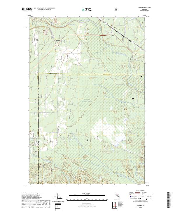 2023 Juniper2023 Print · USGSThe Upper Peninsula interior comes to life in this recent study of the dense timberlands along the Alger and Schoolcraft county line. Outdoorsmen and local historians can trace the Haywire Grade Atv Trl past remote locales like Juniper and Scotts Marsh.
 - 2023 Map of Laughing Fish Point, 2023 Print
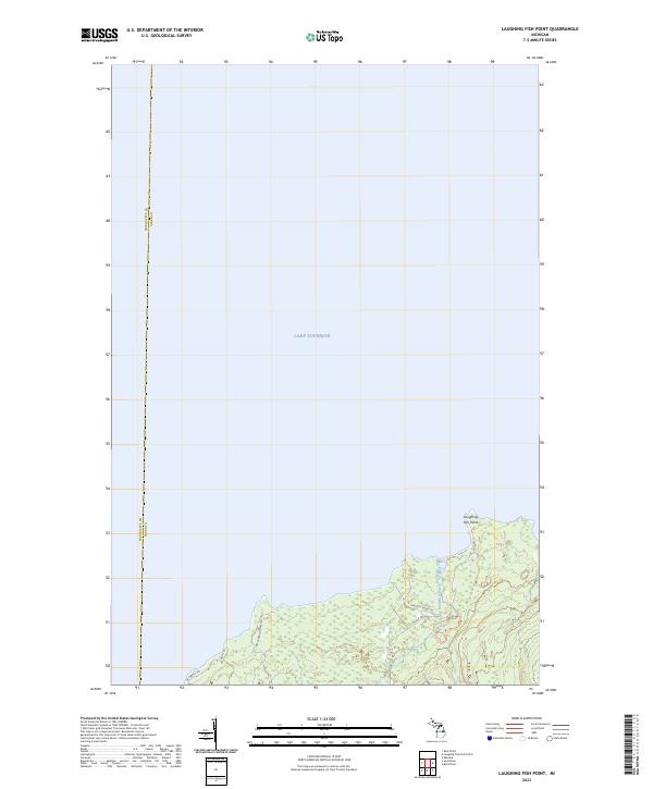 2023 Laughing Fish Point2023 Print · USGSThe Upper Peninsula shoreline meets the cold waters of Lake Superior in this recent survey of the Alger and Marquette county line. Researchers can trace the winding Laughing Whitefish River and follow the route of the Historical Pathway through the wooded terrain.
 - 2023 Map of Au Train, 2023 Print
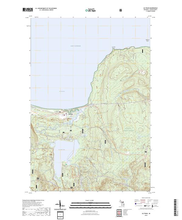 2023 Au Train2023 Print · USGSThe Lake Superior shoreline at Au Train Bay is captured here in the early twenty-first century, showcasing a landscape of deep forests and coastal wetlands. Researchers can locate the Au Train Township Cem or trace recreational routes like the Marquette-manistique Trl and Coalwood Grade Atv Trl.
 - 2023 Map of Powell Lake, 2023 Print
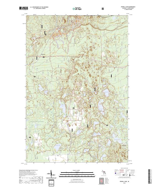 2023 Powell Lake2023 Print · USGSThe northern woods of Michigan come alive in this recent survey of the region's vast trail systems and interconnected glacial lakes. Outdoor historians and researchers can trace the Coalwood Grade Atv Trl past Coalwood or explore the corridor of the Indian Wild And Scenic River.
 - 2023 Map of Au Sable Point, 2023 Print
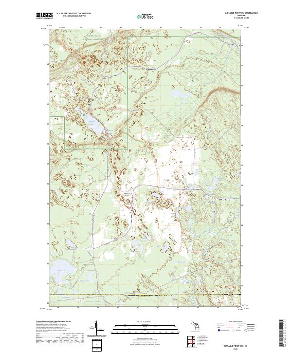
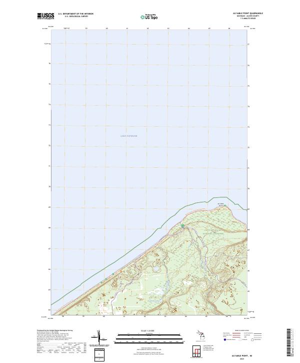 2023 Au Sable Point2023 Print · USGSThe Alger County coast of Lake Superior is captured here in the early twenty-first century, featuring the prominent Au Sable Point. Hikers and historians can trace the North Country National Scenic Trl as it passes the Hurricane River within the Pictured Rocks National Lakeshore.
 - 2023 Map of Wood Island SE, 2023 Print
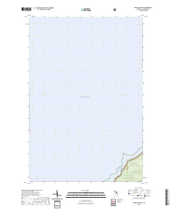 2023 Wood Island SE2023 Print · USGSThe Lake Superior coastline in Alger County is shown in this contemporary study of Michigan’s northern edge. You can trace the path of the North Country National Scenic Trl as it skirts the Pictured Rocks National Lakeshore and the wooded Hiawatha National Forest.
 - 2023 Map of Laughing Fish Point OE E, 2023 Print
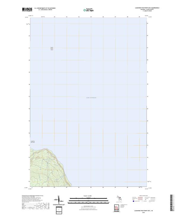 2023 Laughing Fish Point OE E2023 Print · USGSThe shoreline of Alger County meets the open water of Lake Superior in this 2023 survey. Researchers can trace the coastal access along Shore Dr and identify maritime features like Laughing Fish Point and the offshore North Drisco Shoal.
 - 2023 Map of Au Sable Point SW, 2023 Print
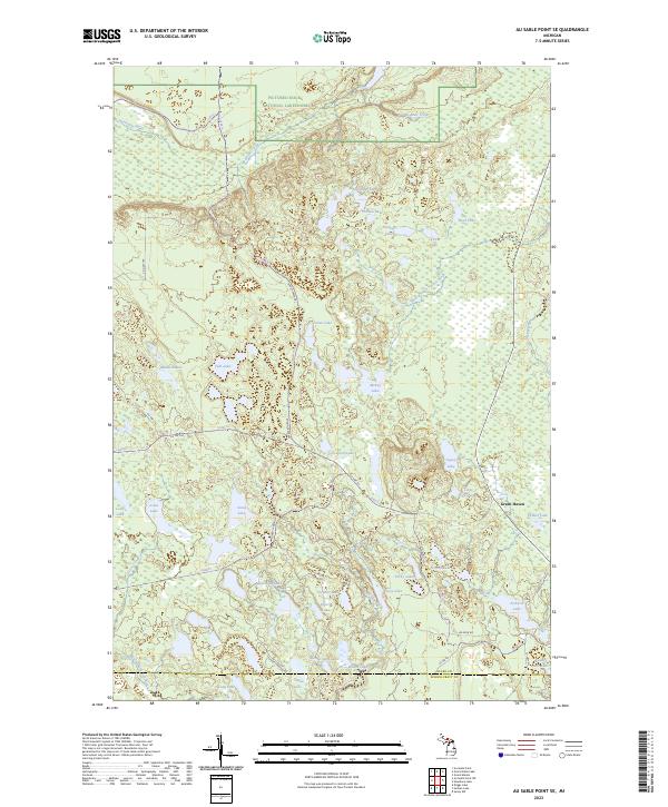
 2023 Au Sable Point SW2023 Print · USGSAlger County's backcountry is captured here in the early twenty-first century, showing the transition from protected parkland to state forest. Researchers can trace the rugged Fox River Pathway Trl as it winds past Kingston Lake and through the Kingston Plains.
 - 2023 Map of Au Sable Point SE, 2023 Print
 2023 Au Sable Point SE2023 Print · USGSUpper Peninsula lake country is captured in this recent survey of the Alger and Schoolcraft county line. Researchers can trace remote trails like Rhody Creek Trl and find quiet settlements like Green Haven among the Porky Lakes and Lavender Lake.
 - 2023 Map of Ladoga, 2023 Print
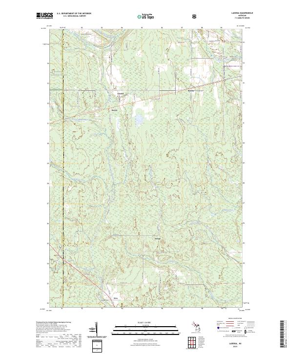 2023 Ladoga2023 Print · USGSUpper Peninsula forests and river headwaters define the landscape of Alger County in the early twenty-first century. Researchers can trace the rural communities of Sundell, Rumely, and Ladoga alongside the protected reaches of the Hiawatha National Forest.
 - 2023 Map of Indian Town, 2023 Print
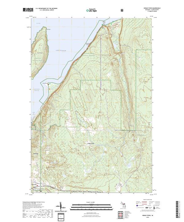 2023 Indian Town2023 Print · USGSAlger County’s northern coast comes into focus in this recent survey of the Upper Peninsula’s shoreline and timberlands. Local historians can trace the roads around Indian Town and Wetmore, or locate the Munising Township Cemetery and the shoreline at Pictured Rocks.
 - 2023 Map of Melstrand, 2023 Print
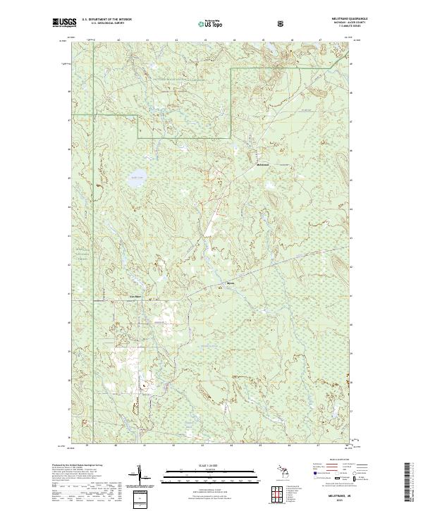 2023 Melstrand2023 Print · USGSThe northern timberlands and lakeshore of Alger County are preserved here during the early twenty-first century. Genealogists and outdoorsmen can trace the rural networks around Melstrand and Van Meer, or follow the Mosquito River through the Pictured Rocks National Lakeshore.
 - 2023 Map of Wood Island, 2023 Print
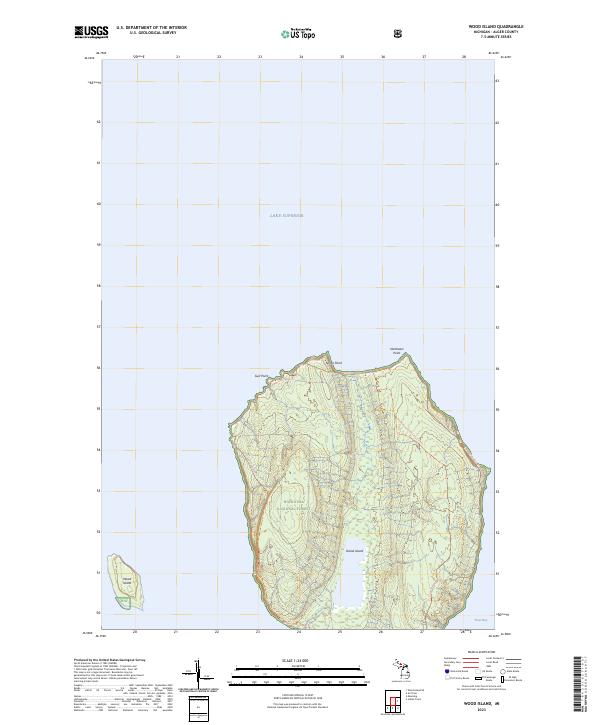 2023 Wood Island2023 Print · USGSGrand Island and its surrounding waters in Lake Superior are mapped here during the early twenty-first century. Researchers can trace the island's trail networks and coastal features like Gull Point and the secluded Trout Bay within the Hiawatha National Forest.
 - 2023 Map of Grand Portal Point, 2023 Print
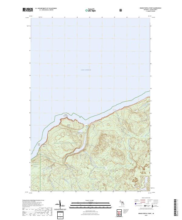 2023 Grand Portal Point2023 Print · USGSThe Lake Superior coast of Alger County is captured here in the early 2020s, showcasing a landscape of protected wilderness and water. You can trace the path of the North Country National Scenic Trl past landmarks like Lovers Leap and Spray Falls.
 - 2023 Map of Tie Lake, 2023 Print
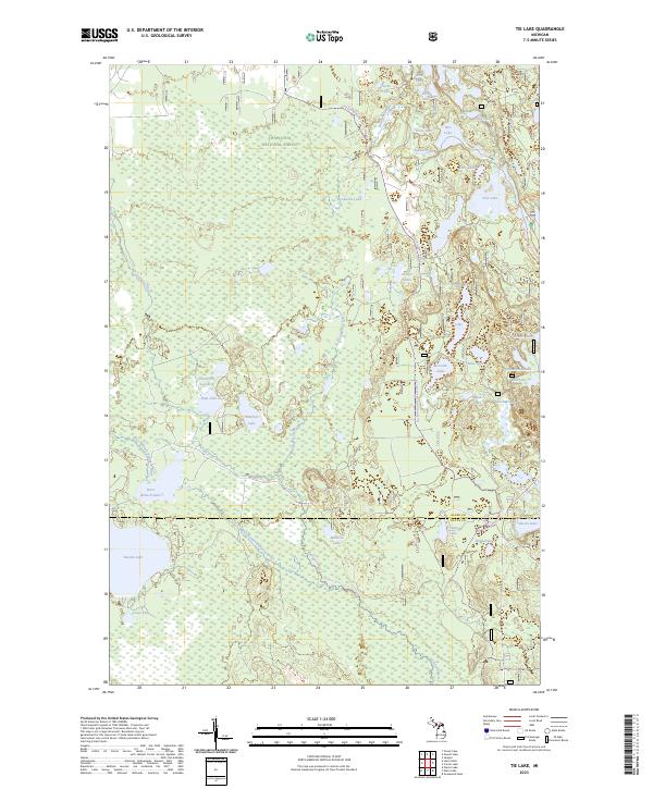 2023 Tie Lake2023 Print · USGSUpper Peninsula wilderness in the modern era reveals a landscape defined by protected forests and labyrinthine waterways. Researchers can trace the courses of the Indian Wild and Scenic River and find remote landmarks like Tie Lake and Nookomis Lake.
 - 2023 Map of Grand Sable Lake, 2023 Print
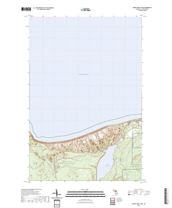 2023 Grand Sable Lake2023 Print · USGSThe eastern reaches of the Pictured Rocks shoreline are shown here in the 2020s, where the massive Grand Sable Dunes meet the lake. You can trace the North Country National Scenic Trl through the sands or locate the namesake Grand Sable Lake and the road to Grand Marais.
 - 2023 Map of Creighton, 2023 Print
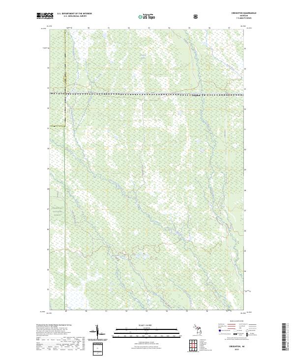 2023 Creighton2023 Print · USGSThe Upper Peninsula wilderness around the Alger and Schoolcraft county line is shown here in the early 2020s. Researchers can trace the boundaries of the Seney Wilderness and follow remote routes like Hartman Camp Rd through the Creighton Marsh.
 - 2023 Map of Trenary, 2023 Print
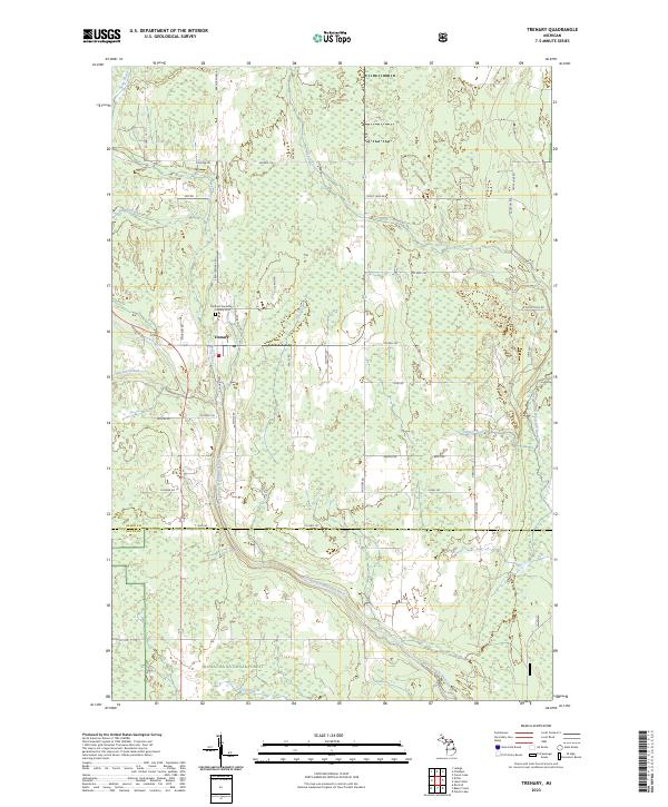 2023 Trenary2023 Print · USGSThe Upper Peninsula community of Trenary is shown here as it appears today, centered at a historic crossroads north of the Hiawatha National Forest. Researchers can trace family names on rural routes and locate the Mathias Township - Trenary Cem and West Branch Whitefish River.
 - 2023 Map of Lake Stella, 2023 Print
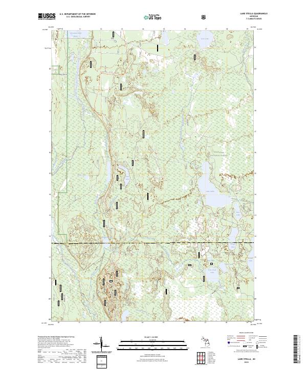 2023 Lake Stella2023 Print · USGSThe Hiawatha National Forest is shown in this recent survey as a vast network of glacial lakes and river systems in Michigan's Upper Peninsula. Researchers can trace the path of the Bay De Noc-Grand Island Trl and locate secluded water bodies like Lake Stella and Saul Lake.
 - 2023 Map of Grand Marais, 2023 Print
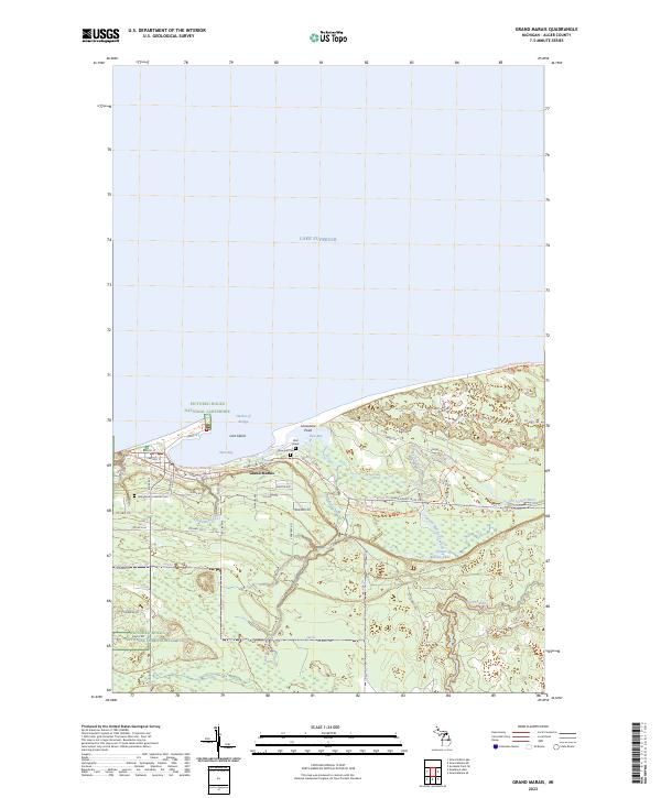 2023 Grand Marais2023 Print · USGSThe Lake Superior coast of Alger County comes alive in this contemporary survey of the Grand Marais area and its surrounding forest lands. Researchers can locate specific local landmarks like Rose Hill Cem, the Bird Grave, and the winding Sucker River valley.
Showing maps 1-25 of 34
Top cities of Alger County
Frequently asked questions
- What are the different types of historical maps available for Alger County?
- What is the oldest map of Alger County?
- Where can I purchase historical maps of Alger County for my home or office?
- Where can I download high-res historical maps of Alger County?
- Are there historical topographic maps available for Alger County?
- Is there historical aerial imagery available for Alger County?
- Where are historical maps of Alger County sourced from?