1900s (20th Century) Maps of Alger County, Michigan
Explore 64 historic maps of Alger County from the 1900s (20th Century). These maps offer a rare glimpse into what life looked like during the 1900s — showing old roads, neighborhoods, homes, and landmarks that have changed or disappeared over time.
Whether you're researching your family's past, planning a metal detecting trip, or studying how Alger County's landscape evolved across the 1900s, these high-resolution maps are a powerful tool for exploring the history of this region.
- Focus on a specific era: All maps on this page are from the 1900s, giving you a focused view of this time period.
- See what’s changed: Compare century-old streets, trails, and buildings to today's modern landscape using overlays and satellite layers.
- Research with precision: Use these maps for genealogy, historical research, land use analysis, or educational projects.
- View, download, or print: Maps are fully viewable online in high resolution, and can be downloaded or printed for your own records.
Start exploring Alger County's history through authentic maps from the 1900s. This is your window into the past.
Alger County, MI maps
(64)- 1931 Map of Shingleton SW
 1931 Shingleton SW1931 Print · USGSThe Upper Peninsula timber and rail landscape at Shingleton comes alive in the early 1930s. Genealogists and historians can trace the intersection of the Duluth South Shore and Atlantic railroad and landmarks like Lilley Lake or Boot Lake.
 - 1931 Map of Shingleton NE
 1931 Shingleton NE1931 Print · USGSThe Alger and Schoolcraft county line in the early 1930s shows a landscape of deep marshes and glacial waters. Trace the path of the L S and Ishpeming railroad or locate the Buck Hill Fire Tower overlooking Spider Lake and the Creighton River.
 - 1931 Map of Skeels Lake NE
 1931 Skeels Lake NE1931 Print · USGSThe Upper Peninsula wilderness of the early thirties is captured here as a labyrinth of glacial waters. Researchers can trace the winding Indian River and locate remote landmarks like Hill Tower, Skeels Lake, and Straits Lake.
 - 1931 Map of Shingleton SE
 1931 Shingleton SE1931 Print · USGSSchoolcraft County in the early 1930s shows a landscape of expansive wetlands being crossed by new industrial infrastructure. Researchers can trace the path of the Duluth South Shore and Atlantic railroad and find localized points like Creighton and Hickey Creek.
 - 1931 Map of Munising SE
 1931 Munising SE1931 Print · USGSThe Michigan Upper Peninsula was a junction of major timber and freight rails in the 1930s. Genealogists and rail historians can trace the paths of the Duluth South Shore and Atlantic and old stops like Evelyn and Doty.
 - 1932 Map of Rock NE
 1932 Rock NE1932 Print · USGSThe timber-heavy border between Alger and Delta Counties comes to life in the early thirties. Trace the legacy of old logging camps and homesteads like Suomi Camp, Gould Homestead, and the Osier Sch along the Chicago and Northwestern rail line.
 - 1932 Map of Skandia SE
 1932 Skandia SE1932 Print · USGSIn the early 1930s, this pocket of the Upper Peninsula was a landscape of managed forests and timber-connected outposts. Genealogists can locate family sites near Dorsey Sch, the community of Sundell, and the remote Fancetts Camp along the river.
 - 1932 Map of Skandia NE
 1932 Skandia NE1932 Print · USGSThe Upper Peninsula coastline near the border of Marquette and Alger counties is captured here in the early 1930s. Trace the path of the Duluth South Shore and Atlantic railroad as it parallels the Sand River and Lake Superior shoreline.
 - 1954 Map of Sault Sainte Marie, 1979 Print
 1954 Sault Sainte Marie1979 Print · USGSThe Eastern Upper Peninsula and Ontario borderlands are captured here at the height of the mid-century era. Family historians can trace settlements like Grand Marais and Stalwart, while mapping the strategic grounds of Kincheloe AFB.3 unique versions available
 - 1956 Map of Sault Sainte Marie, 1964 Print
 1956 Sault Sainte Marie1964 Print · USGSThe Eastern Upper Peninsula and the Canadian border meet in this mid-sixties survey of the bustling Soo Locks region. Genealogists and historians can trace the paths of the Soo Line and locate lakeside communities from Grand Marais to Shelldrake.2 unique versions available
 - 1957 Map of Sault Sainte Marie
 1957 Sault Sainte Marie1957 Print · USGSThe Upper Peninsula and Ontario border come alive in this mid-century portrait of the eastern Lake Superior shoreline and the vital St. Marys River corridor. Genealogists and historians can trace rail-era settlements from Newberry to Detour, while locating military landmarks like Kinross Air Force Base.
 - 1958 Map of Sault Sainte Marie
 1958 Sault Sainte Marie1958 Print · USGSThe eastern Upper Peninsula and the Canadian borderland appear here during the late fifties, a time of military growth and forest management. Researchers can locate vanished rail stops along the Soo Line, early sites like the Fiborn Quarry, and the sprawling Kinross Air Force Base.
 - 1958 Map of Corner Lake, 1959 Print
 1958 Corner Lake1959 Print · USGSIn Michigan's Upper Peninsula during the late fifties, this wilderness terrain was a hub for forestry and seasonal camps within the Hiawatha National Forest. Researchers can locate the settlement of Steuben, trace the Railroad Grade, or identify isolated sites like Camp Twenty-six and the Petoskey Hunting Club.2 unique versions available
 - 1958 Map of Trenary, 1959 Print
 1958 Trenary1959 Print · USGSThe Upper Peninsula landscape around the village of Trenary is shown here during the late fifties, featuring the path of the Minneapolis St Paul and Sault Ste Marie rail line. Researchers can trace remote sites like Osier and Cyr or the network of lakes including Upper Eighteenmile Lake.3 unique versions available
 - 1958 Map of Munising, 1959 Print
 1958 Munising1959 Print · USGSThe Lake Superior shoreline near Munising is captured here in the late fifties, showcasing the area's timber and transport roots. Genealogists and researchers can trace local landmarks like Maple Grove Cem, the Hanely Landing Field, and the rail junction at Coalwood.3 unique versions available
 - 1958 Map of Au Train, 1959 Print
 1958 Au Train1959 Print · USGSCoastal Alger County in the late fifties shows a landscape of timber and rail along the shores of Lake Superior. Genealogists can trace family roots in settlements like Chatham and Traunik, or locate the Pine Grove Cem and Au Train Falls.3 unique versions available
 - 1958 Map of Wood Island, 1959 Print
 1958 Wood Island1959 Print · USGSThe waters off Alger County were still quiet in the late fifties, dominated by the massive profile of Grand Island. Researchers can trace the secluded Echo Lake, the position of the northern Lighthouse, and the untouched shoreline of the Pictured Rocks.3 unique versions available
 - 1958 Map of Laughing Fish Point, 1959 Print
 1958 Laughing Fish Point1959 Print · USGSThe Lake Superior shoreline in the late fifties is defined here by its maritime hazards and vast forest boundaries. Researchers can trace the exact topography of Laughing Fish Point and the mouth of the Laughing Whitefish River within the Hiawatha National Forest.2 unique versions available
 - 1958 Map of Shingleton, 1959 Print
 1958 Shingleton1959 Print · USGSUpper Peninsula timber and rail history come alive in the late fifties across the Alger and Schoolcraft county lines. Trace old transport routes through Shingleton and Creighton, or locate logging era sites like Hartman Camp and the Old Railroad Grade.3 unique versions available
 - 1958 Map of Skandia, 1959 Print
 1958 Skandia1959 Print · USGSThe Lake Superior coast and Michigan's Upper Peninsula timberlands are captured here in the late fifties. Genealogists and local historians can trace family roots at Skandia Cem and Deerton Cem or locate the old Yalmer Station along the historic rail lines.2 unique versions available
 - 1958 Map of Rock, 1959 Print
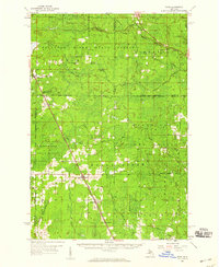 1958 Rock1959 Print · USGSUpper Peninsula timberlands and small rail-side settlements are captured here in the late fifties, just as forest management patterns were maturing. Researchers can trace family roots through locations like Rock, McFarland, and Hillview Cem along the Chicago and Northwestern line.3 unique versions available
 - 1958 Map of Grand Portal Point, 1959 Print
 1958 Grand Portal Point1959 Print · USGSThe Lake Superior shoreline in the late fifties reveals a wilderness of dramatic coastal features and inland lakes. Researchers can trace the drainage of the Mosquito River and locate landmarks like Chapel Rock and the Buck Hill Lookout Tower.2 unique versions available
 - 1958 Map of Marquette, 1968 Print
 1958 Marquette1968 Print · USGSThe Upper Peninsula’s central corridor is captured here in the mid-twentieth century as mining and timber industries thrived alongside new military installations. Genealogists and historians can trace the rail lines of the Soo Line Railroad through settlements like Gwinn, Turin, and Chatham.2 unique versions available
 - 1960 Map of Marquette
 1960 Marquette1960 Print · USGSUpper Peninsula mining and maritime commerce reach their peak in the late fifties across the Lake Superior shoreline. Genealogists and historians can locate remote settlements like Big Bay and Dukes, while tracing the Cyr Mine and the active rail lines of the Lake Superior and Ishpeming railroad.
 - 1961 Map of Marquette
 1961 Marquette1961 Print · USGSUpper Peninsula life in the early sixties centered on the iron docks and timber stands of the Lake Superior shore. Genealogists and historians can trace rail-to-port connections via the Lake Superior and Ishpeming Railroad and locate active sites like Republic Mine or the K.I. Sawyer Air Force Base.
Showing maps 1-25 of 64
Top cities of Alger County
Frequently asked questions
- What are the different types of historical maps available for Alger County?
- What is the oldest map of Alger County?
- Where can I purchase historical maps of Alger County for my home or office?
- Where can I download high-res historical maps of Alger County?
- Are there historical topographic maps available for Alger County?
- Is there historical aerial imagery available for Alger County?
- Where are historical maps of Alger County sourced from?