Old Maps of Covington Township, Michigan for Metal Detecting
Plan your next treasure hunt with 70 historic maps of Covington Township. Find old homesites, ghost towns, trails, and gathering spots that may be lost to time — perfect for identifying promising metal detecting locations.
- Locate forgotten sites: Uncover places like long-lost settlements, abandoned rail lines, or gathering spots.
- Plan better hunts: Use map overlays combined with LiDAR or satellite views to narrow in on historically rich areas.
- Made for detectorists: Thousands of hobbyists use these maps to discover relics, coins, and hidden history.
Use these historic maps to boost your research and find new opportunities beneath the surface of Covington Township.
Covington Township, MI maps
(70)- 1895 Map of Ned Lake
 1895 Ned Lake1895 Print · USGSIron County and Baraga County are captured here during the late nineteenth-century timber and mining era. You can trace the path of the Chicago Milwaukee and St Paul RR as it bypasses the waters of Ned Lake and the Hemlock River.4 unique versions available
 - 1895 Map of Perch Lake
 1895 Perch Lake1895 Print · USGSThe Upper Peninsula wilderness comes into focus in the mid-1890s as railroads began to pierce the deep woods of Iron and Baraga counties. Genealogists and historians can trace early rail routes like the D. S. S. and A. R. R. and remote waters such as Perch Lake and the Net River.3 unique versions available
 - 1954 Map of Perch Lake, 1956 Print
 1954 Perch Lake1956 Print · USGSUpper Peninsula timberlands and glacial lakes are shown here during the mid-fifties at the meeting of Houghton, Baraga, and Iron Counties. Trace the Milwaukee Road rail line through Tunis or locate the Lookout Tower and Snake Rapids.3 unique versions available
 - 1954 Map of Sidnaw, 1956 Print
 1954 Sidnaw1956 Print · USGSUpper Peninsula timber and rail country come to life in this mid-century survey of the Baraga County highlands. Researchers can trace the junction of two major railroads and locate local landmarks like the Covington Cem, Sturgeon Falls, and the Prickett Dam.2 unique versions available
 - 1955 Map of Ned Lake, 1956 Print
 1955 Ned Lake1956 Print · USGSIron County's timberlands and glacial lakes are captured in the mid-fifties, showing a landscape of state forests and rail history. Trace local landmarks like the Triangle Ranch, the Amasa Landing Field, and the Old Railroad Grade.3 unique versions available
 - 1955 Map of Herman, 1956 Print
 1955 Herman1956 Print · USGSUpper Peninsula timberlands and rail corridors are frozen in time here during the mid-1950s. Genealogists and historians can trace the remote settlement of Herman, locate the Herman Cem, and follow the Duluth South Shore and Atlantic railroad past Nestoria.3 unique versions available
 - 1956 Map of Three Lakes, 1957 Print
 1956 Three Lakes1957 Print · USGSThe central Upper Peninsula in the mid-fifties reveals a landscape shaped by timber and ore along the DULUTH SOUTH SHORE AND ATLANTIC line. Trace the history of settlements like Nestoria and the Ohio Mine or locate the Three Lakes Lookout Tower.3 unique versions available
 - 1956 Map of Michigamme, 1957 Print
 1956 Michigamme1957 Print · USGSThe Upper Peninsula's logging and mining heart comes to life in this mid-century portrait of Marquette and Baraga Counties. Traces of industrial history are everywhere, from the Ohio Mine and Railroad Grade to remote camps like Boniface Camp.4 unique versions available
 - 1958 Map of Iron River, 1968 Print
 1958 Iron River1968 Print · USGSThe Upper Peninsula in the late fifties is captured here as a landscape of timber, iron, and rail. Genealogists and historians can trace rail stops like Mass Station or explore the coastlines of Lake Gogebic and Keweenaw Bay.3 unique versions available
 - 1960 Map of Iron River
 1960 Iron River1960 Print · USGSThe Upper Peninsula’s western reaches are shown in the late fifties, featuring the industrial infrastructure of the Copper Country and the vast Ottawa National Forest. Researchers can trace the rail lines of the Milwaukee Road through settlements like Bruce Crossing and the White Pine Mine.
 - 1961 Map of Iron River
 1961 Iron River1961 Print · USGSThe Upper Peninsula and northern Wisconsin are shown here in the early 1960s, a landscape defined by the iron range and vast timberlands. Researchers can trace the legacy of mining and rail transport through Caspian, the Lac Du Flambeau Indian Reservation, and the Milwaukee Road.
 - 1967 Map of Iron River, 1968 Print
 1967 Iron River1968 Print · USGSThe Upper Peninsula and northern Wisconsin borderlands are shown here in the late sixties, a landscape of deep woods and iron-country rail lines. Genealogists and historians can trace the lakeside settlements of L'Anse and Ontonagon or follow the Soo Line through towns like Michigamme and Nestoria.
 - 1985 Map of Drummond Lake, 1986 Print
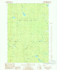 1985 Drummond Lake1986 Print · USGSThe Upper Peninsula forestlands at the Baraga and Iron county line come into focus in the mid-1980s, showing a landscape of timber and isolated homesteads. Researchers can locate the precise coordinates of Fox Farm, Drummond Lake, and the remote Copper Country State Forest.
 - 1985 Map of Sidnaw, 1986 Print
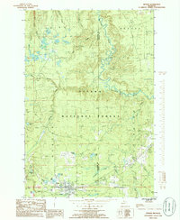 1985 Sidnaw1986 Print · USGSThe community of Sidnaw and the surrounding timberlands of the Ottawa National Forest are captured here in the mid-1980s. Local history researchers can trace the old Sid RR Grade, explore the edges of the L'Anse Indian Reservation, and locate family camps near St George Lake.
 - 1985 Map of Marten Lake, 1986 Print
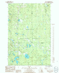 1985 Marten Lake1986 Print · USGSThe Upper Peninsula wilderness near the Houghton and Iron County line is captured here in the mid-1980s. Trace the remote waters of Lake Sainte Kathryn, locate the Roadside Spring by Kunze Lake, and explore the glacial landscape of the Ottawa National Forest.
 - 1985 Map of Ned Lake, 1986 Print
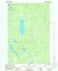 1985 Ned Lake1986 Print · USGSThe Upper Peninsula wilderness at the border of Baraga and Iron counties is documented here in the mid-eighties, centered on the Copper Country State Forest. Naturalists and locals can trace the intricate waterways of Ned Lake, Shank Lake, and the remote Fence River.
 - 1985 Map of Vermilac, 1986 Print
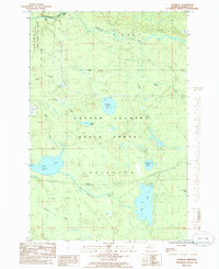 1985 Vermilac1986 Print · USGSBaraga County's interior forest lands are captured in the mid-1980s, showing a landscape defined by water and timber management. Researchers can trace the drainage patterns of Worm Lake and the Sturgeon River or locate the small settlement of Vermilac.
 - 1985 Map of Tunis, 1986 Print
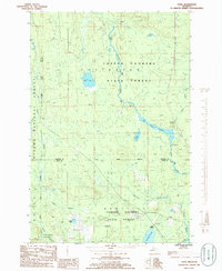 1985 Tunis1986 Print · USGSUpper Peninsula wilderness in the 1980s is captured here as it straddles the Baraga and Iron County lines. Researchers can trace remote forest outposts like Tunis and Park Siding among the extensive wetlands of Net River Flooding.
 - 1985 Map of Nestoria, 1986 Print
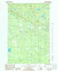 1985 Nestoria1986 Print · USGSIn the mid-eighties, this portion of Baraga County remained a quiet expanse of the Copper Country State Forest centered on the junction at Nestoria. Researchers can map the intricate water systems of the Sturgeon River, locate local landmarks like Tioga Falls, and trace the path of the Pelkie road.
 - 1985 Map of Covington, 1986 Print
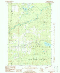 1985 Covington1986 Print · USGSThe Baraga County timberlands near Covington and Watton are captured here in the mid-1980s. Local researchers can trace river networks from Tibbetts Falls to Worm Lake or locate specific landmarks like the local Cem and Ski Lift.
 - 1989 Map of Iron River, 1990 Print
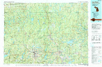 1989 Iron River1990 Print · USGSUpper Peninsula mining and timber lands are documented here in the late 1980s, showcasing the region's industrial and natural interface. Researchers can trace the iron heritage through the Monongahela Mine and local junctions like Kelso Junction and Amasa.
 - 1991 Map of L'Anse
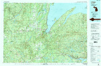 1991 L'Anse1991 Print · USGSUpper Peninsula life in the early nineties centered on the waters of Keweenaw Bay and the timber-rich highlands of the Huron Mountains. Genealogists and researchers can trace the rail-and-road connections between L'Anse, Baraga, and smaller communities like Pequaming and Assinins.2 unique versions available
 - 1999 Map of Covington, 2004 Print
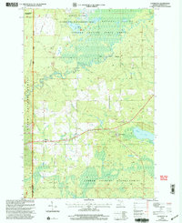 1999 Covington2004 Print · USGSCovington and Watton are documented here in the late twentieth century as the surrounding state and national forests underwent management revisions. Researchers can trace the path of the North Country National Scenic Trail and locate local landmarks like Worm Lake and Tibbetts Falls.
 - 1999 Map of Marten Lake, 2004 Print
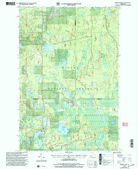 1999 Marten Lake2004 Print · USGSThe northern Michigan wilderness at the close of the century is defined here by the dense lake-and-forest terrain of the Ottawa National Forest. Researchers can trace the winding Sidnaw Interpretive Trail or locate remote water bodies like Lake Sainte Kathryn and Hager Lake.
 - 1999 Map of Sidnaw, 2004 Print
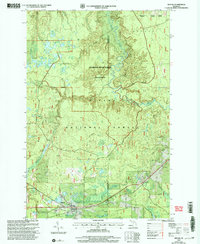 1999 Sidnaw2004 Print · USGSThe Upper Peninsula village of Sidnaw is shown at the close of the twentieth century, surrounded by the deep woods of the Ottawa National Forest. Researchers can locate the local Cem, the Prickett Grooms Landing Strip, and the remote Sturgeon River Gorge Wilderness.
Showing maps 1-25 of 70
Top cities near Covington Township
Top neighborhoods of Covington Township
- Nestoria historical maps
- Watton historical maps
- Tioga historical maps
- Vermilac historical maps
- Tunis historical maps
- Covington historical maps
Frequently asked questions
- What are the different types of historical maps available for Covington Township?
- What is the oldest map of Covington Township?
- Where can I purchase historical maps of Covington Township for my home or office?
- Where can I download high-res historical maps of Covington Township?
- Are there historical topographic maps available for Covington Township?
- Is there historical aerial imagery available for Covington Township?
- Where are historical maps of Covington Township sourced from?