Old Maps of Assyria Township, Michigan
Explore 36 old maps of Assyria Township, spanning from 1918 to today. These high-resolution historic maps reveal how streets, neighborhoods, landmarks, and natural features evolved over time — perfect for genealogy, metal detecting, research, and local history exploration.
What you can do with these maps:
- See how Assyria Township changed over time: Compare historical maps to modern-day views to trace roads, homesites, rail lines & more.
- View detailed metadata: Each map includes creators, publishers, year, scale, and archive source.
- Overlay maps with satellite & LiDAR: Visualize the past alongside modern tools to explore terrain & human change.
- Trusted historical sources: Maps sourced from the USGS, Library of Congress, and other archives.
- Access maps your way: View online, download high-res files, or order prints for personal or research use.
Start exploring old maps of Assyria Township to uncover forgotten places, hidden landmarks, and the deep history beneath your feet.
Assyria Township, MI maps
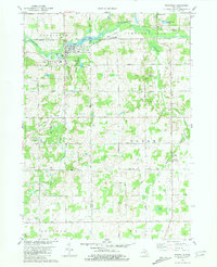
(36)- 1918 Map of Battle Creek
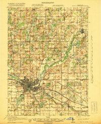 1918 Battle Creek1918 Print · USGSThe Battle Creek area thrived as a rail and industrial hub during the First World War. Genealogists can trace family footprints across rural schoolhouses like Little Brick School and settlements like Ceresco or Bellevue.4 unique versions available
 - 1943 Map of Battle Creek
 1943 Battle Creek1943 Print · USGSBattle Creek and the surrounding Calhoun County countryside are shown during the early years of the Second World War. Genealogists and local historians can locate dozens of country schoolhouses like Cobblestone Sch and trace the Grand Trunk Railway through Bellevue and Ceresco.
 - 1947 Map of Bellevue, 1955 Print
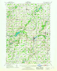
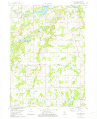
 1947 Bellevue1955 Print · USGSThe town of Bellevue and its surrounding townships are shown here just after the war, centered on the railroad and river. Genealogists can trace family landmarks like Follett Cem, Base Line Ch, and several district schools.
 - 1947 Map of Bedford, 1955 Print
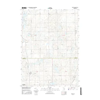
 1947 Bedford1955 Print · USGSThe border of Barry and Calhoun counties in the late 1940s shows a landscape of small lakefront settlements and rural schoolhouses. Genealogists can trace family footprints through sites like Bethel Chapel, Ellis Cem, and the unique Checkered Sch.
 - 1950 Map of Battle Creek
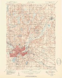 1950 Battle Creek1950 Print · USGSBattle Creek and its surrounding townships thrive in the early post-war years as a vital hub of Michigan industry and aviation. Genealogists and historians can trace family roots through numerous country schools like Cobblestone Sch and cemeteries such as Oak Hill Cem.3 unique versions available
 - 1950 Map of Nashville, 1967 Print
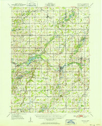
 1950 Nashville1967 Print · USGSThe Thornapple River valley in the mid-twentieth century shows a landscape of rail-connected villages and rural school districts. Genealogists can locate family landmarks like Woodlawn Cem, McKelvey Sch, and the New York Central rail line.
 - 1951 Map of Nashville
 1951 Nashville1951 Print · USGSThe rural landscape of Barry and Eaton Counties in the early 1950s reveals a dense network of family-named landmarks and country schools. Genealogists can trace local roots through numerous sites like Woodland Cem, Quail Trap Sch, and the settlement of Coats Grove.2 unique versions available
 - 1958 Map of Grand Rapids, 1973 Print
 1958 Grand Rapids1973 Print · USGSSouthern Michigan at the peak of the postwar era shows a landscape of burgeoning cities and new interstate highways. Trace family roots and regional growth in Grand Rapids, Battle Creek, and the glacial lake country around Gun Lake or Gull Lake.2 unique versions available
 - 1961 Map of Grand Rapids
 1961 Grand Rapids1961 Print · USGSSouthern Michigan at the dawn of the 1960s reveals a region shaped by major river systems and a robust rail network. Trace mid-century industrial growth and land use from Grand Rapids to the Fort Custer Military Reservation and Gun Lake.
 - 1961 Map of Bellevue, 1962 Print
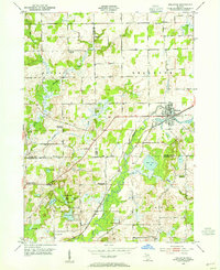
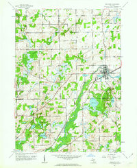 1961 Bellevue1962 Print · USGSThe village of Bellevue and the surrounding township borders are captured here in the early sixties as a bustling rail-and-river crossroads. Genealogists and local historians can trace rural family landmarks like the Base Line Ch, Bell Cem, and the old Boughton Sch.3 unique versions available
 - 1961 Map of Bedford, 1962 Print
 1961 Bedford1962 Print · USGSThe Barry and Calhoun county line in the early sixties shows a rural Michigan landscape defined by its glacial lakes and one-room schoolhouses. Genealogists can trace family roots at Bedford Cemetery or locate long-standing rural institutions like Bethel Chapel and Monroe Sch.4 unique versions available
 - 1962 Map of Grand Rapids
 1962 Grand Rapids1962 Print · USGSMid-century Southern Michigan is mapped here at a time of massive growth, showing the expanding urban footprints of Grand Rapids and Lansing. Researchers can trace the legacy of the Grand Trunk Western RR, find historic boundaries of the Fort Custer Military Reservation, or locate sporting camps around Gun Lake.2 unique versions available
 - 1981 Map of Nashville
 1981 Nashville1981 Print · USGSThe village of Nashville and the high banks of the Thornapple River are captured here in the late seventies. Researchers can locate family landmarks such as Maple Grove Ch, Quaker Cem, and the historic Fuller Sch.
 - 1981 Map of Maple Grove
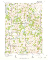
 1981 Maple Grove1981 Print · USGSBarry County in the early eighties shows a landscape of river-fed townships and tight-knit rural communities. Researchers can locate family landmarks like the Maple Leaf Grange Hall, Union Cem, and the old settlement at Quimby.
 - 1982 Map of Kalamazoo, 1983 Print
 1982 Kalamazoo1983 Print · USGSThe Kalamazoo River valley in the early eighties shows a landscape of growing suburban centers and heavy rail infrastructure. Genealogists and researchers can trace the limits of Kalamazoo and Battle Creek or locate landmarks like Fort Custer National Cemetery and Gull Lake.
 - 1984 Map of Grand Rapids
 1984 Grand Rapids1984 Print · USGSWest Michigan in the mid-eighties shows a thriving metropolitan core surrounded by expansive state recreation areas and river valleys. Genealogists and local historians can trace developments around Grand Rapids, institutional landmarks like Grand Rapids Bible College, and the quiet reaches of Jordan Lake.
 - 2011 Map of Bellevue, 2011 Print
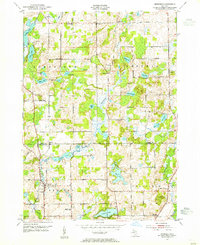
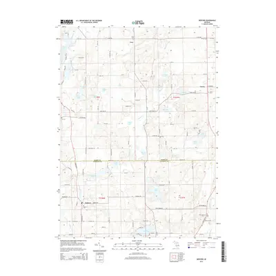
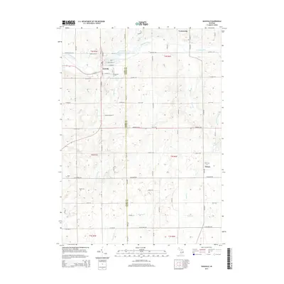
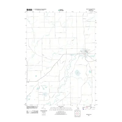 2011 Bellevue2011 Print · USGSCovers Assyria Township, including Bellevue, Bellevue Township, and other nearby areas
 - 2011 Map of Nashville, 2011 Print
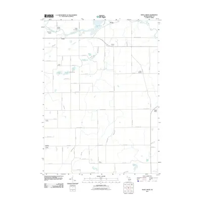
 2011 Nashville2011 Print · USGSCovers Assyria Township, including Kalamo, Nashville, and other nearby areas
 - 2011 Map of Bedford, 2011 Print
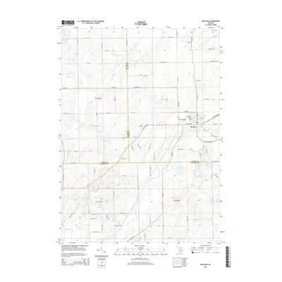
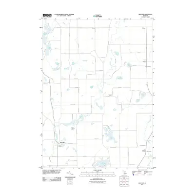 2011 Bedford2011 Print · USGSCovers Assyria Township, including Assyria, Johnstown Township, and other nearby areas
 - 2011 Map of Maple Grove, 2011 Print
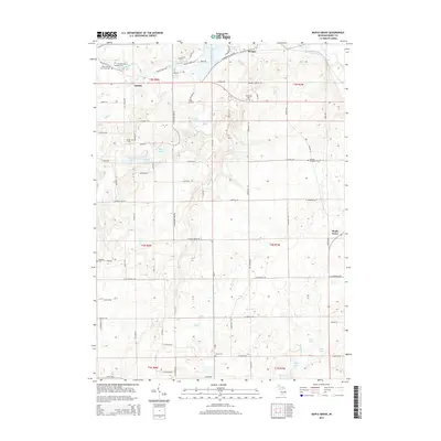
 2011 Maple Grove2011 Print · USGSCovers Assyria Township, including Baltimore Township, Johnstown Township, and other nearby areas
 - 2014 Map of Maple Grove, 2014 Print
 2014 Maple Grove2014 Print · USGSCovers Assyria Township, including Baltimore Township, Johnstown Township, and other nearby areas
 - 2014 Map of Bedford, 2014 Print
 2014 Bedford2014 Print · USGSCovers Assyria Township, including Assyria, Johnstown Township, and other nearby areas
 - 2014 Map of Nashville, 2014 Print
 2014 Nashville2014 Print · USGSCovers Assyria Township, including Kalamo, Nashville, and other nearby areas
 - 2014 Map of Bellevue, 2014 Print
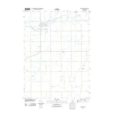
 2014 Bellevue2014 Print · USGSCovers Assyria Township, including Bellevue, Bellevue Township, and other nearby areas
 - 2017 Map of Bedford, 2017 Print
 2017 Bedford2017 Print · USGSCovers Assyria Township, including Assyria, Johnstown Township, and other nearby areas
Showing maps 1-25 of 36
Top cities near Assyria Township
- Battle Creek historical maps
- Marshall historical maps
- Hastings historical maps
- Springfield historical maps
- Assyria historical maps
- Chester historical maps
See more
Top neighborhoods of Assyria Township
Frequently asked questions
- What are the different types of historical maps available for Assyria Township?
- What is the oldest map of Assyria Township?
- Where can I purchase historical maps of Assyria Township for my home or office?
- Where can I download high-res historical maps of Assyria Township?
- Are there historical topographic maps available for Assyria Township?
- Is there historical aerial imagery available for Assyria Township?
- Where are historical maps of Assyria Township sourced from?