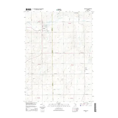
2014 Map of Nashville
USGS Topo · Published 2014About this map
The Thornapple River winds through the northern portion of this landscape, passing through Nashville and feeding the Mill Pond. This area on the Barry Co Eaton Co line is defined by its agricultural grid and dispersed rural settlements like Kalamo and the southern edge of Vermontville. For genealogists, the map is particularly useful for locating several distinct burial grounds, including the Nashville Cem and the smaller Quaker Cem near Quaker Brook. The drainage patterns are intricate, with Wanadoga Cr and Hayon Cr cutting through the farmland, illustrating the local water network that historically supported the region's development between these township centers.
Find a feature on this map
66 named features on this map. Tap any name to fly to it.
Don’t see what you’re looking for? This feature index may not catch every label — zoom into the map to look around manually.
Map Details
Editions of this 2014 Nashville Map
This is the sole edition of this map. No revisions or reprints were ever made.
Other maps of this area

1918 · Battle Creek
USGS Topo · 1:62,500

1921 · Marshall
USGS Topo · 1:62,500

1923 · Marshall
USGS Topo · 1:62,500

1943 · Battle Creek
USGS Topo · 1:62,500

1943 · Marshall
USGS Topo · 1:62,500

1947 · Bellevue
USGS Topo · 1:24,000

1947 · Bedford
USGS Topo · 1:24,000

1949 · Charlotte
USGS Topo · 1:62,500

1950 · Battle Creek
USGS Topo · 1:62,500

1950 · Nashville
USGS Topo · 1:62,500