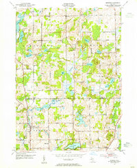
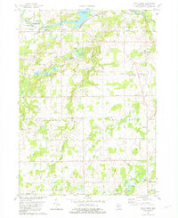
1947 Map of Bedford
USGS Topo · Published 1955About this map
The borderlands of Barry and Calhoun counties in the late 1940s are defined by a dense network of rural schoolhouses and small glacial lakes. This topography reflects a landscape of dispersed agricultural communities, where social life revolved around local landmarks like Bethel Chapel and numerous namesake schools such as Checkered Sch, Poorman Sch, and Eagle Sch. The terrain is characterized by a complex drainage system including Wabascon Creek and Spring Brook, which feed into the numerous basins that dot the townships of Johnstown, Assyria, Bedford, and Pennfield.
Find a feature on this map
46 named features on this map. Tap any name to fly to it.
Don’t see what you’re looking for? This feature index may not catch every label — zoom into the map to look around manually.
Map Details
Editions of this 1947 Bedford Map
This is the sole edition of this map. No revisions or reprints were ever made.
Historical Maps of Assyria Through Time
26 maps found
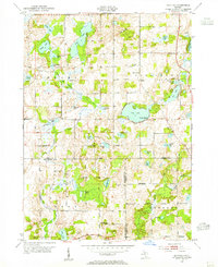
1947 Banfield
Barry County, MI
1947 Bedford
Barry County, MI
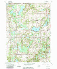
1961 Banfield
Barry County, MI
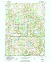
1961 Bedford
Barry County, MI
1981 Maple Grove
Barry County, MI
1982 Cloverdale
Barry County, MI
2011 Banfield
Barry County, MI
2011 Bedford
Barry County, MI
2011 Cloverdale
Barry County, MI
2011 Maple Grove
Barry County, MI
2014 Banfield
Barry County, MI
2014 Bedford
Barry County, MI
2014 Cloverdale
Barry County, MI
2014 Maple Grove
Barry County, MI
2017 Banfield
Barry County, MI
2017 Bedford
Barry County, MI
2017 Cloverdale
Barry County, MI
2017 Maple Grove
Barry County, MI
2019 Banfield
Barry County, MI
2019 Bedford
Barry County, MI
2019 Cloverdale
Barry County, MI
2019 Maple Grove
Barry County, MI
2023 Banfield
Barry County, MI
2023 Bedford
Barry County, MI
2023 Cloverdale
Barry County, MI
2023 Maple Grove
Barry County, MI
Featured Locations
- Assyria Township, MI
- Johnstown Township, MI
- Pennfield Charter Township, MI
- Bedford, Bedford Charter Township
- Assyria, Assyria Township