1920s Maps of Royalton Township, Michigan
Explore 2 historic maps of Royalton Township from the 1920s. These maps offer a rare glimpse into what life looked like during the 1920s — showing old roads, neighborhoods, homes, and landmarks that have changed or disappeared over time.
Whether you're researching your family's past, planning a metal detecting trip, or studying how Royalton Township's landscape evolved across the 1920s, these high-resolution maps are a powerful tool for exploring the history of this region.
- Focus on a specific era: All maps on this page are from the 1920s, giving you a focused view of this time period.
- See what’s changed: Compare century-old streets, trails, and buildings to today's modern landscape using overlays and satellite layers.
- Research with precision: Use these maps for genealogy, historical research, land use analysis, or educational projects.
- View, download, or print: Maps are fully viewable online in high resolution, and can be downloaded or printed for your own records.
Start exploring Royalton Township's history through authentic maps from the 1920s. This is your window into the past.
Royalton Township, MI maps
(2)- 1927 Map of Niles
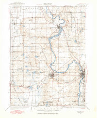 1927 Niles1927 Print · USGSBerrien County and the Michigan-Indiana borderlands are captured here during the late 1920s, showing a landscape of river-powered towns and rural school districts. Genealogists can trace family roots through dozens of local landmarks like Ruggles Cem, Salem Ch, and Emmanuel Missionary College.
 - 1927 Map of Benton Harbor, 1964 Print
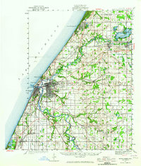 1927 Benton Harbor1964 Print · USGSBenton Harbor and St. Joseph dominate the Lake Michigan shoreline in this late 1920s survey of Berrien County commerce and transit. Genealogists can locate dozens of rural schoolhouses like Bacon Sch and Hull Sch alongside local landmarks like the House of David.
End of results
Showing maps 1-2 of 2
Top cities near Royalton Township
- Niles historical maps
- Benton Harbor historical maps
- Saint Joseph historical maps
- Fair Plain historical maps
- Buchanan historical maps
- Benton Heights historical maps
See more
Top neighborhoods of Royalton Township
Frequently asked questions
- What are the different types of historical maps available for Royalton Township?
- What is the oldest map of Royalton Township?
- Where can I purchase historical maps of Royalton Township for my home or office?
- Where can I download high-res historical maps of Royalton Township?
- Are there historical topographic maps available for Royalton Township?
- Is there historical aerial imagery available for Royalton Township?
- Where are historical maps of Royalton Township sourced from?