Old Maps of Pennfield Charter Township, Michigan for Academic Research
Study the evolution of Pennfield Charter Township with 35 high-resolution historic maps. Whether you're teaching, researching, or modeling changes in land use, these maps provide essential visual documentation of urban, environmental, and geographic change.
- Analyze long-term change: Track patterns in development, transportation, and natural features.
- Ideal for environmental or urban studies: Support academic projects with primary historical map data.
- Use in the classroom or lab: Educators and researchers rely on these maps to bring historical context to life.
These maps are a powerful tool for teaching, research, and visualizing how Pennfield Charter Township has changed over the decades.
Pennfield Charter Township, MI maps
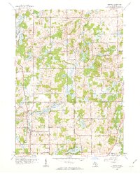
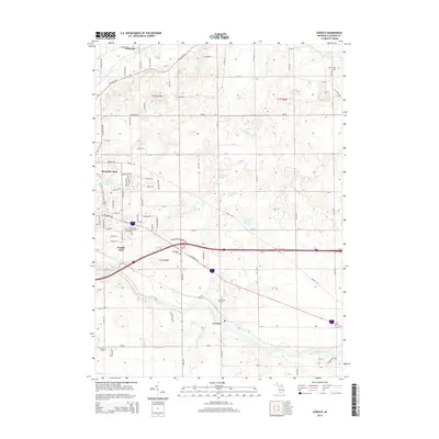
(35)- 1918 Map of Battle Creek
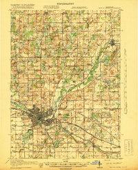 1918 Battle Creek1918 Print · USGSThe Battle Creek area thrived as a rail and industrial hub during the First World War. Genealogists can trace family footprints across rural schoolhouses like Little Brick School and settlements like Ceresco or Bellevue.4 unique versions available
 - 1943 Map of Battle Creek
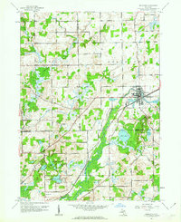
 1943 Battle Creek1943 Print · USGSBattle Creek and the surrounding Calhoun County countryside are shown during the early years of the Second World War. Genealogists and local historians can locate dozens of country schoolhouses like Cobblestone Sch and trace the Grand Trunk Railway through Bellevue and Ceresco.
 - 1947 Map of Bellevue, 1955 Print
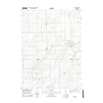
 1947 Bellevue1955 Print · USGSThe town of Bellevue and its surrounding townships are shown here just after the war, centered on the railroad and river. Genealogists can trace family landmarks like Follett Cem, Base Line Ch, and several district schools.
 - 1947 Map of Bedford, 1955 Print
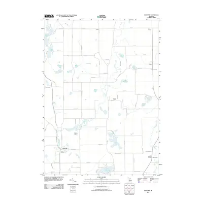
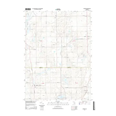
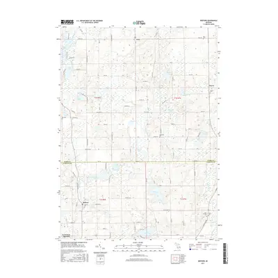
 1947 Bedford1955 Print · USGSThe border of Barry and Calhoun counties in the late 1940s shows a landscape of small lakefront settlements and rural schoolhouses. Genealogists can trace family footprints through sites like Bethel Chapel, Ellis Cem, and the unique Checkered Sch.
 - 1947 Map of Ceresco, 1955 Print
 1947 Ceresco1955 Print · USGSCalhoun County, Michigan, is captured here in the years following World War II, showing a landscape of small river towns and family farms. Researchers can trace dozens of rural schoolhouses and historic burial grounds like Cobblestone Sch and Ceresco Cem along the Kalamazoo River.
 - 1947 Map of Battle Creek, 1955 Print
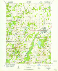
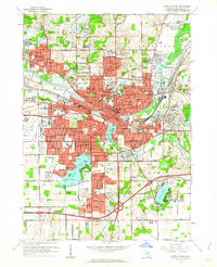
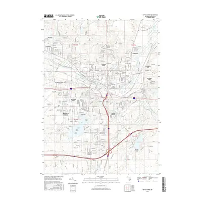
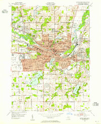 1947 Battle Creek1955 Print · USGSBattle Creek and its surrounding townships thrive in this mid-century survey as a hub of industry, medicine, and education. Genealogists can trace family footprints across dozens of local landmarks like Holy Star Cem, School No 2, and the Sanitarium.
 - 1950 Map of Battle Creek
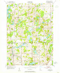
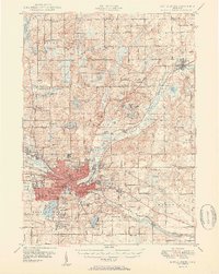 1950 Battle Creek1950 Print · USGSBattle Creek and its surrounding townships thrive in the early post-war years as a vital hub of Michigan industry and aviation. Genealogists and historians can trace family roots through numerous country schools like Cobblestone Sch and cemeteries such as Oak Hill Cem.3 unique versions available
 - 1958 Map of Grand Rapids, 1973 Print
 1958 Grand Rapids1973 Print · USGSSouthern Michigan at the peak of the postwar era shows a landscape of burgeoning cities and new interstate highways. Trace family roots and regional growth in Grand Rapids, Battle Creek, and the glacial lake country around Gun Lake or Gull Lake.2 unique versions available
 - 1961 Map of Grand Rapids
 1961 Grand Rapids1961 Print · USGSSouthern Michigan at the dawn of the 1960s reveals a region shaped by major river systems and a robust rail network. Trace mid-century industrial growth and land use from Grand Rapids to the Fort Custer Military Reservation and Gun Lake.
 - 1961 Map of Bellevue, 1962 Print
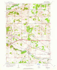
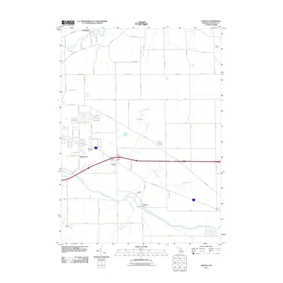
 1961 Bellevue1962 Print · USGSThe village of Bellevue and the surrounding township borders are captured here in the early sixties as a bustling rail-and-river crossroads. Genealogists and local historians can trace rural family landmarks like the Base Line Ch, Bell Cem, and the old Boughton Sch.3 unique versions available
 - 1961 Map of Ceresco, 1962 Print
 1961 Ceresco1962 Print · USGSCalhoun County's river-and-rail corridor is documented here in the early sixties, showing the transition from rural townships to growing residential pockets. Researchers can trace local heritage at Ceresco, Red Brick Sch, and several old burial grounds like Austin Cem.3 unique versions available
 - 1961 Map of Bedford, 1962 Print
 1961 Bedford1962 Print · USGSThe Barry and Calhoun county line in the early sixties shows a rural Michigan landscape defined by its glacial lakes and one-room schoolhouses. Genealogists can trace family roots at Bedford Cemetery or locate long-standing rural institutions like Bethel Chapel and Monroe Sch.4 unique versions available
 - 1961 Map of Battle Creek, 1962 Print
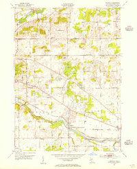
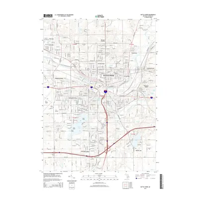
 1961 Battle Creek1962 Print · USGSBattle Creek and its burgeoning suburbs are caught in a moment of significant mid-century growth. Genealogists and researchers can trace local institutions and family-named landmarks like Oak Hill Cemetery, Kimball Sanatorium, and Beadle Lake Sch.3 unique versions available
 - 1962 Map of Grand Rapids
 1962 Grand Rapids1962 Print · USGSMid-century Southern Michigan is mapped here at a time of massive growth, showing the expanding urban footprints of Grand Rapids and Lansing. Researchers can trace the legacy of the Grand Trunk Western RR, find historic boundaries of the Fort Custer Military Reservation, or locate sporting camps around Gun Lake.2 unique versions available
 - 1982 Map of Kalamazoo, 1983 Print
 1982 Kalamazoo1983 Print · USGSThe Kalamazoo River valley in the early eighties shows a landscape of growing suburban centers and heavy rail infrastructure. Genealogists and researchers can trace the limits of Kalamazoo and Battle Creek or locate landmarks like Fort Custer National Cemetery and Gull Lake.
 - 2011 Map of Bellevue, 2011 Print
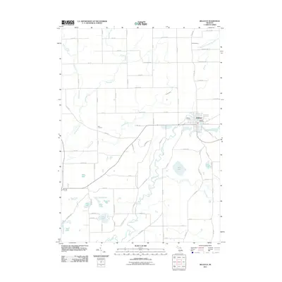 2011 Bellevue2011 Print · USGSCovers Pennfield Charter Township, including Bellevue, Assyria Township, and other nearby areas
 - 2011 Map of Battle Creek, 2011 Print
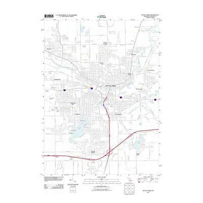 2011 Battle Creek2011 Print · USGSCovers Pennfield Charter Township, including Battle Creek, Springfield, and other nearby areas
 - 2011 Map of Bedford, 2011 Print
 2011 Bedford2011 Print · USGSCovers Pennfield Charter Township, including Assyria, Johnstown Township, and other nearby areas
 - 2011 Map of Ceresco, 2011 Print
 2011 Ceresco2011 Print · USGSCovers Pennfield Charter Township, including Emmett Charter Township, Wattles Park, and other nearby areas
 - 2014 Map of Battle Creek, 2014 Print
 2014 Battle Creek2014 Print · USGSCovers Pennfield Charter Township, including Battle Creek, Springfield, and other nearby areas
 - 2014 Map of Bedford, 2014 Print
 2014 Bedford2014 Print · USGSCovers Pennfield Charter Township, including Assyria, Johnstown Township, and other nearby areas
 - 2014 Map of Ceresco, 2014 Print
 2014 Ceresco2014 Print · USGSCovers Pennfield Charter Township, including Emmett Charter Township, Wattles Park, and other nearby areas
 - 2014 Map of Bellevue, 2014 Print
 2014 Bellevue2014 Print · USGSCovers Pennfield Charter Township, including Bellevue, Assyria Township, and other nearby areas
 - 2017 Map of Battle Creek, 2017 Print
 2017 Battle Creek2017 Print · USGSCovers Pennfield Charter Township, including Battle Creek, Springfield, and other nearby areas
 - 2017 Map of Bedford, 2017 Print
 2017 Bedford2017 Print · USGSCovers Pennfield Charter Township, including Assyria, Johnstown Township, and other nearby areas
Showing maps 1-25 of 35
Top cities near Pennfield Charter Township
- Battle Creek historical maps
- Marshall historical maps
- Springfield historical maps
- Assyria historical maps
- Kalamo historical maps
- Olivet historical maps
See more
Top neighborhoods of Pennfield Charter Township
Frequently asked questions
- What are the different types of historical maps available for Pennfield Charter Township?
- What is the oldest map of Pennfield Charter Township?
- Where can I purchase historical maps of Pennfield Charter Township for my home or office?
- Where can I download high-res historical maps of Pennfield Charter Township?
- Are there historical topographic maps available for Pennfield Charter Township?
- Is there historical aerial imagery available for Pennfield Charter Township?
- Where are historical maps of Pennfield Charter Township sourced from?