1950s Maps of Charlevoix County, Michigan
Explore 11 historic maps of Charlevoix County from the 1950s. These maps offer a rare glimpse into what life looked like during the 1950s — showing old roads, neighborhoods, homes, and landmarks that have changed or disappeared over time.
Whether you're researching your family's past, planning a metal detecting trip, or studying how Charlevoix County's landscape evolved across the 1950s, these high-resolution maps are a powerful tool for exploring the history of this region.
- Focus on a specific era: All maps on this page are from the 1950s, giving you a focused view of this time period.
- See what’s changed: Compare century-old streets, trails, and buildings to today's modern landscape using overlays and satellite layers.
- Research with precision: Use these maps for genealogy, historical research, land use analysis, or educational projects.
- View, download, or print: Maps are fully viewable online in high resolution, and can be downloaded or printed for your own records.
Start exploring Charlevoix County's history through authentic maps from the 1950s. This is your window into the past.
Charlevoix County, MI maps
(11)- 1954 Map of Gaylord
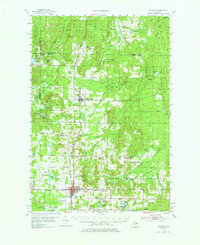 1954 Gaylord1954 Print · USGSOtsego County's transition into a modern recreational and transit hub is evident in the mid-fifties, centered on the growing community of Gaylord. Genealogists and historians can locate several legacy sites, from Vanderbilt Cem to numerous rural schools like McCoy Sch.3 unique versions available
 - 1954 Map of Central Lake, 1955 Print
 1954 Central Lake1955 Print · USGSNorthern Antrim County in the mid-fifties is defined by the winding shores of Torch Lake and the inland Chain of Lakes. Local historians can trace the foundations of Central Lake and rural landmarks like the Greenwood Grange Sch or Antrim Cem.2 unique versions available
 - 1954 Map of Charlevoix, 1955 Print
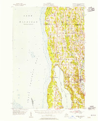
 1954 Charlevoix1955 Print · USGSThe Lake Michigan shoreline at Charlevoix is captured here in the mid-fifties, showing the vital connection between Round L and the open lake. Genealogists and historians can trace the Chesapeake and Ohio rail line, Brookside Cem, and the old settlement of Barnard.3 unique versions available
 - 1955 Map of Hog Island, 1958 Print
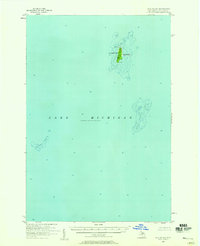
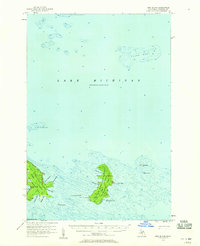 1955 Hog Island1958 Print · USGSThe Beaver Island archipelago in the mid-1950s reveals a wilderness of state forests and hazardous reefs. Maritime researchers can trace the shorelines of Hog Island and Garden Island or locate remote outcrops like Hat Island and Shoe Island.2 unique versions available
 - 1955 Map of Gull Island, 1959 Print
 1955 Gull Island1959 Print · USGSGull Island and its surrounding waters are captured in detail during the mid-1950s. Maritime researchers can trace underwater topography and navigational aids such as the Light and the dangerous shoals of Gull Island Reef and Boulder Reef.2 unique versions available
 - 1955 Map of Cheboygan, 1964 Print
 1955 Cheboygan1964 Print · USGSNorthern Michigan in the mid-fifties is a landscape of dense timber and deep water, showing the region just as the road network began to modernize. Trace family roots in lakeside towns like St Ignace and Petoskey, or follow the historic tracks of the Pennsylvania RR and New York Central RR.5 unique versions available
 - 1956 Map of Beaver Island, 1959 Print
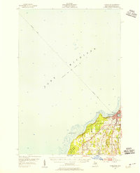
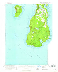 1956 Beaver Island1959 Print · USGSBeaver Island and High Island appear here in the mid-1950s, showing the isolated fishing and timber communities of Lake Michigan. Genealogists can trace the rural landscape of St James and locate the Holy Cross Ch and Roseville Sch (Abandoned).2 unique versions available
 - 1957 Map of Wolverine, 1958 Print
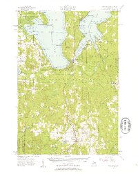 1957 Wolverine1958 Print · USGSNorthern Michigan's lake country is captured here during the late fifties, showing the rail-and-river geography of the Cheboygan area. Genealogists and historians can trace old community centers like Indian River, the Ohioville Sch, and the Wolverine Lookout Tower.3 unique versions available
 - 1958 Map of Cheboygan
 1958 Cheboygan1958 Print · USGSThe tip of Michigan's Lower Peninsula and the surrounding Great Lakes islands are shown here in the late fifties, during the peak of the rail-and-ferry era. Trace the paths of the Pennsylvania RR and explore lakeside settlements like St James, Petoskey, and Indian River.2 unique versions available
 - 1958 Map of Bayshore, 1959 Print
 1958 Bayshore1959 Print · USGSCoastal life in the late fifties centered on the waters of Little Traverse Bay and Lake Charlevoix. Researchers can trace old family sites at Undine Cem, visit the Greensky Ch, or locate the Drive-in Theater and Quarry near Bayshore.2 unique versions available
 - 1958 Map of Petoskey, 1959 Print
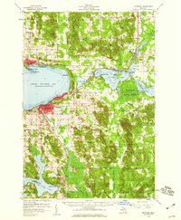 1958 Petoskey1959 Print · USGSCoastal Emmet County in the late fifties is captured here through its growing resort towns and inland forest tracts. Researchers can trace the legacy of local families through landmarks like Patons Corner, Morford Sch, and Curtis Cem.4 unique versions available
End of results
Showing maps 1-11 of 11
Top cities of Charlevoix County
Frequently asked questions
- What are the different types of historical maps available for Charlevoix County?
- What is the oldest map of Charlevoix County?
- Where can I purchase historical maps of Charlevoix County for my home or office?
- Where can I download high-res historical maps of Charlevoix County?
- Are there historical topographic maps available for Charlevoix County?
- Is there historical aerial imagery available for Charlevoix County?
- Where are historical maps of Charlevoix County sourced from?