1980s Maps of Saint James Township, Michigan
Explore 7 historic maps of Saint James Township from the 1980s. These maps offer a rare glimpse into what life looked like during the 1980s — showing old roads, neighborhoods, homes, and landmarks that have changed or disappeared over time.
Whether you're researching your family's past, planning a metal detecting trip, or studying how Saint James Township's landscape evolved across the 1980s, these high-resolution maps are a powerful tool for exploring the history of this region.
- Focus on a specific era: All maps on this page are from the 1980s, giving you a focused view of this time period.
- See what’s changed: Compare century-old streets, trails, and buildings to today's modern landscape using overlays and satellite layers.
- Research with precision: Use these maps for genealogy, historical research, land use analysis, or educational projects.
- View, download, or print: Maps are fully viewable online in high resolution, and can be downloaded or printed for your own records.
Start exploring Saint James Township's history through authentic maps from the 1980s. This is your window into the past.
Saint James Township, MI maps
(7)- 1980 Map of Garden Island West, 1981 Print
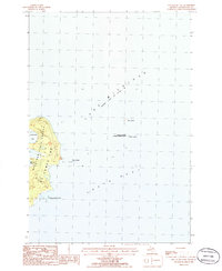
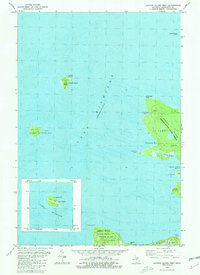 1980 Garden Island West1981 Print · USGSGarden Island and the northern reaches of Beaver Island are captured in the early 1980s, documenting a remote archipelago before modern development. Researchers can find old island settlements like Garden and Graves, or locate heritage sites such as Indian Cem and the Abandoned Lighthouse on Squaw Island.
 - 1984 Map of Beaver Island, 1985 Print
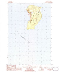
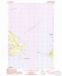
 1984 Beaver Island1985 Print · USGSBeaver Island and the surrounding archipelago are shown in the mid-eighties before modern developments changed these remote coastal landscapes. Researchers can trace the layout of island settlements like St James or mainland hamlets such as Good Hart and Middle Village.2 unique versions available
 - 1986 Map of High Island
 1986 High Island1986 Print · USGSHigh Island sits in northern Lake Michigan during the mid-1980s, primarily managed as a wilderness forest. Researchers can trace the shoreline of High Island Bay, the secluded Lake Maria, and the boundaries of the Mackinaw State Forest.
 - 1986 Map of Gull Island
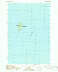 1986 Gull Island1986 Print · USGSGull Island and its surrounding reef system are charted here during the mid-1980s as part of a remote island chain. Researchers can trace the navigation points and wildlife boundaries of the Michigan Islands National Wildlife Refuge and the Light at the island's north end.
 - 1986 Map of Beaver Island North
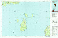
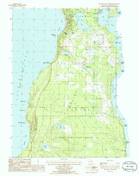 1986 Beaver Island North1986 Print · USGSNorthern Beaver Island in the mid-1980s shows a landscape defined by maritime heritage and the dense woods of the Mackinaw State Forest. Local historians can trace the development of St James and Bonner Landing or locate landmarks like the Lighthouse and Weike Airport.
 - 1986 Map of Hog Island West
 1986 Hog Island West1986 Print · USGSNorthern Lake Michigan's remote island chains are documented here in the mid-eighties, showing the preserved landscapes of St James Twp. Maritime researchers can trace the shorelines of Garden Island and Hog Island and find protected points like Sturgeon Bay.
 - 1986 Map of Hog Island East
 1986 Hog Island East1986 Print · USGSThe eastern shores of Hog Island and its surrounding archipelagos are captured here in the mid-eighties. Researchers can trace the boundaries of the Michigan Islands National Wildlife Refuge and locate remote features like Hat Island and Grays Reef.
End of results
Showing maps 1-7 of 7
Top cities near Saint James Township
Top neighborhoods of Saint James Township
Frequently asked questions
- What are the different types of historical maps available for Saint James Township?
- What is the oldest map of Saint James Township?
- Where can I purchase historical maps of Saint James Township for my home or office?
- Where can I download high-res historical maps of Saint James Township?
- Are there historical topographic maps available for Saint James Township?
- Is there historical aerial imagery available for Saint James Township?
- Where are historical maps of Saint James Township sourced from?