1950s Maps of Cheboygan County, Michigan
Explore 11 historic maps of Cheboygan County from the 1950s. These maps offer a rare glimpse into what life looked like during the 1950s — showing old roads, neighborhoods, homes, and landmarks that have changed or disappeared over time.
Whether you're researching your family's past, planning a metal detecting trip, or studying how Cheboygan County's landscape evolved across the 1950s, these high-resolution maps are a powerful tool for exploring the history of this region.
- Focus on a specific era: All maps on this page are from the 1950s, giving you a focused view of this time period.
- See what’s changed: Compare century-old streets, trails, and buildings to today's modern landscape using overlays and satellite layers.
- Research with precision: Use these maps for genealogy, historical research, land use analysis, or educational projects.
- View, download, or print: Maps are fully viewable online in high resolution, and can be downloaded or printed for your own records.
Start exploring Cheboygan County's history through authentic maps from the 1950s. This is your window into the past.
Cheboygan County, MI maps
(11)- 1954 Map of Gaylord
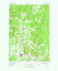 1954 Gaylord1954 Print · USGSOtsego County's transition into a modern recreational and transit hub is evident in the mid-fifties, centered on the growing community of Gaylord. Genealogists and historians can locate several legacy sites, from Vanderbilt Cem to numerous rural schools like McCoy Sch.3 unique versions available
 - 1954 Map of Hetherton, 1956 Print
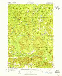 1954 Hetherton1956 Print · USGSNorthern Michigan’s sprawling timberlands are captured here in the mid-fifties, showing a landscape of state forests and quiet lakes. Researchers can trace the rural infrastructure of Hetherton, the Metzger Sch, and remote landmarks like the Pigeon River Lookout Tower.4 unique versions available
 - 1955 Map of Atlanta, 1956 Print
 1955 Atlanta1956 Print · USGSMontmorency County is mapped here in the mid-fifties, showing a landscape of state forests and quiet settlements before modern development. Genealogists and researchers can trace local landmarks like Pleasant Valley Ch, Avery Cem, and the Edwards Sch (Abandoned).3 unique versions available
 - 1955 Map of Cheboygan, 1964 Print
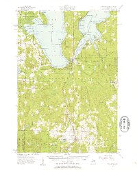
 1955 Cheboygan1964 Print · USGSNorthern Michigan in the mid-fifties is a landscape of dense timber and deep water, showing the region just as the road network began to modernize. Trace family roots in lakeside towns like St Ignace and Petoskey, or follow the historic tracks of the Pennsylvania RR and New York Central RR.5 unique versions available
 - 1957 Map of Tower, 1958 Print
 1957 Tower1958 Print · USGSCheboygan County’s timberlands and rural junctions are captured here in the late fifties as the regional rail network still served the forest economy. Researchers can locate the Waverly Cem, abandoned schoolhouses, and old stops like Fingerboard Corner and Afton.3 unique versions available
 - 1957 Map of Wolverine, 1958 Print
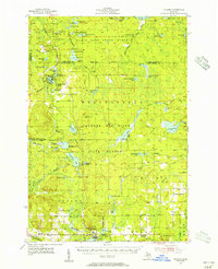
 1957 Wolverine1958 Print · USGSNorthern Michigan's lake country is captured here during the late fifties, showing the rail-and-river geography of the Cheboygan area. Genealogists and historians can trace old community centers like Indian River, the Ohioville Sch, and the Wolverine Lookout Tower.3 unique versions available
 - 1957 Map of Cheboygan, 1958 Print
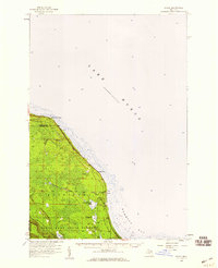
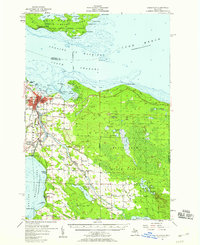 1957 Cheboygan1958 Print · USGSThe Straits of Mackinac meet the northern Michigan timberlands in the late fifties, showing a landscape defined by Great Lakes shipping and inland rail. Researchers can locate many local landmarks, from Cheboygan harbor to rural sites like School No 2 and Pine Hill Cem.3 unique versions available
 - 1957 Map of Mullett Lake, 1959 Print
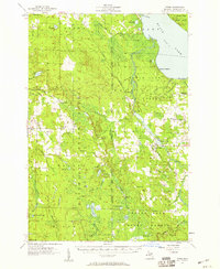
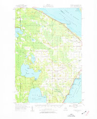 1957 Mullett Lake1959 Print · USGSThe tip of Michigan's Lower Peninsula is defined by its massive inland waters and coastal reaches along the Straits in the late fifties. Genealogists and researchers can locate several rural schools and parish churches like Sacred Heart Ch and Hebron Cem.2 unique versions available
 - 1957 Map of Onaway, 1959 Print
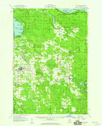 1957 Onaway1959 Print · USGSNorthern Michigan's timber and rail country is captured here in the late fifties, centered on the community of Onaway. Genealogists and historians can trace the Detroit and Mackinac railroad line, find old schools like Vibber Sch, and locate family plots in North Allis Cem.2 unique versions available
 - 1958 Map of Cheboygan
 1958 Cheboygan1958 Print · USGSThe tip of Michigan's Lower Peninsula and the surrounding Great Lakes islands are shown here in the late fifties, during the peak of the rail-and-ferry era. Trace the paths of the Pennsylvania RR and explore lakeside settlements like St James, Petoskey, and Indian River.2 unique versions available
 - 1958 Map of Grace, 1959 Print
 1958 Grace1959 Print · USGSThe northern coast of Presque Isle County is captured in the late fifties as a landscape of dense state forests and quiet bay shores. Researchers can locate the Grace Cem, the Huron Beach Ch, and the small settlement at Greene.
End of results
Showing maps 1-11 of 11
Top cities of Cheboygan County
Frequently asked questions
- What are the different types of historical maps available for Cheboygan County?
- What is the oldest map of Cheboygan County?
- Where can I purchase historical maps of Cheboygan County for my home or office?
- Where can I download high-res historical maps of Cheboygan County?
- Are there historical topographic maps available for Cheboygan County?
- Is there historical aerial imagery available for Cheboygan County?
- Where are historical maps of Cheboygan County sourced from?