Old Maps of Cheboygan County, Michigan for Metal Detecting
Plan your next treasure hunt with 169 historic maps of Cheboygan County. Find old homesites, ghost towns, trails, and gathering spots that may be lost to time — perfect for identifying promising metal detecting locations.
- Locate forgotten sites: Uncover places like long-lost settlements, abandoned rail lines, or gathering spots.
- Plan better hunts: Use map overlays combined with LiDAR or satellite views to narrow in on historically rich areas.
- Made for detectorists: Thousands of hobbyists use these maps to discover relics, coins, and hidden history.
Use these historic maps to boost your research and find new opportunities beneath the surface of Cheboygan County.
Cheboygan County, MI maps
(169)- 1954 Map of Gaylord
 1954 Gaylord1954 Print · USGSOtsego County's transition into a modern recreational and transit hub is evident in the mid-fifties, centered on the growing community of Gaylord. Genealogists and historians can locate several legacy sites, from Vanderbilt Cem to numerous rural schools like McCoy Sch.3 unique versions available
 - 1954 Map of Hetherton, 1956 Print
 1954 Hetherton1956 Print · USGSNorthern Michigan’s sprawling timberlands are captured here in the mid-fifties, showing a landscape of state forests and quiet lakes. Researchers can trace the rural infrastructure of Hetherton, the Metzger Sch, and remote landmarks like the Pigeon River Lookout Tower.4 unique versions available
 - 1955 Map of Atlanta, 1956 Print
 1955 Atlanta1956 Print · USGSMontmorency County is mapped here in the mid-fifties, showing a landscape of state forests and quiet settlements before modern development. Genealogists and researchers can trace local landmarks like Pleasant Valley Ch, Avery Cem, and the Edwards Sch (Abandoned).3 unique versions available
 - 1955 Map of Cheboygan, 1964 Print
 1955 Cheboygan1964 Print · USGSNorthern Michigan in the mid-fifties is a landscape of dense timber and deep water, showing the region just as the road network began to modernize. Trace family roots in lakeside towns like St Ignace and Petoskey, or follow the historic tracks of the Pennsylvania RR and New York Central RR.5 unique versions available
 - 1957 Map of Tower, 1958 Print
 1957 Tower1958 Print · USGSCheboygan County’s timberlands and rural junctions are captured here in the late fifties as the regional rail network still served the forest economy. Researchers can locate the Waverly Cem, abandoned schoolhouses, and old stops like Fingerboard Corner and Afton.3 unique versions available
 - 1957 Map of Wolverine, 1958 Print
 1957 Wolverine1958 Print · USGSNorthern Michigan's lake country is captured here during the late fifties, showing the rail-and-river geography of the Cheboygan area. Genealogists and historians can trace old community centers like Indian River, the Ohioville Sch, and the Wolverine Lookout Tower.3 unique versions available
 - 1957 Map of Cheboygan, 1958 Print
 1957 Cheboygan1958 Print · USGSThe Straits of Mackinac meet the northern Michigan timberlands in the late fifties, showing a landscape defined by Great Lakes shipping and inland rail. Researchers can locate many local landmarks, from Cheboygan harbor to rural sites like School No 2 and Pine Hill Cem.3 unique versions available
 - 1957 Map of Mullett Lake, 1959 Print
 1957 Mullett Lake1959 Print · USGSThe tip of Michigan's Lower Peninsula is defined by its massive inland waters and coastal reaches along the Straits in the late fifties. Genealogists and researchers can locate several rural schools and parish churches like Sacred Heart Ch and Hebron Cem.2 unique versions available
 - 1957 Map of Onaway, 1959 Print
 1957 Onaway1959 Print · USGSNorthern Michigan's timber and rail country is captured here in the late fifties, centered on the community of Onaway. Genealogists and historians can trace the Detroit and Mackinac railroad line, find old schools like Vibber Sch, and locate family plots in North Allis Cem.2 unique versions available
 - 1958 Map of Cheboygan
 1958 Cheboygan1958 Print · USGSThe tip of Michigan's Lower Peninsula and the surrounding Great Lakes islands are shown here in the late fifties, during the peak of the rail-and-ferry era. Trace the paths of the Pennsylvania RR and explore lakeside settlements like St James, Petoskey, and Indian River.2 unique versions available
 - 1958 Map of Grace, 1959 Print
 1958 Grace1959 Print · USGSThe northern coast of Presque Isle County is captured in the late fifties as a landscape of dense state forests and quiet bay shores. Researchers can locate the Grace Cem, the Huron Beach Ch, and the small settlement at Greene.
 - 1964 Map of St. Ignace, 1966 Print
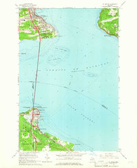 1964 St. Ignace1966 Print · USGSThe Straits of Mackinac were in a period of transition in the mid-sixties, linked by the recently completed Mackinac Bridge. Genealogists and historians can trace the rail terminals of the Pennsylvania and waterfront sites like Old Mackinac Point and Edgewater Beach.2 unique versions available
 - 1982 Map of Petoskey
 1982 Petoskey1982 Print · USGSNorthern Michigan in the early eighties shows a landscape of deep timber and vast inland lakes. Genealogists and historians can trace the rail corridors of the Michigan Central and Detroit and Mackinac between Petoskey, Gaylord, and Wolverine.
 - 1982 Map of Cordwood Point, 1983 Print
 1982 Cordwood Point1983 Print · USGSCoastal Cheboygan County during the early eighties shows a landscape of protected timberlands and quiet bays. You can trace early trails and landmarks like Cordwood Trail, the Coast Guard Chapel, and the elevated vistas of High Banks.
 - 1982 Map of Cheboygan, 1983 Print
 1982 Cheboygan1983 Print · USGSCheboygan and the southern tip of Bois Blanc Island are captured here in the early 1980s. Researchers can trace the city’s residential grid and maritime infrastructure near Duncan Bay, locating the Pine Hill Cem and the Detroit & Mackinac rail line.
 - 1982 Map of Point Nipigon, 1983 Print
 1982 Point Nipigon1983 Print · USGSCoastal Cheboygan County at the start of the 1980s shows a landscape of dense state forest and lakeside landings. Researchers can trace family names along Hebron Mail Route Road or locate the Fine Hill Cem and Cheboygan City-County Airport.
 - 1982 Map of Grace, 1983 Print
 1982 Grace1983 Print · USGSCoastal Presque Isle County meets the shoreline of the Great Lakes in the early 1980s, showcasing a landscape defined by state forests and northern waters. Local historians can trace the lakeside settlements of Grace and Huron Beach or locate the Township Cem near Clear Lake.
 - 1982 Map of Aloha, 1983 Print
 1982 Aloha1983 Print · USGSCheboygan County’s eastern shorelines and forest lands are captured here in the early eighties. Genealogists and local historians can locate Calvary Cem, the Black River Sch, and the lakeside community of Aloha before modern development.
 - 1982 Map of Indianville, 1983 Print
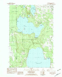 1982 Indianville1983 Print · USGSCheboygan County in the early eighties was defined by the massive presence of the University of Michigan Biological Station and protected forest lands. Researchers and genealogists can trace property lines near Indianville, locate the Munro Cem, or study the shoreline development of Douglas Lake and Burt Lake.
 - 1982 Map of Mullett Lake, 1983 Print
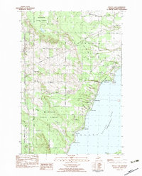 1982 Mullett Lake1983 Print · USGSCheboygan County’s western lakeside communities and interior timberlands are captured here in the early eighties. Researchers can trace the heritage of Riggsville through its namesake Riggsville Cem or locate the lakeside Country Club and Inverness Sch.
 - 1982 Map of Freedom, 1983 Print
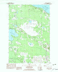 1982 Freedom1983 Print · USGSThe Straits of Mackinac shoreline and the northern reaches of the Lower Peninsula are captured here in the early eighties. Genealogists and local historians can locate Hebron Cem, the Hebron Town Hall, and the village of Carp Lake along the shore of Lake Paradise.
 - 1982 Map of Nilemile Point, 1983 Print
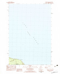 1982 Nilemile Point1983 Print · USGSThe Lake Huron shoreline comes into focus in the early eighties at the boundary of Cheboygan and Presque Isle counties. Researchers can trace the coastal geography of Benton and Bearinger townships, from Greene Creek to the Roadside Park at Ninemile Point.
 - 1982 Map of Manning, 1983 Print
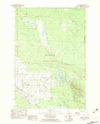 1982 Manning1983 Print · USGSCheboygan County’s backcountry comes into focus in the early eighties, showing the transition from the Black River wetlands to the heights of Black Mountain. Researchers can locate the Black River Ch and trace old transportation routes like the northern Railroad Grade.
 - 1984 Map of Cheboygan, 1985 Print
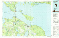 1984 Cheboygan1985 Print · USGSThe Straits of Mackinac and the northern tip of Michigan's Lower Peninsula are shown here in the mid-1980s. Local researchers can trace family landmarks and rural crossroads from St Ignace to Cheboygan, including Riggsville and Levering.
 - 1986 Map of Onaway
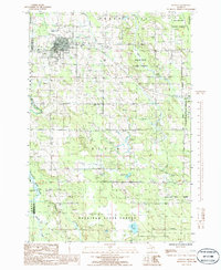 1986 Onaway1986 Print · USGSIn the mid-1980s, the northern Michigan community of Onaway sat at the edge of the sprawling Mackinaw State Forest. Researchers can trace the path of an Abandoned Railroad or locate local landmarks like Loon Lake and the Cem near the county line.
Showing maps 1-25 of 169
Top cities of Cheboygan County
Frequently asked questions
- What are the different types of historical maps available for Cheboygan County?
- What is the oldest map of Cheboygan County?
- Where can I purchase historical maps of Cheboygan County for my home or office?
- Where can I download high-res historical maps of Cheboygan County?
- Are there historical topographic maps available for Cheboygan County?
- Is there historical aerial imagery available for Cheboygan County?
- Where are historical maps of Cheboygan County sourced from?