1980s Maps of Chippewa County, Michigan
Explore 7 historic maps of Chippewa County from the 1980s. These maps offer a rare glimpse into what life looked like during the 1980s — showing old roads, neighborhoods, homes, and landmarks that have changed or disappeared over time.
Whether you're researching your family's past, planning a metal detecting trip, or studying how Chippewa County's landscape evolved across the 1980s, these high-resolution maps are a powerful tool for exploring the history of this region.
- Focus on a specific era: All maps on this page are from the 1980s, giving you a focused view of this time period.
- See what’s changed: Compare century-old streets, trails, and buildings to today's modern landscape using overlays and satellite layers.
- Research with precision: Use these maps for genealogy, historical research, land use analysis, or educational projects.
- View, download, or print: Maps are fully viewable online in high resolution, and can be downloaded or printed for your own records.
Start exploring Chippewa County's history through authentic maps from the 1980s. This is your window into the past.
Chippewa County, MI maps
(7)- 1984 Map of Drummond, 1985 Print
 1984 Drummond1985 Print · USGSUpper Peninsula maritime life and the island geography of Chippewa County are captured here in the mid-eighties. Trace the roads through Maxton, locate the Quarry near the shore, or explore the inlets of Potagannissing Bay and Sturgeon Bay.2 unique versions available
 - 1984 Map of Cheboygan, 1985 Print
 1984 Cheboygan1985 Print · USGSThe Straits of Mackinac and the northern tip of Michigan's Lower Peninsula are shown here in the mid-1980s. Local researchers can trace family landmarks and rural crossroads from St Ignace to Cheboygan, including Riggsville and Levering.
 - 1984 Map of De Tour Village, 1985 Print
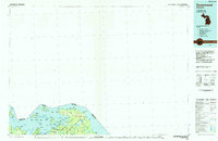
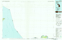
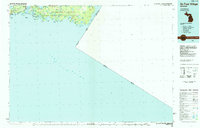 1984 De Tour Village1985 Print · USGSThe eastern Upper Peninsula and Drummond Island are captured in the mid-1980s before modern development altered these remote shorelines. Genealogists and historians can trace the isolated settlements of De Tour Village and Johnswood or locate the historic De Tour Lighthouse.2 unique versions available
 - 1984 Map of Sault Ste. Marie South, 1985 Print
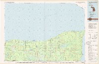
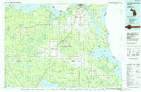 1984 Sault Ste. Marie South1985 Print · USGSEastern Upper Peninsula life in the 1980s is captured here, from the northern forests down to the northern shores of Lake Huron. Researchers can locate small lakeside communities like Dollar Settlement, trace the Soo Line Railroad, and find family sites near Pine Grove Cem.2 unique versions available
 - 1985 Map of Manistique Lake
 1985 Manistique Lake1985 Print · USGSThe eastern Upper Peninsula’s wilderness and rail-side villages are captured here in the mid-1980s, from the Soo Line corridor to the Lake Michigan shore. Genealogists and historians can trace the foundations of local life in Newberry, Engadine, and Seney, alongside industrial landmarks like the Calspar Quarry Pool.2 unique versions available
 - 1985 Map of Two Hearted River
 1985 Two Hearted River1985 Print · USGSThe Lake Superior coast of the Upper Peninsula is shown here during the mid-1980s, stretching from the Sucker River to Whitefish Bay. Researchers can trace remote logging grades and find small settlements such as Deer Park, Emerson, and the notable Pine Stump Junction.2 unique versions available
 - 1985 Map of Sault Ste. Marie North
 1985 Sault Ste. Marie North1985 Print · USGSThe international waters of the Upper Peninsula take center stage in the mid-eighties as the shipping lanes connect the Great Lakes. Traces of early settlements and vital maritime infrastructure are visible at the Soo Locks, Sugar Island, and the remote Whitefish Point.2 unique versions available
End of results
Showing maps 1-7 of 7
Top cities of Chippewa County
Frequently asked questions
- What are the different types of historical maps available for Chippewa County?
- What is the oldest map of Chippewa County?
- Where can I purchase historical maps of Chippewa County for my home or office?
- Where can I download high-res historical maps of Chippewa County?
- Are there historical topographic maps available for Chippewa County?
- Is there historical aerial imagery available for Chippewa County?
- Where are historical maps of Chippewa County sourced from?