2020s Maps of West Branch Township, Michigan
Explore 6 historic maps of West Branch Township from the 2020s. These maps offer a rare glimpse into what life looked like during the 2020s — showing old roads, neighborhoods, homes, and landmarks that have changed or disappeared over time.
Whether you're researching your family's past, planning a metal detecting trip, or studying how West Branch Township's landscape evolved across the 2020s, these high-resolution maps are a powerful tool for exploring the history of this region.
- Focus on a specific era: All maps on this page are from the 2020s, giving you a focused view of this time period.
- See what’s changed: Compare century-old streets, trails, and buildings to today's modern landscape using overlays and satellite layers.
- Research with precision: Use these maps for genealogy, historical research, land use analysis, or educational projects.
- View, download, or print: Maps are fully viewable online in high resolution, and can be downloaded or printed for your own records.
Start exploring West Branch Township's history through authentic maps from the 2020s. This is your window into the past.
West Branch Township, MI maps
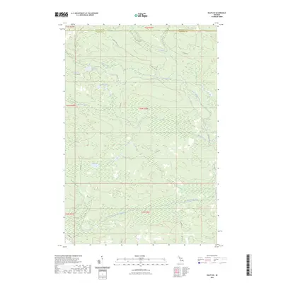
(6)- 2023 Map of Northland NE, 2023 Print
 2023 Northland NE2023 Print · USGSThe wilderness of Marquette and Dickinson counties comes alive in this 2020s survey of the Upper Peninsula backcountry. Researchers can trace the winding West Branch Escanaba River and find named forest routes like Ross Grade and Perrin Brothers Trl.
 - 2023 Map of Alfred, 2023 Print
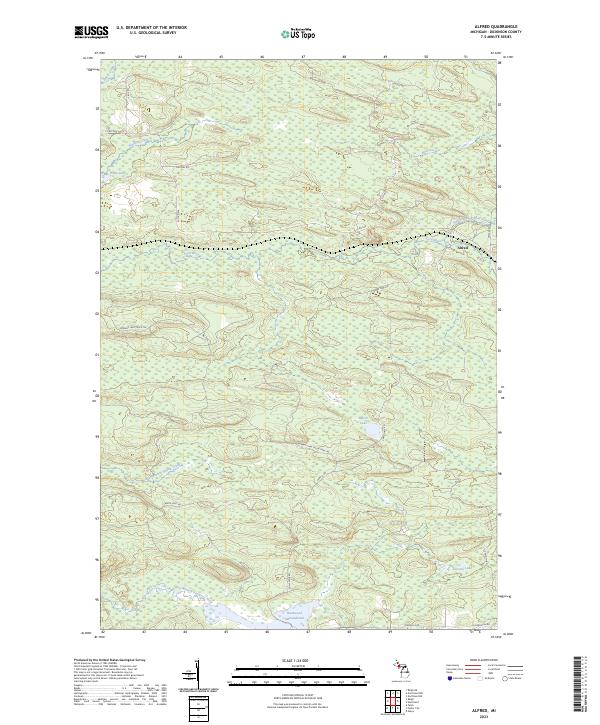 2023 Alfred2023 Print · USGSDickinson County's timberlands and river valleys are captured here in the early 2020s, centered on the community of Alfred. Researchers can trace the reach of the Ford River and its branches, alongside remote landmarks like Peronto Lake and the Hardwood Impoundment.
 - 2023 Map of Northland, 2023 Print
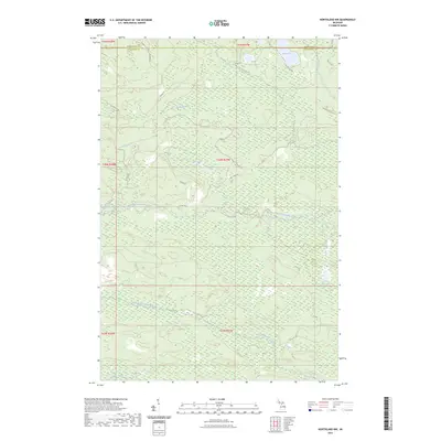
 2023 Northland2023 Print · USGSThe Dickinson and Marquette county line comes alive in the early 2020s, showing a landscape defined by the Ford River and the North Branch Ford River. Genealogists and researchers can trace the settlement at Northland, locate Riverview Cemetery, and follow rural routes like Co Rd 426.
 - 2023 Map of Ralph, 2023 Print
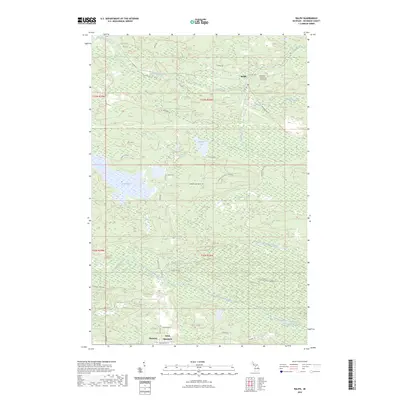 2023 Ralph2023 Print · USGSThis Dickinson County landscape in the early twenty-first century reflects a quiet history of timber and river-linked settlements. Genealogists and researchers can locate Ralph Cemetery, the community of Theodore, and geographic markers like Felch Mountain.
 - 2023 Map of Northland NW, 2023 Print
 2023 Northland NW2023 Print · USGSThe Upper Peninsula wilderness at the Dickinson and Marquette county line is captured here in the early twenty-first century. Researchers can trace the remote waterways of the West Branch Escanaba River and remote forest routes like Moose Country Trl and Tower Rd.
 - 2023 Map of Ralph NE, 2023 Print
 2023 Ralph NE2023 Print · USGSTracing the border of Dickinson and Marquette counties in the early 2020s, this map reveals a landscape defined by its waterways. Researchers can locate remote access points and forest tracks like Lake Oneil Rd and Up32 Trl near O'Neil Lake and McGregor Creek.
End of results
Showing maps 1-6 of 6
Top cities near West Branch Township
Top neighborhoods of West Branch Township
Frequently asked questions
- What are the different types of historical maps available for West Branch Township?
- What is the oldest map of West Branch Township?
- Where can I purchase historical maps of West Branch Township for my home or office?
- Where can I download high-res historical maps of West Branch Township?
- Are there historical topographic maps available for West Branch Township?
- Is there historical aerial imagery available for West Branch Township?
- Where are historical maps of West Branch Township sourced from?